Tarrama
Tarrama | |
|---|---|
| Arabic transcription(s) | |
| • Arabic | طرّامة |
| • Latin | Khirbet al-Tarramah (official) |
 Tarrama Location of Tarrama within Palestine | |
| Coordinates: 31°28′51″N 35°01′57″E / 31.48083°N 35.03250°ECoordinates: 31°28′51″N 35°01′57″E / 31.48083°N 35.03250°E | |
| Palestine grid | 153/098 |
| State | State of Palestine |
| Governorate | Hebron |
| Government | |
| • Type | |
| Area | |
| • Total | 210 dunams (0.2 km2 or 0.08 sq mi) |
| Population (2007) | |
| • Total | 631 |
| • Density | 3,200/km2 (8,200/sq mi) |

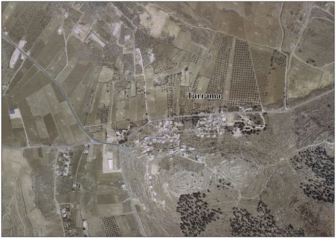
Tarrama (Arabic: طرّامة, also known as Khirbet al-Tarramah) is a Palestinian village situated on a hilltop with an elevation of 879 meters (2,884 ft) in the southern West Bank, part of the Hebron Governorate. Located just south of Dura, nearby localities include at-Tabaqa to the north, Fawwar to the east, Khursa to the west, and Deir Razih to the south.
Its total land area is 210 dunams and the village is provided with electricity and telephone lines.[1]
History[]
Khirbet Tarrama has been suggested as a possible site of the "Jezreel" mentioned as a town in the territory of Judah in the Bible.[2]
Ceramics from the Byzantine era have been found here.[3]
Ottoman era[]
In 1863, Victor Guérin visited.[4] In 1883, the PEF's Survey of Western Palestine (SWP) noted of Khurbet Terrama: "This ruin, not on the map, was found by Guerin about half an hour north of Khurbet Deir Razi. It was on the top of a terraced hill, and contains the remains of an old fort, with caves cut in the rock, one of which is pierced with columbaria."[5]
British Mandate era[]
At the time of the 1931 census of Palestine, conducted by the British Mandate authorities, the population of Kh. Tarama was counted under Dura.[6]
Jordanian era[]
In the wake of the 1948 Arab–Israeli War, and after the 1949 Armistice Agreements, Tarrama came under Jordanian rule.
In 1961, there were 161 residents here.[7]
Post-1967[]
After the Six-Day War in 1967, Tarrama has been under Israeli occupation.
During the 1970s, the Israeli Military unsuccessfully attempted to establish a military air field on Tarrama's lands to serve the al-Majnouna camp.[1]
Most of its inhabitants belong to the Awlad Muhammad extended family,[1] but over 10% were Palestinian refugees in 1997.[8]
The population increased to 404 by 1997.[9]
In 2007, Tarrama had a population of 630, according to the Palestinian Central Bureau of Statistics census.[10]
References[]
- ^ Jump up to: a b c Background to Tarrama Land Research Center. 19 February 2009.
- ^ "Jezreel". Encyclopædia Britannica. 2009. Encyclopædia Britannica Online. 5 March 2009.
- ^ Dauphin, 1998, p. 962
- ^ Guérin, 1869, p. 372: "nous atteignons le sommet d'une colline qui s'élève comme par gradins successifs et dont les terres sont soutenues par plusieurs murs d'appui. Un dernier mur d'enceinte, qui a été démoli, mais dont les traces sont reconnaissables, environnait jadis la plate-forme supérieure, où sont épars des amas de gros blocs disjoints, ayant appartenu à une assez puissante construction, presque entièrement détruite, qui semble avoir eu une destination militaire. On y remarque aussi plusieurs cavernes pratiquées dans le roc, une, entre autres, dont les parois sônt percées intérieurement d'une foule de petites niches semblables à des trous de pigeonnier. Ces ruines me sont désignées sous le nom de Khirbet Terrama."
- ^ Conder and Kitchener, 1883, SWP III, p. 369
- ^ Mills, 1932, p. 32
- ^ Government of Jordan, Department of Statistics, 1964, p. 22
- ^ Palestinian Population by Locality and Refugee Status Archived 2008-11-19 at the Wayback Machine Palestinian Central Bureau of Statistics (PCBS).
- ^ Welcome to Khirbet al-Tarramah Palestine Remembered.
- ^ 2007 PCBS Census Palestinian Central Bureau of Statistics. p.119.
Bibliography[]
- Conder, C.R.; Kitchener, H.H. (1883). The Survey of Western Palestine: Memoirs of the Topography, Orography, Hydrography, and Archaeology. 3. London: Committee of the Palestine Exploration Fund.
- Dauphin, Claudine (1998). La Palestine byzantine, Peuplement et Populations. BAR International Series 726 (in French). III : Catalogue. Oxford: Archeopress. ISBN 0-860549-05-4.
- Government of Jordan, Department of Statistics (1964). First Census of Population and Housing. Volume I: Final Tables; General Characteristics of the Population (PDF).
- Guérin, V. (1869). Description Géographique Historique et Archéologique de la Palestine (in French). 1: Judee, pt. 3. Paris: L'Imprimerie Nationale.
- Mills, E., ed. (1932). Census of Palestine 1931. Population of Villages, Towns and Administrative Areas. Jerusalem: Government of Palestine.
External links[]
- Welcome to Khirbet al-Tarramah
- Tarrama village (fact sheet), Applied Research Institute–Jerusalem (ARIJ)
- Tarrama village profile, ARIJ
- Tarrama aerial photo, ARIJ
- The priorities and needs for development in Tarrama village based on the community and local authorities' assessment, ARIJ
| hide | ||
|---|---|---|
| Cities |
|  |
| Towns |
| |
| Villages |
| |
| Refugee camps | ||
- Hebron Governorate
- Villages in the West Bank