Bernadotte Township, Fulton County, Illinois
Bernadotte Township | |
|---|---|
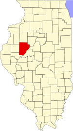
 Location in Fulton County | |
 Fulton County's location in Illinois | |
| Coordinates: 40°24′24″N 90°16′14″W / 40.40667°N 90.27056°WCoordinates: 40°24′24″N 90°16′14″W / 40.40667°N 90.27056°W | |
| Country | United States |
| State | Illinois |
| County | Fulton |
| Established | November 6, 1849 |
| Area | |
| • Total | 37.7 sq mi (98 km2) |
| • Land | 37.69 sq mi (97.6 km2) |
| • Water | 0.01 sq mi (0.03 km2) 0.03% |
| Elevation | 476 ft (145 m) |
| Population (2010) | |
| • Estimate (2016)[1] | 266 |
| • Density | 7.2/sq mi (2.8/km2) |
| Time zone | UTC-6 (CST) |
| • Summer (DST) | UTC-5 (CDT) |
| ZIP codes | 61427, 61441, 61477, 61482, 61542 |
| FIPS code | 17-057-05469 |

Bernadotte Township is one of twenty-six townships in Fulton County, Illinois, USA. As of the 2010 census, its population was 273 and it contained 141 housing units.[2]
Geography[]
According to the 2010 census, the township has a total area of 37.7 square miles (98 km2), of which 37.69 square miles (97.6 km2) (or 99.97%) is land and 0.01 square miles (0.026 km2) (or 0.03%) is water.[2]
Extinct towns[]
- Tuscumbia
- Cameron Grove (aka Colemans grove) was a picnic area & settlement 3 miles up the spoon River north of Bernadotte in the early days.
- Providence was a small community with a lovely church and cemetery.
- Bennington was a former village that had a post office established Sept 20,1823 and discontinued May 20, 1835.
Cemeteries[]
The township contains these four cemeteries: Engle, Providence, Randol and Stites.
Landmarks[]
- Camp Ellis Landing Strip
Demographics[]
| Historical population | |||
|---|---|---|---|
| Census | Pop. | %± | |
| 2016 (est.) | 266 | [1] | |
| U.S. Decennial Census[3] | |||
School districts[]
- Community Unit School District 3 Fulton City
- Lewistown School District 97
- V I T Community Unit School District 2
Political districts[]
- Illinois' 17th congressional district
- State House District 94
- State Senate District 47
References[]
- "Bernadotte Township, Fulton County, Illinois". Geographic Names Information System. United States Geological Survey. Retrieved 2010-01-16.
- United States Census Bureau 2007 TIGER/Line Shapefiles
- United States National Atlas
- ^ a b "Population and Housing Unit Estimates". Retrieved June 9, 2017.
- ^ a b "Population, Housing Units, Area, and Density: 2010 - County -- County Subdivision and Place -- 2010 Census Summary File 1". United States Census. Archived from the original on 2020-02-12. Retrieved 2013-05-28.
- ^ "Census of Population and Housing". Census.gov. Retrieved June 4, 2016.
External links[]
Places adjacent to Bernadotte Township, Fulton County, Illinois | |
|---|---|
Municipalities and communities of Fulton County, Illinois, United States | ||
|---|---|---|
| Cities | ||
| Town | ||
| Villages | ||
| Townships | ||
| Unincorporated communities | ||
| Ghost towns | ||
| Footnotes | ‡This populated place also has portions in an adjacent county or counties | |
| ||
Categories:
- Townships in Fulton County, Illinois
- Townships in Illinois