Cass Township, Fulton County, Illinois
Cass Township | |
|---|---|
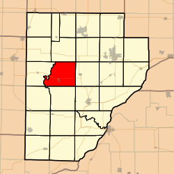 Location in Fulton County | |
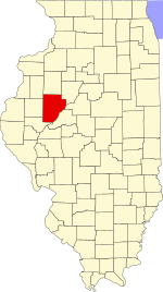 Fulton County's location in Illinois | |
| Coordinates: 40°29′41″N 90°16′54″W / 40.49472°N 90.28167°WCoordinates: 40°29′41″N 90°16′54″W / 40.49472°N 90.28167°W | |
| Country | United States |
| State | Illinois |
| County | Fulton |
| Established | November 6, 1849 |
| Area | |
| • Total | 39.55 sq mi (102.4 km2) |
| • Land | 39.4 sq mi (102 km2) |
| • Water | 0.15 sq mi (0.4 km2) 0.38% |
| Elevation | 630 ft (192 m) |
| Population (2010) | |
| • Estimate (2016)[1] | 605 |
| • Density | 15.8/sq mi (6.1/km2) |
| Time zone | UTC-6 (CST) |
| • Summer (DST) | UTC-5 (CDT) |
| ZIP codes | 61427, 61477, 61542 |
| FIPS code | 17-057-11696 |

Cass Township is one of twenty-six townships in Fulton County, Illinois, USA. As of the 2010 census, its population was 622 and it contained 271 housing units.[2]
Geography[]
According to the 2010 census, the township has a total area of 39.55 square miles (102.4 km2), of which 39.4 square miles (102 km2) (or 99.62%) is land and 0.15 square miles (0.39 km2) (or 0.38%) is water.[2]
Cities, towns, villages[]
Unincorporated towns[]
(This list is based on USGS data and may include former settlements.)
- Totten Prairie
- Travis was an old town site near Poverty Ridge which was near seville and the old fuller mill. It is said that the foundation of the mill can still be found. Travis did not become nothing but an old forgotten town site which never organized.
Cemeteries[]
The township contains these six cemeteries: Baughman, Buckeye, Fuller, Henderson, Howard and Sinnett Chapel.
Major highways[]
Demographics[]
| Historical population | |||
|---|---|---|---|
| Census | Pop. | %± | |
| 2016 (est.) | 605 | [1] | |
| U.S. Decennial Census[3] | |||
School districts[]
- Community Unit School District 3 Fulton City
Political districts[]
- Illinois' 17th congressional district
- State House District 94
- State Senate District 47
References[]
- "Cass Township, Fulton County, Illinois". Geographic Names Information System. United States Geological Survey. Retrieved 2010-01-16.
- United States Census Bureau 2007 TIGER/Line Shapefiles
- United States Board on Geographic Names (GNIS)
- United States National Atlas
- ^ Jump up to: a b "Population and Housing Unit Estimates". Retrieved June 9, 2017.
- ^ Jump up to: a b "Population, Housing Units, Area, and Density: 2010 - County -- County Subdivision and Place -- 2010 Census Summary File 1". United States Census. Archived from the original on 2020-02-12. Retrieved 2013-05-28.
- ^ "Census of Population and Housing". Census.gov. Retrieved June 4, 2016.
External links[]
| show Places adjacent to Cass Township, Fulton County, Illinois |
|---|
| show Municipalities and communities of Fulton County, Illinois, United States |
|---|
Categories:
- Townships in Fulton County, Illinois
- Townships in Illinois