Waterford Township, Fulton County, Illinois
Waterford Township | |
|---|---|
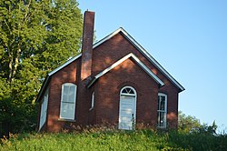 The former East Waterford School | |
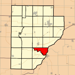 Location in Fulton County | |
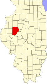 Fulton County's location in Illinois | |
| Coordinates: 40°20′49″N 90°06′36″W / 40.34694°N 90.11000°WCoordinates: 40°20′49″N 90°06′36″W / 40.34694°N 90.11000°W | |
| Country | United States |
| State | Illinois |
| County | Fulton |
| Established | November 6, 1849 |
| Area | |
| • Total | 21.17 sq mi (54.8 km2) |
| • Land | 20.96 sq mi (54.3 km2) |
| • Water | 0.21 sq mi (0.5 km2) 0.99% |
| Elevation | 446 ft (136 m) |
| Population (2010) | |
| • Estimate (2016)[1] | 181 |
| • Density | 8.9/sq mi (3.4/km2) |
| Time zone | UTC-6 (CST) |
| • Summer (DST) | UTC-5 (CDT) |
| ZIP codes | 61542 |
| FIPS code | 17-057-79137 |

Waterford Township is one of twenty-six townships in Fulton County, Illinois, USA. As of the 2010 census, its population was 187 and it contained 92 housing units.[2]
Geography[]
According to the 2010 census, the township has a total area of 21.17 square miles (54.8 km2), of which 20.96 square miles (54.3 km2) (or 99.01%) is land and 0.21 square miles (0.54 km2) (or 0.99%) is water.[2]
Unincorporated towns[]
(This list is based on USGS data and may include former settlements.)
Extinct towns[]
- Waterford at 40°20′20″N 90°07′47″W / 40.338931°N 90.129841°W
(These towns are listed as "historical" by the USGS.)
Cemeteries[]
The township contains the main Waterford Cemetery. Also family cemeteries:Ames Cemetery and the Ashby cemetery
Major highways[]
Airports and landing strips[]
- G Bray Airport
- Norris Farms Airport
Landmarks[]
- Dickson Mounds State Park
Demographics[]
| Historical population | |||
|---|---|---|---|
| Census | Pop. | %± | |
| 2016 (est.) | 181 | [1] | |
| U.S. Decennial Census[3] | |||
School districts[]
- Lewistown School District 97
Political districts[]
- Illinois' 17th congressional district
- State House District 94
- State Senate District 47
References[]
- "Waterford Township, Fulton County, Illinois". Geographic Names Information System. United States Geological Survey. Retrieved 2010-01-16.
- United States Census Bureau 2007 TIGER/Line Shapefiles
- United States National Atlas
- ^ a b "Population and Housing Unit Estimates". Retrieved June 9, 2017.
- ^ a b "Population, Housing Units, Area, and Density: 2010 - County -- County Subdivision and Place -- 2010 Census Summary File 1". United States Census. Archived from the original on 2020-02-12. Retrieved 2013-05-28.
- ^ "Census of Population and Housing". Census.gov. Retrieved June 4, 2016.
External links[]
Places adjacent to Waterford Township, Fulton County, Illinois | |
|---|---|
Municipalities and communities of Fulton County, Illinois, United States | ||
|---|---|---|
| Cities | ||
| Town | ||
| Villages | ||
| Townships | ||
| Unincorporated communities | ||
| Ghost towns | ||
| Footnotes | ‡This populated place also has portions in an adjacent county or counties | |
| ||
Categories:
- Townships in Fulton County, Illinois
- Townships in Illinois