Lee Township, Fulton County, Illinois
Lee Township | |
|---|---|
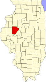
 Location in Fulton County | |
 Fulton County's location in Illinois | |
| Coordinates: 40°35′14″N 90°23′31″W / 40.58722°N 90.39194°WCoordinates: 40°35′14″N 90°23′31″W / 40.58722°N 90.39194°W | |
| Country | United States |
| State | Illinois |
| County | Fulton |
| Established | November 6, 1849 |
| Area | |
| • Total | 37.18 sq mi (96.3 km2) |
| • Land | 37.18 sq mi (96.3 km2) |
| • Water | 0 sq mi (0 km2) 0% |
| Elevation | 633 ft (193 m) |
| Population (2010) | |
| • Estimate (2016)[1] | 228 |
| • Density | 6.4/sq mi (2.5/km2) |
| Time zone | UTC-6 (CST) |
| • Summer (DST) | UTC-5 (CDT) |
| ZIP codes | 61415, 61431, 61459, 61477 |
| FIPS code | 17-057-42574 |

Lee Township is one of twenty-six townships in Fulton County, Illinois, USA. As of the 2010 census, its population was 237 and it contained 110 housing units.[2]
Geography[]
According to the 2010 census, the township has a total area of 37.18 square miles (96.3 km2), all land.[2]
Unincorporated towns[]
(This list is based on USGS data and may include former settlements.)
Extinct towns[]
- Virgil
- Oak Grove
Cemeteries[]
The township contains these six cemeteries: Barnes, Checkrow, Guernsey, Peirsol, Rigdon and Virgil.
Peirsol Cemetery was a family cemetery which many at one time scattered the county. Like many it was abandoned & is in poor condition if not destroyed.
Guernsey Cemetery is a cemetery off route 9,it too is in very poor condition & overgrown with brush.
Major highways[]
Demographics[]
| Historical population | |||
|---|---|---|---|
| Census | Pop. | %± | |
| 2016 (est.) | 228 | [1] | |
| U.S. Decennial Census[3] | |||
School districts[]
- Avon Community Unit School District 176
- Bushnell Prairie City Community Unit School District 170
- Spoon River Valley Community Unit School District 4
Political districts[]
- Illinois' 17th congressional district
- State House District 94
- State Senate District 47
References[]
- "Lee Township, Fulton County, Illinois". Geographic Names Information System. United States Geological Survey. Retrieved 2010-01-16.
- United States Census Bureau 2007 TIGER/Line Shapefiles
- United States National Atlas
- ^ a b "Population and Housing Unit Estimates". Retrieved June 9, 2017.
- ^ a b "Population, Housing Units, Area, and Density: 2010 - County -- County Subdivision and Place -- 2010 Census Summary File 1". United States Census. Archived from the original on 2020-02-12. Retrieved 2013-05-28.
- ^ "Census of Population and Housing". Census.gov. Retrieved June 4, 2016.
External links[]
Places adjacent to Lee Township, Fulton County, Illinois | |
|---|---|
Municipalities and communities of Fulton County, Illinois, United States | ||
|---|---|---|
| Cities | ||
| Town | ||
| Villages | ||
| Townships | ||
| Unincorporated communities | ||
| Ghost towns | ||
| Footnotes | ‡This populated place also has portions in an adjacent county or counties | |
| ||
Categories:
- Townships in Fulton County, Illinois
- Townships in Illinois