Beulah, Victoria
| Beulah Victoria | |||||||||
|---|---|---|---|---|---|---|---|---|---|
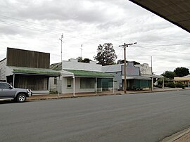 Main street of Beulah, 2012 | |||||||||
 Beulah | |||||||||
| Coordinates | 35°56′17″S 142°25′12″E / 35.93806°S 142.42000°ECoordinates: 35°56′17″S 142°25′12″E / 35.93806°S 142.42000°E | ||||||||
| Population | 329 (2016 census)[1] | ||||||||
| Postcode(s) | 3395 | ||||||||
| Elevation | 100 m (328 ft) | ||||||||
| Location | |||||||||
| LGA(s) | Shire of Yarriambiack | ||||||||
| State electorate(s) | Mildura | ||||||||
| Federal division(s) | Mallee | ||||||||
| |||||||||

Beulah is a town in the southern Mallee region of Victoria, Australia. The town is in the Shire of Yarriambiack local government area, 395 kilometres north-west of the state capital, Melbourne. At the 2016 census, Beulah had a population of 329.[1]
History[]
The town's name is taken from the Book of Isaiah, 62:4.In some English translations the word is given as "married" or "inhabited".[2]
Beulah was established on land that was once part of Brim station. Closer settlement began in the 1880s and the town site was proclaimed in 1891. A Post Office opened on May 6, 1891, and the railway from Warracknabeal opened on 5 January 1893.[3][4] The line to Hopetoun opened on 6 March 1894.[4] The town claims to be the closest to the rabbit-proof fence, established to prevent the incursion of rabbit plagues.[5]
In January 2020, Beulah became the focus of national news coverage after the owner of a house, Cheryl Lawdorn, flew a large Wehrmacht flag featuring a swastika over her home for a fortnight. The flag drew criticism from locals, Yarriambiack Shire Council, the Australian B'nai B'rith Anti-Defamation Commission, Victoria Police, and the state premier Daniel Andrews who referred to the flag as "disgusting". The event led to calls for a ban on people publicly displaying the swastika.[6][7]
References[]
- ^ a b Australian Bureau of Statistics (27 June 2017). "Beulah (State Suburb)". 2016 Census QuickStats. Retrieved 4 October 2018.

- ^ "Beulah". Travel. Sydney Morning Herald. 8 February 2004. Retrieved 28 May 2007.
- ^ Phoenix Auctions History. "Post Office List". Retrieved 28 January 2021.
- ^ a b "Hopteoun Line". Infrastructure. VICSIG. 2012. Retrieved 30 November 2012.
- ^ "Beulah, Victoria". Travelmate. Retrieved 27 May 2007.
- ^ Fox Koob, Simone. "Couple flies Nazi flag over Victorian home". The Age. Nine.
- ^ Thorne, Leonie; Wales, Sean. "Nazi flag flying over Victorian home condemned amid calls to strengthen anti-vilification laws". ABC NEWS. ABC. Retrieved 14 January 2020.
External links[]
![]() Media related to Beulah, Victoria at Wikimedia Commons
Media related to Beulah, Victoria at Wikimedia Commons
- Official town website
- Yarriambiack Shire Council - Official council site
This article about a location in the is a stub. You can help Wikipedia by . |
- Towns in Victoria (Australia)
- Wimmera
- Mallee (Victoria)
- Mallee geography stubs