Horsham, Victoria
| Horsham Victoria | |||||||||
|---|---|---|---|---|---|---|---|---|---|
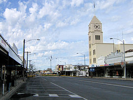 Firebrace Street, Horsham's main street, in 2006 | |||||||||
 Horsham Location in Victoria | |||||||||
| Coordinates | 36°43′S 142°12′E / 36.717°S 142.200°ECoordinates: 36°43′S 142°12′E / 36.717°S 142.200°E | ||||||||
| Population | 16,514 (2018)[1] | ||||||||
| Postcode(s) | 3400 | ||||||||
| Elevation | 128 m (420 ft) | ||||||||
| Location | |||||||||
| LGA(s) | Rural City of Horsham | ||||||||
| County | Borung | ||||||||
| State electorate(s) | Lowan | ||||||||
| Federal Division(s) | Mallee | ||||||||
| |||||||||

Horsham (/ˈhɔːrʃəm/)[2] is a regional city in the Wimmera region of western Victoria, Australia. Located on a bend in the Wimmera River, Horsham is approximately 300 kilometres (190 mi) northwest of the state capital Melbourne. In June 2018, Horsham had an estimated population of 16,514.[1] It is the most populous city in Wimmera, and the main administrative centre for the Rural City of Horsham local government area. It is the eleventh largest city in Victoria after Melbourne, Geelong, Ballarat, Bendigo, Wodonga, Mildura, Shepparton, Warrnambool, Traralgon, and Wangaratta.
An early settler James Monckton Darlot named the settlement after the town of Horsham in his native England. It grew throughout the latter 19th and early 20th centuries as a centre of Western Victoria's wheat and wool industry, becoming the largest city in the Wimmera and Western Victoria by the early 1910s. Horsham was declared a city in 1949 and was named Australia's Tidiest Town in 2001.[3]
History[]


Pre-colonisation[]
Recent archaeological research of rock shelters by La Trobe University in the Grampians found clear evidence of Aboriginal occupation 3–4,000 years ago, and the possibility of occupation up to 22,000 years ago.[4] The rock shelters would have provided reliable access to water and a base to hunt megafauna on the plains of the Wimmera.[4] Then "around the time of the arrival of the First Fleet, the Jardwa people were being forced south by either a Murray or northern Victorian tribe called the Wotjol".[5] By the time of European exploration and settlement, the Jardwadjali language (a dialect of the Wemba-wemba language group common across most of Western Victoria)[6]) was well established across the southern portion of the Wimmera region.[4] Wimmera Aboriginal people hunted and traded widely, with stone for their tools coming up from the Grampians in the Ararat district.[5] Relations between Europeans and Aboriginal people, as across much of Australia, were mixed, featuring both conflict[4] and cooperation.[7] One of the last Aboriginal missions in Victoria, Ebenezer Mission, was run successfully by the Moravian Order during the 1870s and 1880s, providing education and employment for the region's Indigenous people before it fell into decline in the 1890s and closed in 1902.[5]
European Exploration[]
Major Thomas Mitchell was the first European to pass through the area, naming the Wimmera River on 18 July 1836.[8] After the explorer Edward Eyre passed through the region seeking an overland route between Port Philip and Adelaide, he reported to The Adelaide Gazette on 14 July 1838 that the region was "well-watered and affording good pasturage for stock."[9]
Settlement[]
The Squatters were the first European settlers in the Wimmera. William J Bracewell made the first claim, claiming 100,000 acres at Dooen on 10 August 1842.[10] Although Captain Chris Lewis was the first resident of the Wimmera, settling at Ledcourt Station at Glenorchy in 1840. Charles Carter, a Squatter from Van Diemen's Land established his property "Brim Springs" nearby in 1845.[11] The Wimmera region was made part of the Portland Bay district in 1843 and then became its own district in 1846.[12] Land ownership was formalised in 1847, and the "Wimmera squatters wasted no time in securing their land cheaply as leasehold."[12] George Langlands, a merchant from Melbourne was encouraged by James Darlot to move to the Wimmera region and open a store. Langlands reached the Wimmera and opened a general store in October 1849 on what is now the corner of Darlot and Hamilton Street. A Post Office had opened a year earlier on 1 July 1848.[13] By 1851 the small village of Horsham had been established, consisting of an estimated 18 homes.[12]
Town[]
The 1851 census counted 2,019 people living in the Wimmera region.[14] The Victorian gold rush connected Horsham with the rest of the state, when it became a stop-over point for the Gold Escort in 1851.[14] Governance was formalised in 1858 when the Wimmera area was included in region's first electoral district, covering an area from the Murry River in the north, then south to the Wimmera River and then east to the Grampian Range.[15] Then in 1862 the Horsham District Road Board was established, which later evolved into the Horsham Shire with the passing of the Local Government Act in 1864.[15] The electric telegraph was connected in 1875[16] and the main railway from Melbourne reached Horsham in 1879.[17] The Horsham Borough Council and the Shire of Wimmera operated the McKenzie Creek Tramway from the town to a stone quarry, approximately 8 kilometres (5 mi) to the south. The horse tramway opened within the town in 1885 but had ceased operating by 1927. Special picnic trains operated from time to time conveying residents in open wagons along the McKenzie Creek Tramway.[18]
The 1870s saw significant economic and demographic growth in Horsham. During this period the foundry, the hospital, and the Horsham Agricultural Society were established, with the first Horsham show held in 1876.[19] Geoffrey Blainey, notes in his History of Victoria, that the Victorian railway building boom of the 1870s enabled large-scale wheat production to begin in the Wimmera.[17] He also describes a unique migration of German farmers, mostly Lutherans from South Australia, who travelled across east in covered-wagons along with their families and herds of cattle and then settled in the Wimmera district.[17] Blainey writes that "nothing in Australian history so resembles the opening of the American west as this trek of farmers to the Victorian plains in the 1870s'." Farming production in the region dramatically increased, and wheat was established as the dominant agricultural crop.[17]
Although flooding along the Wimmera River was noted during the early period of the settlement, the first major flood was recorded in 1883 with the first flood causing serious damage occurring in 1889, when several buildings and the tramway were damaged.[20] Several serious floods then occurred along the Wimmera River over the next five decades, in 1894, 1903, 1909, 1915 and then in 1923. The flood in 1923 was the third largest on record.[20] In response to this history of flooding, the council successfully applied in 1946 for money from the State Parliamentary Public Works Committee for flood management.[20]

Men from Horsham fought in the First World War. "By mid-August 1914 the first of Horsham's soldiers were given a rousing civic farewell at the Town Hall."[21] However conscription "divided the community", with the Anti-Conscription League noting the high rate (6%) of conscription in the Horsham district.[21] The Discharged Soldier Settlement Act of 1917 was created to give returning soldiers a head-start establishing farms in regional Australia. According to the act returning soldiers with farm-experience could apply for a block of land. By 1919 2,933 ex-servicemen had taken up the opportunity.[22] The average size of the land grants were 250 to 500 acres (100 to 200 ha). When World War II started, men from Horsham again volunteered. The war effort was enthusiastically embraced, for example in May 1940, when King George VI made a Commonwealth-wide call to prayer, 1,800 people attended a religious service at the town hall.[21] Returning servicemen were again given the opportunity to take up land grants at the end of the war, with the average size of the blocks being between 650 to 750 acres (260 to 300 ha).[22]
City[]

Horsham's population had reached 6,388 in 1947[23] and so it was declared a city on 24 May 1949.[24] In 1950 Horsham celebrated its Centenary with a parade through the city.[25] But then tragedy struck on 24 February 1951 when a train and bus collided at a level crossing on Dimboola Road, resulting in 11 deaths.[26] The Horsham Streetscape was dramatically remodelled in the 1960s when planning laws were changed and shopfront verandahs were removed from the Post Office, The Bull and Mouth, and The White Hart pubs.[27] The Horsham City council installed the first parking meters on Firebrace Street in 1963.[25] A major fire damaged the new State Public Office on McLachlan Street in 1971.[25] In 1995, the Rural City of Horsham was formed through the amalgamation of the Horsham City, Wimmera and Aprapiles Shires.[23] Horsham was then named Australia's Tidiest Town in 2001[3] and was also named Victoria's tidiest town in 2015.[28]
The Black Saturday bushfires of 2009 affected Horsham, with 5,700 ha (14,000 acres) area burnt around the city's fringe including the golf club and eight homes destroyed in the Haven area.[29] Horsham experienced significant flooding in successive years in 2010 and 2011 Victorian floods. During these events, the Wimmera reached 3.32 m and 4.71 m respectively. The 2011 event was particularly severe with the Wimmera River reaching a record peak; over 1,000 residents were evacuated as flood waters divided the city and damaged 600 houses pushing up to a metre of water into parts of the CBD.[30]
Traditional Ownership[]
The Victorian government has recognised the Wotjobaluk, Jaadwa, Jadawadjali, Wergaia and Jupagik nations as the traditional owners for the Horsham area.[31] These five nations are represented by the Barengi Gadjin Land Council Aboriginal Corporation.[32]
Population[]
According to the 2016 census of Population, there were 16,250 people in Horsham.
- 90.3% of people spoke only English at home.
- 87.4% of people were born in Australia. The next most common countries of birth were England 1.2% and India 0.7%.
- Aboriginal and Torres Strait Islander people made up 1.7% of the population.
- The most common responses for religion were No Religion 29.8%, Catholic 17.4%, Uniting Church 15.1%, Anglican 10.6% and Lutheran 8.4%.[33]
Geography[]
Wimmera River[]
The city of Horsham is situated on the floodplain of the Wimmera River, south of the Dooen Swamp and north of the River's junction with McKenzie Creek.[34] The Wimmera River rises in the western slopes of the Pyrenees and then runs west towards Horsham before turning north at Quantong and heading north towards the Murray, but empties into Lake Hindmarsh.[34] The Wimmera River is dammed by a weir at the southern edge of the city. A recent study in December 2017, found that the Millennium drought decimated the Platypus population in the River leaving only a solitary colony south of the weir.[35]
Climate[]
Horsham is classified as a oceanic climate (Köppen Climate Classification Cfb) similar to Stawell although with slightly less mean rainfall amounts. As such, although its latitude makes it on average a degree cooler than Mildura, it can receive relatively more extremes of temperature.
| hideClimate data for Horsham Aerodrome (YHSM) since 1997 | |||||||||||||
|---|---|---|---|---|---|---|---|---|---|---|---|---|---|
| Month | Jan | Feb | Mar | Apr | May | Jun | Jul | Aug | Sep | Oct | Nov | Dec | Year |
| Record high °C (°F) | 46.0 (114.8) |
47.4 (117.3) |
41.0 (105.8) |
35.0 (95.0) |
28.0 (82.4) |
24.0 (75.2) |
20.0 (68.0) |
26.0 (78.8) |
31.0 (87.8) |
38.0 (100.4) |
42.3 (108.1) |
46.0 (114.8) |
47.4 (117.3) |
| Average high °C (°F) | 31.0 (87.8) |
30.5 (86.9) |
26.8 (80.2) |
22.2 (72.0) |
17.7 (63.9) |
14.4 (57.9) |
13.6 (56.5) |
15.2 (59.4) |
18.2 (64.8) |
21.6 (70.9) |
26.1 (79.0) |
28.4 (83.1) |
22.1 (71.8) |
| Average low °C (°F) | 12.5 (54.5) |
12.6 (54.7) |
10.0 (50.0) |
7.1 (44.8) |
5.1 (41.2) |
3.7 (38.7) |
3.2 (37.8) |
3.2 (37.8) |
4.5 (40.1) |
5.4 (41.7) |
8.6 (47.5) |
10.4 (50.7) |
7.2 (45.0) |
| Record low °C (°F) | 1.0 (33.8) |
2.5 (36.5) |
1.0 (33.8) |
−2.0 (28.4) |
−4.0 (24.8) |
−6.0 (21.2) |
−5.0 (23.0) |
−4.0 (24.8) |
−3.0 (26.6) |
−3.0 (26.6) |
−2.0 (28.4) |
1.0 (33.8) |
−6.0 (21.2) |
| Average precipitation mm (inches) | 28.7 (1.13) |
26.0 (1.02) |
14.7 (0.58) |
26.5 (1.04) |
31.3 (1.23) |
37.4 (1.47) |
41.2 (1.62) |
39.6 (1.56) |
36.8 (1.45) |
33.7 (1.33) |
32.8 (1.29) |
27.8 (1.09) |
374.8 (14.76) |
| Average rainy days | 5.0 | 4.7 | 4.6 | 6.5 | 11.5 | 16.5 | 19.0 | 17.0 | 13.1 | 9.2 | 7.1 | 5.7 | 119.9 |
| Source: [36] | |||||||||||||
Land Use[]

Horsham's topography is flat, approximately 128 metres (420 ft) above sea level. The central business district (CBD) is laid out in a grid plan south of the train line and is characterised by wide streets and several roundabouts.[34] Firebrace Street, running north–south through the middle of the CBD is one of Horham's original "thoroughfares" (first surveyed in 1849) and is named after a soldier from the British Army, Major William Firebrace (1795-1856).[37] Residential areas extend north of the train line, west towards Natimuk and south-west towards Haven and south-east across Burnt Creek. A light industrial area is located south of the Wimmera River.
Due to the flat topography and floodplain clay, there are very few multi-story buildings. The five most prominent buildings in the city are the State Government Offices on McLauchlin Street, the T&G clocktower on Firebrace Street, St John Anglican church on the Western Highway, the Horsham Cinema and Horsham Town Hall, both on Pynsent Street.

Mining[]
Due to Horsham's location in the Murray Basin, the area to the east and south of the city contain extensive deposits of Mineral Sands, primarily ilmenite, zircon and rutile.[38] Preliminary exploration was conducted in the 1980s at Drung, a locality 20 kilometres (12 mi) east of Horsham. However, the Conservation Council of Australia opposed the exploration citing the long-term consequences of mining activity and the possibility of inadequate rehabilitation.[39]
In June 2018 new mining exploration leases for the Wimmera region were granted by the Victorian State Government.[40]
Governance[]

In 1993 the Kennett Government passed the Local Government (Miscellaneous Amendments) Bill which resulted in council amalgamations across Victoria.[41] So in 1995 the City of Horsham merged with the Wimmera and Arapiles shires to form the Horsham Rural City Council, making Horsham the seat of local government.[41] The current Mayor of Horsham is Mark Radford.[42]
In the Legislative Assembly of Victoria Horsham is part of the Electoral district of Lowan and is currently represented by Emma Kealy. For the Legislative Council of Victoria Horsham is part of the Western Victoria Region and is currently represented by Jaala Pulford, Simon Ramsay, Gayle Tierney, Josh Morris and James Purcell.
In the Federal Parliament of Australia the city is represented in the Australian House of Representatives by the Division of Mallee. Currently held by Anne Webster and until the 2019 Federal Election was considered a very safe National party seat.[43]
The Horsham Police station on Roberts Ave, along with ordinary policing duties also handles traffic, firearm registration and crime investigation.[44] Next to the Police station is the Horsham Magistrates' Court.[45]
Culture[]

The Horsham Botanic Gardens, managed by the Horsham Rural City Council, are located between the Horsham City Oval and Horsham Caravan Park and were designed by landscape architect William Guilfoyle. Sawyer park alongside the Wimmera River contains a sound shell and hosts the ANZAC day dawn service, Carols by Candlelight and Australia Day events.
Arts[]
The Horsham Town Hall, rebuilt and enlarged in February 2016, is the city's main performing arts venue, attracting a wide range of national and international acts.[46] It is operated by the Horsham Rural City Council also contains the Horsham Regional Art Gallery. The Wesley Performing Arts Centre, once the Wesley Church, was, until 2018, a second performance venue. However, it was closed indefinitely in June 2018 due to safety concerns.[47] The Horsham Arts Council, formed in 1972 and based in Old Hamilton Road, regularly stages musicals.[48] Horsham also hosts the annual Art is...festival, some aspects of the biennial Nati Frinj Festival and Awakenings (Australia's only regional disability arts festival).[49]
Music[]
Horsham has community bands such as the Horsham City Brass Band and the Horsham Pipe Band with many towns surrounding the city having their own community bands. Some of the Horsham pubs host live music and the city hosts both the annual Kannamroo festival and Horsham Country Music Festival.
Media[]
Horsham is served by two newspapers, the Wimmera Mail-Times (a tri-weekly paid publication) and the Weekly Advertiser (a free weekly). 3WM 1089 AM and MIXXFM 101.3 are the local commercial stations and Triple H 96.5 FM is the local community radio station.[50] Centre Cinemas manage a movie theatre on Pynsent St.[51]
Religion[]
Most people in Horsham identified with Christianity (60% - which is higher than the national average) in the 2016 census although nearly 30% identified as "no religious affiliation", which reflected the national average.[52] There are over half dozen Protestant churches (Anglican, Assemblies of God, Church of Christ, Lutheran, Presbyterian, Salvation Army, Uniting Church and independent Pentecostal), a Roman Catholic Church, a Mormon chapel and a Jehovah Witness Kingdom Hall. The local Ministers Association established the Christian Food Depot on Firebrace street[53] and help organise the annual Carols by Candlelight. The Lutheran Church oversees a local school (Holy Trinity College) and Nursing Home (Sunnyside Nursing Home) and maintains a Christian bookshop, Jacob's Well.[54][55]
A Sunni Mosque was built on Stawell Road in October 2014.[56]
Sport[]

Sport and fitness are popular pastimes in Horsham. The Horsham Aquatic Centre contains an indoor and outdoor pool, gym, kiosk and child care centre, owned by the Horsham Rural City Council and operated by the YMCA.[57] Horsham has an outdoor velodrome, indoor squash centre as well as a Basketball stadium. The Horsham City Oval located between Baker Street and Hocking Street next to the Botanical Gardens hosts a variety of football games and cricket matches.
There are two football and netball leagues based in and around Horsham – the Wimmera Football & Netball League and the Horsham & District Football & Netball League. The town has two Australian rules football teams competing in the Wimmera Football League, the Horsham Demons and the Horsham Saints. The Demons have had success in recent years, having won the last 10 Wimmera Football League premierships until 2012. Kalkee have been the biggest grand final winners in the Horsham District League, in both football and netball, over the past 50 years. Footballer and 2014 Australian of the Year Adam Goodes grew up in Horsham, where he worked at the cinema before being drafted to the Sydney Swans. Horsham currently has four players representing the town in the Australian Football League.
Cricket and tennis are the main summer sports in Horsham. The Horsham Cricket Association has clubs based in the Horsham district including Laharum, Noradjuha, Quantong, Natimuk, Rupanyup, Minyip, Dimboola and Murtoa. Horsham teams include the Homers, Horsham Saints, Jung Tigers and Colts. Basketball is also popular in the town.
Horsham Panthers play rugby league in NRL Victoria.
There are various volleyball facilities, with a weekly domestic competition run for enjoyment, and training programs run, in conjunction with Horsham's key secondary school, Horsham College. Teams from the College compete in the National Volleyball Schools Cup each year, and over previous years, have won various gold, silver and bronze medals, in both men's and women's, Division 2, Division 1 and Honours.
The horse racing club, the Wimmera Racing Club, schedules around five race meetings a year at Horsham, including the Horsham Cup meeting in October.[58]
Horsham Harness racing Club conducts regular meetings at its racetrack in the city,[59] and the Horsham Greyhound Racing Club has held regular greyhound racing meetings at the Horsham Showgrounds since 17 December 1973.[60][61]
Golfers play at the course of the Horsham Golf Club on Golf Course Road.[62]
The Horsham Flying Club[63] is the home of sport aviation and gliding in the Wimmera Mallee region of Victoria. The club was formed in 1963 as Wimmera Soaring Club and later amalgamated with Wimmera Sports Aircraft Association. The city also hosts the longest-running gliding competition in Australia, Horsham Week,[64] held yearly in the first week of February since 1967.
Infrastructure[]
Community Services[]
operates from offices adjacent to May Park, while the Department of Health and Human Services has an office on McLachlan Street[65] and there is a Centrelink branch on Darlot Street. Grampians Community Health, a not-for-profit company established in 1986, handles a variety of mental health issues, gambling, drug and alcohol rehabilitation services for the Wimmera region from its Horsham offices.[66] The Children's Hub on Kalkee Road, built and operated by the Horsham Rural City Council, handles immunisations, hosts playgroups, maternal health nurses, and is the location of one of Horsham's five Kindergartens.[67]
Education[]
The Workingmen's College opened in 1891 and continued until its closure in 1922.[68] The original buildings of the College became the Horsham High School in 1912, however, the High School was moved to a new site on Dimboola Road in 1926.[68] Public primary school education was conducted at the Central School until 1955 when another primary campus was added in the west. A third primary school was added in 1965 in the north.[69] A Roman Catholic primary school was established in 1883 and a Lutheran primary school was established in 1978.[69] Technical education was re-introduced as part of the Horsham High School curriculum in 1959 and the nearby Longernong Agricultural College was opened in 1889 at Dooen.[68]
- Federation University: Wimmera campus offering "Bachelor courses in Social Sciences, Business and as well as Masters programs and PhD Research."[70]
- Holy Trinity Lutheran College: independent, co-educational years prep to 12 school. Founded in 1978 and governed by a council elected from the Holy Trinity Lutheran Church[71]
- Horsham College: Public co-educational years 7 to 12 high school.
- Horsham Primary School (298 and Rasmussan campuses): Public, co-educational years prep to 6 primary school.
- Horsham West and Haven Primary School: Public, co-educational years prep to 6 primary school.
- SS Michael and John's Primary School: Roman Catholic, co-educational, years prep to 6 primary school.
- St Brigid's College: Roman Catholic, co-educational, years 7 to 12 high school.
- Longernong Agricultural College: Often abbreviated Longy, is an agricultural college. The focus of study at the College is "agronomy, rural merchandise management, wool classing, agricultural education, farm management, research and livestock sales."
- Sunraysia Institute of TAFE: Wimmera campus offering training for trades and engineering. It also hosts trainers and admin support for around eight industries both locally and abroad.
Health[]
The Wimmera Base Hospital located on Baillie street has been managed by Wimmera Health Care Group since 1995. The hospital is also a recognised regional training facility, and along with ordinary hospital operations provides a range of allied health services.[72] Horsham also contains a number of nursing homes, several pharmacies, two medical surgeries, two dental surgeries and various allied health services.
Australian Bureau of Statistics reports the median age of Horsham is older than the national average with just over 20% of the population over 65 years old.[73] There are four Nursing homes in Horsham, Sunnyside Lutheran Retirement Village, Wimmera Lodge, Ingenia Gardens and the Wimmera Health Care Wimmera Nursing Home.
Transport[]


Road transport and the motor vehicle is the main form of transport. The Western Highway (connecting Melbourne to Adelaide) is the most significant road system in the city. It connects with the Henty Highway (A200) (from Portland north towards Mildura) cross paths with the Wimmera Highway on the eastern side of the central business district, The Western Highway will eventually be diverted around the city in a bypass.[74] The Wimmera-Henty Highway (B200) is the main northern road, connecting Horsham to Warracknabeal and the Sunraysia Highway (B220) to Mildura as well as the Wimmera Highway (B240) and St Arnaud. The Wimmera Highway continues west to Naracoorte, South Australia.
Rail transport includes both passenger rail and freight rail. The city's only passenger station is Horsham railway station which is on the Melbourne–Adelaide railway is located approximately four blocks (1 km) north of the CBD. The Overland operates between the state capitals and stops in Horsham twice a week in each direction for passengers.[75] While there is no direct connection to the Victorian broad gauge rail network, there are plans to increase the frequency of rail services between Ararat and Melbourne, and eventually improve the rail services to Horsham itself.[76] Interstate freight trains regularly travel through Horsham to the Wimmera Intermodal Freight Terminal located nearby in Dooen.
V/Line operates a coach service into Horsham from Ararat and onward to Nhill. Melbourne bound passengers then board a train in Ararat to continue their journey. A local company the 'Wimmera Roadways and Horsham Bus Lines' provide 6 routes through the city.[77] Along with the bus service two taxi companies operate from a depot at 30 Wawunna Road.
The Horsham Airport is located to the north of the city and hosts a variety of private aviation companies as well a depot for the Royal Flying Doctors Service.[78]
Utilities[]
Water and waste-water services are provided by Grampians Wimmera Mallee Water (GWMWater), "a government-owned statutory corporation established in 2004" who manage water services for most north-western Victoria.[79] Horsham's primary water source is Lake Wartook, with a bore field at Laharum providing a supplementary supply source for the town when water levels are low.[80] Electricity is provided to Horsham via the Horsham Terminal Station, operated by Power Corp Australia and located to the east of the city on the corner of Riverside East and Horsham-Lubeck Roads.[81]
Economy[]
Healthcare, education and government related are the main employers in Horsham, although the largest number of businesses in 2017 were agriculture, forestry and fishing related, and the median income is $40,245 (2013).[73] The Wimmera Development Association is based in Horsham, they gather economic data, lobby for improved infrustructure, organize events and encourage connections between local businesses and civic leaders.[82] The Victorian Regional Development Association is represented locally by the Wimmera Southern Mallee Regional Partnership.[83]
Commercial[]
According to the Australian Bureau of Statistics, most businesses in Horsham have fewer than four employees, with only 35 businesses employing 20 or more people.[73] There are over a hundred retail outlets in Horsham of varying sizes, many independent, but some part of larger national or international chains, such as Aldi, Bunnings, Harvey Norman, Coles, McDonald's, Kmart and Woolworths.[73]
Foundry[]
The Horsham Foundry formerly operated by CMI Horsham was closed in July 2012.[84]
Grains Innovation Park[]
The Horsham Grains Innovation Centre was established in 1962 to breed wheat varieties for Victoria.[85] The scope of research has become "a world leader in science and innovation...for barley, canola, field peas, lentils and chickpeas.”[85] Today the complex also hosts the Australian Grains Genebank, the Horsham Incident Control Centre service and depots for Agriculture Victoria, Department of Environment, Land, Water and Planning and the Victorian Fisheries Authority.[85] .
Renewable Energy[]
The Murra Warra Wind Farm project is located 25 kilometres (16 mi) north of Horsham at Murra Warra, a 99-turbine producing 434 megawatts of electricity is being constructed with stage 1 completed in mid-2019.[86] Renewable Energy Systems and Macquarie Capital are providing the $750 million equity for the project.[86]
Tourism[]
The city is a significant stop-over point between Adelaide and Melbourne and contains nearly a dozen motels. West of Horsham is Mount Arapiles, south of Horsham are the Grampians, northwest is the Little Desert National Park and north of Horsham the Silo Art Trail begins in Brim. The Wimmera River and its annual Fishing Competition are notable features of the city.[87]
Wheat and Wool[]
By 1910 Horsham sat on the boundary between Victoria's primary wool-producing area, the south-west and the state's second-largest wheat-producing area the Wimmera.[88] Wheat is one of Australia's largest agricultural exports[89] with the Wimmera and Mallee regions producing between 10 and 40 tonnes of wheat per square kilometer.[90] Farmers around Horsham often rotate wheat with canola and legumes.
Notable people[]
- Aaron Bruce Former NBL and NCAA Basketballer with Baylor University.
- Jannik Blair a.k.a. The Bizzness Current Australia men's national wheelchair basketball team 'The Rollers' Paralympic Silver medalist, 2014 World Gold
- Adam Goodes Former Australian Football League player and Australian of the Year who grew up and did his schooling in Horsham.
- Craig Sholl Former AFL Footballer.
- Brad Sholl Former AFL Footballer.
- Shane Heard Former AFL Footballer.
- Adrian Hickmott Former AFL Footballer.
- Doug Wade Former VFL Footballer.
- Jake Lloyd (footballer) AFL Footballer.
- Portia de Rossi (born Amanda Rogers), actress, married to Ellen DeGeneres
- Jen Storer Children's Author, grew up in Horsham.
- Shaun Bruce NBL Basketballer. Current team of the Brisbane Bullets, former of Cairns Taipans
- Mitch Creek NBL/NBA Basketballer
- Jarrod Berry AFL Footballer
- Tom Berry (Australian footballer) AFL Footballer
- Darcy Tucker (footballer) AFL Footballer
- Sebastian Ross AFL Footballer
- Chris Crewther Former Federal Member of Parliament for Dunkley & Chair of Parliament's Foreign Affairs & Aid Sub-Committee
- Pauline Toner (1935-1989), first female Victorian Cabinet minister
- Patrick Carnegie Simpson (1865-1947) He returned to Scotland with his father, a Presbyterian missionary, a year after the death of his mother. Carnegie Simpson was to become a leading churchman, Professor of Church History at Westminster College, Cambridge and Moderator of the Presbyterian Church of England (1928)
- Brett Goodes Former AFL footballer for Western Bulldogs who grew up in Horsham.
- Australian Racing Hall of Fame jockey
- Jason Niblett Champion Australian Cyclist and Commonwealth Wealth Games Gold medallist.
References[]
- ^ Jump up to: a b "3218.0 – Regional Population Growth, Australia, 2017-18: Population Estimates by Significant Urban Area, 2008 to 2018". Australian Bureau of Statistics. Australian Bureau of Statistics. 27 March 2019. Retrieved 25 October 2019. Estimated resident population, 30 June 2018.
- ^ Macquarie Dictionary, Fourth Edition (2005). Melbourne, The Macquarie Library Pty Ltd. ISBN 1-876429-14-3
- ^ Jump up to: a b HRCC. "Horsham Rural City Council". Archived from the original on 31 August 2007. Retrieved 30 October 2007.
- ^ Jump up to: a b c d Wettenhall, Gib (1999). The People of Gariwerd: The Grampians Aboriginal Heritage. Melbourne: Aboriginal Affairs Victoria. pp. 6–9. ISBN 095771310X.
- ^ Jump up to: a b c Reid, John; Lovett, Keith H.; Blake, les J. (1996). Road Board to Restructure: The History of the Shire of Wimmera. Bacchus Marsh: Joval. pp. 1–4. ISBN 095881127X.
- ^ Dixon, R.M.W.; Moore, Bruce; Ramson, W.S.; Thomas, Mandy (2006). Australian Aboriginal Words in English. Oxford: Oxford University Press. p. 36. ISBN 9780195540734.
- ^ Cahir, Fred; Clark, Ian; Clarke, Philip (2018). Aboriginal Biocultral Knowledge in South-eastern Australia: Perspectives of Early Colonists. Clayton South: CSIRO Publishing. pp. 229–245. ISBN 9781486306114.
- ^ Brooke, Brian; Finch, Alan (1982). A Story of Horsham: A Municipal Century. Horsham: The City of Horsham. p. 3. ISBN 0959831215.
- ^ Reid, John; Lovett, Keith H.; Blake, les J. (1996). Road Board to Restructure: The History of the Shire of Wimmera. Bacchus Marsh: Joval. p. 9. ISBN 095881127X.
- ^ Peach, John. The Biggest Ever Gold-mining Swindle in the Colonies. pg 240
- ^ "Carter, Charles (1797–1875)". Australian Dictionary of Biography. Australian National University. Retrieved 17 September 2009.
- ^ Jump up to: a b c Reid, John; Lovett, Keith H.; Blake, les J. (1996). Road Board to Restructure: The History of the Shire of Wimmera. Bacchus Marsh: Joval. pp. 15–18. ISBN 095881127X.
- ^ Phoenix Auctions History. "Post Office List". Retrieved 26 January 2021.
- ^ Jump up to: a b Reid, John; Lovett, Keith H.; Blake, les J. (1996). Road Board to Restructure: The History of the Shire of Wimmera. Bacchus Marsh: Joval. pp. 19–20. ISBN 095881127X.
- ^ Jump up to: a b Reid, John; Lovett, Keith H.; Blake, les J. (1996). Road Board to Restructure: The History of the Shire of Wimmera. Bacchus Marsh: Joval. pp. 32–34. ISBN 095881127X.
- ^ Brooke, Brian; Finch, Alan (1982). A Story of Horsham: A Municipal Century. Horsham: The City of Horsham. p. 13. ISBN 0959831215.
- ^ Jump up to: a b c d Blainey, Geoffrey (2013). A History of Victoria. Cambridge: Cambridge University Press. pp. 66–68. ISBN 9781107691612.
- ^ Vanstan, K (September 1974). "The McKenzie Creek Tramway". Australian Railway Historical Society Bulletin: 202–207.
- ^ Reid, John; Lovett, Keith H.; Blake, les J. (1996). Road Board to Restructure: The History of the Shire of Wimmera. Bacchus Marsh: Joval. p. 130. ISBN 095881127X.
- ^ Jump up to: a b c Brooke, Brian; Finch, Alan (1982). A Story of Horsham: A Municipal Century. Horsham: Horsham City Council. pp. 68–71. ISBN 0959831215.
- ^ Jump up to: a b c Brooke, Brian; Finch, Alan (1982). A Story of Horsham: A Municipal Century. Horsham: Horsham City Council. pp. 239–246. ISBN 0959831215.
- ^ Jump up to: a b Reid, John; Lovett, Keith H.; Blake, les J. (1996). Road Board to Restructure: The History of the Shire of Wimmera. Bacchus Marsh: Joval. pp. 133–134. ISBN 095881127X.
- ^ Jump up to: a b "Horsham". victorianplaces.com.au. Monash University. 2015. Retrieved 25 June 2018.
- ^ Jenkinson, Noelene; Foley, Marie (1999). Horsham in Focus: 1849-1999. Horsham: Horsham Historical Society. p. 5. ISBN 0646377302.
- ^ Jump up to: a b c Jenkinson, Noelene; Foley, Marie (1999). Horsham in Focus: 1849-1999. Horsham: Horsham Historical Society. pp. 139–142. ISBN 0646377302.
- ^ Hornemen, Trent (22 June 2007). "Plaque unveiled for crash victims". Wimmera Mail Times. Horsham. Retrieved 27 June 2018.
- ^ "Royal Hotel". heritage.vic.gov.au. Heritage Victoria. 25 April 2015. Retrieved 25 June 2018.
- ^ "Tidy Town 2015". kvb.org.au. Keep Victoria Beautiful. 2015. Retrieved 27 June 2018.
- ^ "Death toll may reach more than 40: police". Fairfax Media. Melbourne: The Age. 7 February 2009. Retrieved 7 February 2009.
- ^ "Sandbags stem Horsham flood crisis". The Age. Melbourne. 16 January 2011. Retrieved 27 June 2018.
- ^ "Map of formally recognised traditional owners". Aboriginal Victoria. Retrieved 2 June 2019.
- ^ "Welcome to Barengi Gadjin Land Council". Barengi Gadjin Land Council. Retrieved 2 June 2019.
- ^ Australian Bureau of Statistics (27 June 2017). "Horsham (Significant Urban Area)". 2016 Census QuickStats. Retrieved 20 June 2019.

 Material was copied from this source, which is available under a Creative Commons Attribution 4.0 International License.
- ^ Jump up to: a b c "VICNAMES". maps.land.vic.gov.au. Victoria State Government. 2018. Retrieved 27 June 2018.
- ^ Cansdale, Dominic (6 December 2017). "Platypus population virtually extinct in Victoria's upper Wimmera". ABC. Horsham. Retrieved 27 June 2018.
- ^ "Climate statistics for Horsham". Australian Bureau of Meteorology. Retrieved 13 April 2013.
- ^ Reynolds, Vivian (2003). Naming Horsham Streets 1849-1998. Horsham: Horsham Historical Society. p. 39. ISBN 0957876416.
- ^ "Mineral Sands". vic.gov.au. Victorian State Government. 12 August 2015. Retrieved 25 June 2018.
- ^ Reid, John; Lovett, Keith H.; Blake, les J. (1996). Road Board to Restructure: The History of the Shire of Wimmera. Bacchus Marsh: Joval. pp. 91–93. ISBN 095881127X.
- ^ Martinich, Rex (25 June 2018). "Mining opens across region". Wimmera Mail Times. Horsham. p. 3.
- ^ Jump up to: a b Reid, John; Lovett, Keith H.; Blake, les J. (1996). Road Board to Restructure: The History of the Shire of Wimmera. Bacchus Marsh: Joval. p. 74. ISBN 095881127X.
- ^ "Councillors". hrcc.vic.gov.au. Horsham Rural City Council. 2018. Retrieved 25 June 2018.
- ^ Antony Green. "Mallee – Federal Election 2007". Retrieved 30 October 2007.
- ^ "Horsham". police.vic.gov.au. Police Victoria. 2018. Retrieved 26 June 2018.
- ^ "Horsham". magistratescourt.vic.gov.au. Magistrates Courts of Victoria. 20 July 2012. Retrieved 26 June 2018.
- ^ "Welcome". horshamtownhall.com.au. Horsham Rural City Council. 2018. Retrieved 25 June 2018.
- ^ Macchia, Elijah (7 June 2018). "The Wesley Performing Arts Centre will remain closed indefinitely". Wimmera Mail Times. Horsham. Retrieved 25 June 2018.
- ^ "About HAC". horshamartscouncil.com. Horsham Arts Council. 2015. Retrieved 25 June 2018.
- ^ Visit Horsham. "Events+Festivals". Retrieved 21 September 2013.
- ^ "Triple H 96.5 FM". cbaa.org.au. Community Broadcasting Association of Australia. 2014. Retrieved 25 June 2018.
- ^ "About". horshamcentrecinemas.com.au. Centre Cinema. 2018. Retrieved 9 July 2018.
- ^ "Horsham:Population and people". stat.abs.gov.au. ABS. 26 June 2018. Retrieved 26 June 2018.
- ^ McLaren, Rebecca (1 July 2010). "The Christian Emergency Food Centre". ABC. Horsham. Retrieved 9 July 2018.
- ^ "Christian book shop | Horsham, VIC". www.jacobswellbookshop.com.au. Retrieved 29 October 2018.
- ^ "JACOBS WELL CHRISTIAN BOOKSHOP". lutheranhorsham.org. Holy Trinity Lutheran Church. 2018. Retrieved 29 July 2018.
- ^ Coughlan, Matthew (28 October 2018). "Wimmera's first mosque opens in Horsham". Wimmera Mail Times. Horshanm. Retrieved 26 June 2018.
- ^ "About". horsham.ymca.org.au. YMCA. 2018. Retrieved 25 June 2018.
- ^ Country Racing Victoria. "Wimmera Racing at Horsham". Archived from the original on 13 September 2007. Retrieved 7 May 2009.
- ^ Australian Harness Racing. "Horsham". Retrieved 11 May 2009.
- ^ "History of the Horsham GRC". History of Greyhound Racing. Retrieved 15 March 2021.
- ^ Greyhound Racing Victoria. "Horsham". Archived from the original on 30 March 2009. Retrieved 15 April 2009.
- ^ Golf Select. "Horsham". Retrieved 11 May 2009.
- ^ "Horsham Flying Club".
- ^ "Horsham Week gliding competition".
- ^ "Horsham Office". dhhs.vic.gov.au. DHHS. 2017. Retrieved 27 June 2018.
- ^ "About Us". grampianscommunityhealth.org.au. Grampians Community Health. 2018. Retrieved 27 June 2018.
- ^ Oliver, Daina (13 February 2018). "Horsham's Kalkee Road Children's and Community Hub welcomes first family". Wimmera Mail times. Horsham. Retrieved 27 June 2018.
- ^ Jump up to: a b c Reid, John; Lovett, Keith H.; Blake, les J. (1996). Road Board to Restructure: The History of the Shire of Wimmera. Bacchus Marsh: Joval. pp. 111–113. ISBN 095881127X.
- ^ Jump up to: a b Brooke, Brian; Finch, Alan (1982). A Story of Horsham: A Municipal Century. Horsham: Horsham City Council. pp. 131–137. ISBN 0959831215.
- ^ "Wimmera Campus". federation.edu.au. Federation University. 4 May 2018. Retrieved 25 June 2018.
- ^ "Governance". htlc.vic.edu.au. Holy Trinity College. 2018. Retrieved 25 June 2018.
- ^ "About Us". whcg.org.au. Wimmera Health Care Group. 2018. Retrieved 25 June 2018.
- ^ Jump up to: a b c d "Horsham (SA2) (215011388)". stat.abs.gov.au. ABS. 26 June 2018. Retrieved 26 June 2018.
- ^ "Horsham Bypass Planning". vicroads.vic.gov.au. Vic Roads. 8 November 2016. Retrieved 25 June 2018.
- ^ "The Overland". greatsouthernrail.com.au. Great Southern Rail. 2018. Retrieved 25 June 2018.
- ^ "Western Rail". hrcc.vic.gov.au. Horsham Rural City Council. 2018. Retrieved 25 June 2018.
- ^ "Timetables". wimmeraroadways.com.au. Wimmera Roadways. 2017. Retrieved 25 June 2018.
- ^ "Mobile Paitent Care". flyingdoctor.org.au. Royal Flying Doctor Service. 2018. Retrieved 25 June 2018.
- ^ "About GWMWater". gwmwater.org.au. GWMWater. 2018. Retrieved 27 June 2018.
- ^ Henrey, Lauren (29 March 2009). "Horsham on 100% groundwater". Wimmera Mail Times. Horsham. Retrieved 27 June 2018.
- ^ "Powercor Zone Substation Reports". powercor.com.au. Power Corp Australia. 2018. Retrieved 27 June 2018.
- ^ "Welcome". wda.org.au. Wimmera Development Association. 2016. Retrieved 26 June 2018.
- ^ "Wimmera Southern Mallee Regional Partnership". rdv.vic.gov.au. Victorian Regional Development Association. 5 February 2018. Retrieved 26 June 2018.
- ^ "CMI Horsham foundry to close". ABC. Horsham. 21 June 2012. Retrieved 26 June 2018.
- ^ Jump up to: a b c "DEDJTR Horsham - Grains Innovation Park". Agriculture.vic.gov.au. State Government of Victoria. 20 June 2018. Retrieved 3 July 2018.
- ^ Jump up to: a b Werner, Carly (14 March 2018). "Murra Warra Wind Farm construction to start". Wimmera Mail Times. Horsham. Retrieved 26 June 2018.
- ^ "Wimmera River injects $4.75 million into local economy". Wimmera Development Association. Horsham. 21 June 2012. Retrieved 26 June 2018.
- ^ Blainey, Geoffrey (2013). A History of Victoria. Cambridge: Cambridge University Press. p. 153. ISBN 9781107691612.
- ^ "VALUE OF AGRICULTURAL COMMODITIES PRODUCED". abs.gov.au. ABS. 21 May 2018. Retrieved 26 June 2018.
- ^ "THE AUSTRALIAN WHEAT INDUSTRY". abs.gov.au. ABS. 5 March 2007. Retrieved 26 June 2018.
External links[]
| Wikimedia Commons has media related to Horsham, Victoria. |
| Wikivoyage has a travel guide for Horsham (Victoria). |
| show Authority control |
|---|
- Wimmera
- Cities in Victoria (Australia)