Black Creek Drive
| Black Creek Drive | |||||||
|---|---|---|---|---|---|---|---|
| 400 Extension | |||||||
A map of Black Creek Drive | |||||||
| Route information | |||||||
| Maintained by City of Toronto | |||||||
| Length | 3.5 km[1] (2.2 mi) | ||||||
| Existed | 1982–present | ||||||
| Major junctions | |||||||
| South end | Weston Road | ||||||
| Eglinton Avenue West Trethewey Drive Lawrence Avenue West | |||||||
| North end | (Jane Street) | ||||||
| Location | |||||||
| Major cities | Toronto | ||||||
| Highway system | |||||||
Roads in Toronto
| |||||||

Black Creek Drive is a four lane north-south arterial road[2] in the Canadian city of Toronto, which connects Weston Road and Humber Boulevard with Highway 401 via Highway 400, the latter of which it forms a southerly extension. Black Creek Drive officially transitions into Highway 400 at the Maple Leaf Drive overpass, southeast of Jane Street. The roadway is named after the Black Creek ravine, which it parallels for most of its route. It features a maximum speed limit of 70 km/h (43 mph). As a municipal road, it is patrolled by the Toronto Police Service.
Originally intended to be a freeway extension of Ontario Highway 400, it was built instead as an arterial road with at-grade intersections by the provincial government. While Metropolitan Toronto and the province sought to extend Highway 400 south to the Gardiner Expressway, public opposition to building freeways into central Toronto resulted in the cancellation of a larger network of highways planned throughout the city.
Route description[]
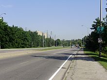
Black Creek Drive begins at an intersection with Weston Road and Humber Boulevard, in the Mount Dennis neighbourhood of Toronto. The four-lane road passes beneath railway tracks that carry the Kitchener GO Line and Union Pearson Express rail corridors. It travels north alongside Black Creek, from which it takes its name; Keelesdale Park lies to the east. The road continues north–northwest, intersecting Eglinton Avenue West. Coronation Park and Trethewey Park occupy the eastern side of the road north of Eglinton, while the western side is occupied by commercial and industrial uses.[1][3] Much of this land was a former Kodak plant, marked today only by the existence of Photography Drive.[4] Between Trethewey Drive and Lawrence Avenue West, the road passes between residential subdivisions within the Black Creek ravine. North of Lawrence, the road diverges from the Black Creek ravine. It is separated at-grade from Queens Drive and Maple Leaf Drive, which pass overhead.[1][3]
At the Maple Leaf Drive overpass, Black Creek Drive becomes Highway 400 and thereafter falls under the control of the Ministry of Transportation of Ontario.[5] The road has signalized intersections at Photography Drive, Eglinton Avenue West, Todd Bayliss Boulevard, Trethewey Drive and Lawrence Avenue West. From Trethewey north, the two directions are separated by a concrete barrier, and north of Lawrence, the directions are separated by a set of steel guard rails. South of Trethewey, the two directions are separated by a grass median.[1] The speed limit is 70 km/h for the route's entire length.[6] Bicycles and pedestrians are banned from using the roadway or paved shoulders north of Eglinton Avenue.[7]
History[]
Black Creek Drive forms the southerly extension to Highway 400, and part of a proposed highway that would have connected Highway 401 with the Gardiner Expressway. A piece of a larger plan to expand a network of expressways across Toronto, the route was ultimately completed as a compromise between Metropolitan Toronto and the provincial government, as part of the larger Spadina Expressway controversy.[8] The goal of Metro Toronto was to establish a freeway network across Toronto, including the Crosstown and Richview Expressways along Eglinton Avenue West.[9][10] The proposed route of the Highway 400 extension would have followed Weston Road and the CP right-of-way along Dupont Street (connecting with the Crosstown at present-day Christie Street), before continuing southward along Christie and Clinton Streets to the Gardiner Expressway. Alternate alignments included one following Parkside Drive south to the Gardiner, and one following the CN tracks south to Front Street, before connecting to the Gardiner.[citation needed]
By 1966, the province had completed the first leg of the route to Jane Street,[citation needed] and had acquired the necessary lands through the Black Creek Valley south to Eglinton Avenue.[citation needed] The cancellation of the Spadina Expressway in 1971 spelled the end of expressway projects in Toronto, including the Crosstown and the Richview Expressways. However, the Highway 400 Extension was still being considered as a possibility, and the Province still intended to extend Highway 400 south to Eglinton Avenue.
The provincial government still owned the right-of-way along the Black Creek Valley and agreed to construct it as a four-lane arterial road, instead of a grade-separated expressway. The Metro Toronto government agreed to extend it farther south to St. Clair Avenue. The Province began construction on the 400 Extension in 1976.
Fresh from battling the Spadina Expressway, anti-Spadina groups started battling the extension and soon, Parkdale residents joined in the debate, fearing an extension would pass directly through their neighbourhood. Additionally, the City of Toronto objected to the construction of the road south to St. Clair Avenue. A compromise was reached at Weston Road; the 400 Extension would end there, but Weston Road would be widened to support the flow of traffic from Black Creek Drive.
The roadway opened in 1982 from Jane Street south to Weston Road. On March 1, 1983, Metro Council performed a land transfer in which the right-of-way for the Spadina Expressway south of Eglinton was assumed by the province in exchange for Black Creek Drive being transferred to Metro.[11] In 1989, Metro Toronto initiated a study of the extension of Black Creek Drive south to the Gardiner Expressway.[12]
Major intersections[]
The following table lists intersections along Black Creek Drive. The entire route is located within Toronto.
| Location[13] | km[1] | mi | Destinations | Notes | |
|---|---|---|---|---|---|
| Mount Dennis / Silverthorn | 0.0 | 0.0 | Weston Road / Humber Boulevard | ||
| 0.3 | 0.19 | Photography Drive | |||
| 0.6 | 0.37 | Eglinton Avenue West | |||
| 0.9 | 0.56 | Todd Baylis Boulevard | |||
| Amesbury | 1.3 | 0.81 | |||
| Maple Leaf | 2.7 | 1.7 | Lawrence Avenue West | ||
| 3.5 | 2.2 | Maple Leaf Drive | Grade-separated overpass; Black Creek Drive continues north as Highway 400 | ||
| 1.000 mi = 1.609 km; 1.000 km = 0.621 mi | |||||
See also[]
References[]
| Wikimedia Commons has media related to Black Creek Drive, Toronto. |
- Transportation Services (2008). Road Classification System (PDF). City of Toronto. Retrieved June 6, 2021.
- ^ Jump up to: a b c d e Google (June 3, 2021). "Black Creek Drive – Length and Route" (Map). Google Maps. Google. Retrieved June 3, 2021.
- ^ Transportation Services, City of Toronto 2008, p. 55.
- ^ Jump up to: a b Golden Horseshoe StreetFinder (Map). Cartography by Rand McNally. Allmaps Canada. 1996. p. 48. §§ H6–I9.
- ^ Burley, Robert (August 25, 2007). "The end of Photography Drive: A city landmark, and an industry, fade out". Globe and Mail. Retrieved June 3, 2021.
- ^ Ministry of Transportation of Ontario (2016). "Annual Average Daily Traffic (AADT) counts". Retrieved January 1, 2021.
- ^ Transportation Services, City of Toronto 2008, p. 33.
- ^ Transportation Services (May 19, 2009). Black Creek Drive – Pedestrian Prohibited On Certain Highways: Amendments (PDF) (Report). City of Toronto. Retrieved January 26, 2021.
- ^ Sewell, John (October 11, 1984). "Unfinished Business". Globe and Mail. p. M.1.
- ^ "The Eglinton Crosstown West Extension completes a missing link: How a decades-old expressway plan will help bridge a transit gap". Metrolinx. December 8, 2020. Retrieved June 4, 2021.
- ^ Gee, Marcus (May 29, 2015). "The Man, His Highway, Their Legacy: What Toronto Can Learn From Frederick 'Big Daddy' Gardiner". Globe and Mail. Retrieved June 4, 2021.
- ^ Stein, David (February 26, 1983). "End of the Spadina Saga?". The Nation. The Toronto Star. p. B5.
- ^ Byers, Jim (June 2, 1989). "Tonks predicts big battle over traffic in west end". Toronto Star. p. A5.
- ^ "Toronto Neighbourhood Map". The Toronto Star. Retrieved October 19, 2020.
External links[]
Route map:

| ( • help)
|
| hide Major roads, highways and streets in Toronto | |||||||||
|---|---|---|---|---|---|---|---|---|---|
| North–south |
| ||||||||
| East–west |
| ||||||||
| |||||||||
| |||||||||
- Roads in Toronto