Sherbourne Street, Toronto
| Sherbourne Street | |||||||
|---|---|---|---|---|---|---|---|

| |||||||
| Route information | |||||||
| Maintained by City of Toronto government | |||||||
| Length | 3.65 km (2.27 mi) | ||||||
| Major junctions | |||||||
| South end | Queens Quay | ||||||
| North end | South Drive | ||||||
| Highway system | |||||||
Roads in Toronto
| |||||||
Sherbourne Street is a roadway in Downtown Toronto.[1] It is one of the original streets in the old city of York, Upper Canada.
It was named by (son of Thomas Ridout) in 1845 after the town in Dorset, England; the Ridout family emigrated from Sherborne to Maryland in 1774.[2] Before 1845 the short stretch from Palace Street (now Front Street East) to Duchess Street (now Richmond Street) was called Caroline Street.
In 1838, following the Upper Canada Rebellion, seven blockhouses were built, guarding the approaches to Toronto, including the Sherbourne Blockhouse, built at the current intersection of Sherbourne and Bloor.
In the 19th Century Sherbourne was lined with the stately homes of many of Toronto's most prominent families, but by the 20th Century remaining stately houses, like had been converted to rooming houses.[3]
Streetcars ran down Sherbourne from 1874 (as horsecar service until electrified in 1891, then as Belt Line to 1923 and finally as Sherbourne streetcar line) to 1942.[4]
Buses did not begin on Sherbourne until 1947 and is now signed as 75 Sherbourne since 1957.
In the early 2000s City Council chose Sherbourne as one of the first streets in Toronto to be retrofitted with dedicated bike lanes. In 2012 Sherbourne's bike lanes were improved, changing them from lanes separated from cars and trucks solely by painted lines to lanes with a pavement change that would warn motorists when they had strayed out of their lanes.[5][6]
Landmarks[]
| Landmark | Cross street | Notes | Image |
|---|---|---|---|
| Rosedale Ravine | 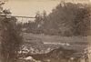
| ||
| Sherbourne Subway Station | Bloor Street | ||
| Trinity Evangelical Lutheran Church | 
| ||
| James Cooper House | Linden Street | 
| |
| Our Lady of Lourdes Church | Earl Street | 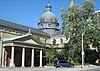
| |
| Phoenix Concert Theatre | 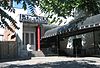
| ||
| St. James Town Branch of the Toronto Public Library |
Wellesley Street | 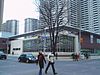
| |
| St. Luke's United Church | Carlton Street | 
| |
| Allan Gardens | between Gerrard Street East and Carlton Street | 
| |
| Allandale House | Dundas Street East | 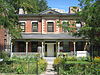
| |
| Moss Park | between Queen Street East and Shuter Street | 
| |
| Paul Bishop's House | Adelaide Street East | 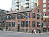
| |
| National Hotel | King Street East | 
| |
| Sherbourne Common | Queens Quay | 
|
References[]
- ^
Mary Ormsby (November 29, 2009). "Sherbourne: Toronto's 'city in one street'". Toronto Star. Archived from the original on March 5, 2013.
From its origins two centuries ago, Sherbourne reflected what the city of York would become – a duelling ground where privilege, poverty and politics would battle to shape the metropolis. Those duels aren't over.
- ^ Wise & Gould 2000, pp. 193–194.
- ^
Lesley McCave (2005). "Time Out Toronto". . p. 80. ISBN 9781904978329. Retrieved March 11, 2013.
Sherbourne Street houses many excellent 19th-century buildings, but the most interesting is probably the Clarion Selby Hotel & Suites at No. 592. At different times it has house everything and everyone from Ernest Hemingway to a gay backroom bar. The original macho man stayed here in September 1923, when the building was the Selby Hotel and Hemingway was a reporter for the Toronto Star.
- ^
James Bow, Pete Coulman (January 3, 2013). "Remembering the Sherbourne Streetcar (1874-1942)". Transit Toronto. Archived from the original on March 5, 2013.
Sherbourne Street was, after Yonge Street, the first major north-south street in Toronto to reach north towards Bloor. As streetcar service grew and developed in the young city, it wasn’t long before streetcar tracks followed.
- ^
Don Peat (September 25, 2012). "Sherbourne Bike Lanes Get Ready to Roll as Jarvis Fight Looms". Toronto Sun. Archived from the original on March 6, 2013.
The stretch of separated lanes are expected to be completed next month and will be the first on-road separated bike lanes in the city.
- ^
James Armstrong (February 20, 2013). "North American cyclists up to 30 times more likely to be injured than European cyclists". Global Toronto. Archived from the original on March 6, 2013.
The study found that separated bike lanes, found on the length of Sherbourne Street from King Street to Bloor Street, significantly decrease the risk of injury among cyclists.
External links[]
 Media related to Sherbourne Street, Toronto at Wikimedia Commons
| hide Major roads, highways and streets in Toronto | |||||||||
|---|---|---|---|---|---|---|---|---|---|
| North–south |
| ||||||||
| East–west |
| ||||||||
| |||||||||
| |||||||||
- Roads in Toronto