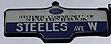
Steeles Avenue
 | |||||||
|---|---|---|---|---|---|---|---|
| Peel Regional Road 15 Halton Regional Road 8 | |||||||
 Steeles in Toronto and York Region | |||||||
| Route information | |||||||
| Maintained by City of Toronto Region of Peel Region of Halton | |||||||
| Length | 77.3 km[1] (48.0 mi) | ||||||
| Major junctions | |||||||
| West end | Appleby Line | ||||||
Hurontario Street / Main Street Islington Avenue Weston Road Jane Street Keele Street Dufferin Street Bathurst Street Yonge Street Bayview Avenue Don Mills Road Warden Avenue Kennedy Road McCowan Road Markham Road | |||||||
| East end | Scarborough-Pickering Townline / | ||||||
| Location | |||||||
| Major cities | Toronto Vaughan Markham Brampton | ||||||
| Towns | Milton Halton Hills | ||||||
| Highway system | |||||||
Roads in Ontario
| |||||||
Steeles Avenue is an east–west street that forms the northern city limit of Toronto and the southern limit of York Region in Ontario, Canada. It stretches 77.3 km (48.0 mi) across the western and central Greater Toronto Area from Appleby Line in Milton in the west to the Toronto-Pickering city limits in the east, where it continues east into Durham Region as Taunton Road, which itself extends 58 km (36 mi) across the length of Durham Region to its boundary with Northumberland County.
York Region refers to Steeles Avenue as Regional Road 95, but the designation is strictly internal and there are no signs posted. Through Peel and Halton Regions, the street is signed as Peel Road 15 and Halton Road 8, respectively.
The combination of Steeles and Taunton Road is the only arterial road to cross almost the entire Greater Toronto Area without breaks or turnoffs.
History[]

The street is named after Thomas Steele (1806-1877),[2] the first proprietor of the Green Bush Inn on the northwest corner of the street's intersection with Yonge Street in Thornhill.[3] Thomas Steele also previously managed an Inn in Bond Head, Ontario. The street's name originally contained an apostrophe (before the 'S'), a suggestive of Steele's possession of the inn and land around the intersection, but it was dropped by the mid-20th century.
Steeles in Scarborough was once referred to as Scarborough Town Line from 1850 to 1953. Prior to 1967, Steeles Avenue was named Upper Base Line (Lower Base Line being Eglinton Avenue, which is still named as such) in Halton County.[4]
Steeles became a division boundary in 1953 when the road, which was a common township boundary across the width of the-then York County between the more urban townships surrounding the old City of Toronto and the more rural ones farther north, was chosen as the northern boundary of the new Metropolitan Toronto, which was severed from the county that year.[5] To the west in Peel County, it was also the southern boundary of Chinguacousy Township and the Town of Brampton and the northern boundary of Toronto Township (later the Town of Mississauga between 1968 and 1974) until the municipal restructuring of 1974 brought Steeles fully within Brampton when the new city limits were set to the south at the-then future Highway 407 corridor and the Canadian National Halton Subdivision.[6]
A 1.5 kilometres (0.93 mi) stretch of Steeles Avenue will be widened from east of Tapscott Road to just east of Ninth Line from 2020 to 2024.[7]
Route description[]


Starting from the east, the road begins at Scarborough-Pickering Town Line/York-Durham Line, although east of the town line, the road continues as Taunton Road or Durham Regional Road 4. It is a two-lane rural road until east of Markham Road. It becomes a four lane suburban road with bicycle lanes on each side between Markham and Kennedy Roads, six lanes from Kennedy to Victoria Park Avenue, and eight lanes from Victoria Park to Highway 404. West of there, it alternates between four and six lanes the rest of way to Albion Road. The Toronto-York Region portion of the road is maintained by Toronto. As a result, limited planning authority is granted to the City of Toronto over York Region for lands that is within 45 metres (148 ft) of Steeles; formalized through a 1974 agreement between the City of Toronto and York Region.[8] Like many other east–west arterial roads within Toronto and York Region, Steeles is divided into east and west segments by Yonge Street.
Taunton Road continues as is until reaching Highway 35, where it becomes Concession Road 6, then after a turn, will become East Town Line, then to 6th Line, before ending at County Road 65.
The areas around the street in Toronto and York Region consists of farmland (within the Rouge National Urban Park) in the east, a mix of commercial and residential in the middle, and industrial zones near the west.
West of Albion Road, Steeles Avenue continues into Brampton in Peel Region, where it is also designated as Peel Regional Road 15. Like the section in Toronto, Steeles Avenue has east–west segments, this time on either side of Hurontario and Main Streets. It runs through Brampton and into Halton Region, where it is also designated as Halton Regional Road 8, through the town of Milton, ending at Appleby Line at a T intersection. Originally, the road had a second section west of the height of the Niagara Escarpment (the location of the Crawford Lake Conservation Area), which ran from just east of Guelph Line west to the Milborough Townline on the boundary between Milton and Hamilton, but this section was renamed to Conservation Road and is thus no longer part of Steeles.
Public transit[]
Toronto and York Region

The road is served predominantly by TTC bus routes 53 Steeles East and 60 Steeles West. Both routes turn south at Yonge Street to terminate at Finch Station on the eastern portion of the Line 1 Yonge–University subway line. There are also two counterpart express bus routes during the rush hours, 953 Steeles East Express and 960 Steeles West Express, as well as two overnight Blue Night routes, 353 and 360. YRT routes 88 and 91 also passes a short portion of Steeles West and Steeles East, respectively.
Several TTC bus routes provide service on north-south arterial roads in York Region that continue north from Toronto on a contractual basis. Steeles forms the fare zone boundary, and extra fare is required for bus riders to continue across it.
On December 17, 2017, an extension of the western portion of the Line 1 subway up to Vaughan was opened, passing through York University, with a station at Steeles called Pioneer Village, which was named after the nearby Black Creek Pioneer Village heritage museum (as opposed to simply having a West designation as is the practice on most of the western section of the line). Unlike TTC-contracted bus routes however, no extra fare is charged when crossing Steeles on the subway, due to the difficulty of implementing a payment-on-exit system.[9] MoveOntario 2020 also includes plans to extend the Yonge branch north and add a station at Steeles.
Brampton
In Brampton, Brampton Transit routes 11 Steeles, 51 Hereford, and 511 Züm Steeles (bus rapid transit) run along much of the street in Brampton. The 11A branch of route 11 serves the street from Brampton Gateway Terminal to Humber College, while limited trips along route 11 and all 511 Züm Steels trips run from Lisgar GO Station to Humber College.[10][11] Route 51 Hereford serves the route west of Brampton Gateway Terminal to Mississauga Road.[12] In addition, several other routes run along it for shorter stretches.
Milton
In Milton, Milton Transit operates 2 routes that run along part of Steeles Avenue: 1 Industrial and 2 Main. Route 2 runs between Lawson Road and Thompson Road before going south.[13] Route 1 is split into 3 branches, 1A, 1B and 1C. Routes 1A and 1B are separate directions in a loop, running on Steeles between Industrial Drive and Ontario Street and Thompson Road and Esquesing Line while route 1C operates on the section of Steeles between Martin Street and Ontario Street.[13]
Canadian Automobile Association rating[]
Steeles Avenue was listed by the CAA as the "worst road in Ontario" for 2006, and as the fifth-worst road in October 2007. In October 2008, it was again crowned the worst road in Ontario.[14] Reasons include potholes and general quality of surface. Soon after the results of CAA's survey were made public, some parts of the road between Dufferin Street and Bayview Avenue were resurfaced. The results of the 2009 survey listed Steeles as Ontario's worst road, for the second year in a row.
However, in 2010, Steeles Avenue was resurfaced from Yonge Street to Markham Road, with the funds coming from the federal infrastructure stimulus program, and the CAA named it the "Best Road in Ontario".[15]
Landmarks[]
Landmarks and notable sites along Steeles from west to east
| Landmark | Cross street | Notes | Image |
|---|---|---|---|
| Crawford Lake Conservation Area | Guelph Line | Former separate section of road west of Guelph Line now known as Conservation Road | 
|
| Rattlesnake Point | Appleby Line, Guelph Line | Road now officially begins at Appleby Line | 
|
| Toronto Premium Outlets | Trafalgar Road | First Premium Outlets Center in Canada | |
| Sheridan College-Davis Campus | McLaughlin Road | Sheridan's largest campus, educating nearly 8,000 students. | 
|
| Shoppers World Brampton | Hurontario Street | Road becomes Steeles West and Steeles East | 
|
| Bramalea GO Station | Bramalea Road | 
| |
| Wet 'n' Wild Toronto | Finch Avenue West | Canada's largest waterpark | |
| Black Creek Pioneer Village | Jane Street | 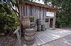
| |
| Pioneer Village station | Northwest Gate | 
| |
| York University | Keele Street, Founders Road, Murray Ross Parkway | Toronto's second largest university | 
|
| Centerpoint Mall | Yonge Street | Formerly Towne and Country Square | 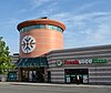
|
| Brebeuf College School | Conacher Drive | 
| |
| Pacific Mall | Kennedy Road | largest indoor Chinese Asian mall in North America | 
|
| Market Village | Kennedy Road, Redlea Avenue | Currently closed on March 1, 2018. To be replaced by Remington Centre | 
|
| Splendid China Mall | Kennedy Road, Redlea Avenue | Former Canadian Tire store | 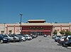
|
| Milliken GO Station | Old Kennedy Road, Silverstar Boulevard | Station moved across the street from Markham to Toronto | 
|
| Cedar Brae Golf & Country Club | Staines Road | Road enters Rouge Park. Formerly Cedar Brook Golf and Country Club c. 1922 | |
| Menno-Reesor House (6461 Steeles Avenue East) | Littles Road | Home and barn will be renovated as part of the development[16] |
References[]
- ^ "Steeles Ave. route". Google Maps. Retrieved April 2, 2017.
- ^ "THE WAY WE WERE: History at the crossroads".
- ^ Toronto Archives photo
- ^ "Canadian Champion (Milton, ON), 7 Dec 1966, p. 11".
- ^ Colton 1990, pp. 71–72.
- ^ "Brampton's historic Churchville village turns 200". Pam Douglas. Brampton Guardian. July 28, 2015. Retrieved August 12, 2020.
- ^ "Steeles Avenue Widening and Morningside Avenue Extension". 22 November 2017.
- ^ Alcoba, Natalie (26 March 2011). "Who's afraid of Shops on Steeles?". National Post. Postmedia Network Inc. Retrieved 29 July 2020.
- ^ James Bow. "A History of Subways on Bloor and Queen Streets: Celebrating the Subway's first stop in the suburbs". Transit Toronto.
- ^ "Route 11/11A Steeles Schedule" (PDF). brampton.ca. City of Brampton. 2019. Retrieved 14 January 2020.
- ^ "Route 511 Züm Steeles Schedule" (PDF). brampton.ca. City of Brampton. 2019. Retrieved 14 January 2020.
- ^ "Route 51 Hereford Schedule" (PDF). brampton.ca. City of Brampton. 2019. Retrieved 14 January 2020.
- ^ Jump up to: a b "Transit Map" (PDF). milton.ca. Town of Milton. Retrieved 14 January 2020.
- ^ "Ontario's Worst Roads Final Results". 2007-10-04. Archived from the original on 2007-10-06. Retrieved 2007-10-06.
- ^ Rush, Curtis (2010-10-28). "Federal infrastructure money resurfaced Steeles Ave. from Yonge St., to Markham Rd., which is now the Best Road in Ontario". The Star. Toronto. Retrieved 2010-10-28.
- ^ https://www.toronto.ca/legdocs/mmis/2014/sc/bgrd/backgroundfile-69799.pdf
| hide Major roads, highways and streets in Toronto | |||||||||
|---|---|---|---|---|---|---|---|---|---|
| North–south |
| ||||||||
| East–west |
| ||||||||
| |||||||||
| |||||||||
- Roads in Toronto
- Roads in Brampton
- Roads in the Regional Municipality of Peel