The Queensway
  Queensway | |||||||
|---|---|---|---|---|---|---|---|
| Peel Regional Road 20 | |||||||
 The Queensway within Toronto | |||||||
| Route information | |||||||
| Maintained by City of Toronto Region of Peel City of Mississauga | |||||||
| Existed | 1947–present | ||||||
| Major junctions | |||||||
| West end | Glengarry Road | ||||||
| Mavis Road Hurontario Street Kipling Avenue Islington Avenue Royal York Road South Kingsway | |||||||
| East end | Roncesvalles Avenue / King Street (Continues as Queen Street) | ||||||
| Highway system | |||||||
Roads in Ontario
| |||||||
The Queensway (or Queensway) is a major street in the municipalities of Toronto and Mississauga, Ontario, Canada. It is a western continuation of Queen Street, after it crosses Roncesvalles Avenue and King Street in Toronto. The Queensway is a divided roadway from Roncevalles westerly until 600 metres of the South Kingsway (accessed by ramps) with its centre median dedicated to streetcar service. The road continues undivided west from there to Etobicoke Creek as a four- or six-lane thoroughfare.
After crossing the creek, it enters Mississauga under Peel Region jurisdiction as Peel Regional Road 20, as far west as Mavis Road, with the westernmost portion to Glengarry Road being maintained by the city. There is a road allowance with hydro lines, cutting into the Mississaugua Golf & Country Club on the shores of the Credit River. In the 1990s, the name Queensway was eliminated on the roads on this allowance west of the river. The street gives its name to Etobicoke's the Queensway neighbourhood.
Etymology[]

The Queensway in Toronto was once named Queen Street and was officially the western part of the street in Old Toronto. There were three separate portions: the easternmost being a stub of the main section of Queen that continued west of Roncesvalles Avenue to Colborne Lodge Drive; a central section separated from it by a swampy area south of Grenadier Pond in High Park, running west of Ellis Avenue; and the westernmost running through the former Etobicoke west of the Humber River. The section west of the Humber was named the Queensway in 1947 to avoid confusion due to the break, but the name "Queen Street" was not restored after the present Queensway was completed to connect the sections of the formerly broken street. The most likely reason for this was because the Borough of Etobicoke desired a counterpart The Kingsway.[1][2]
In Mississauga, the road is simply named "Queensway", with east and west designations on either side of Hurontario Street: Queensway East and Queensway West
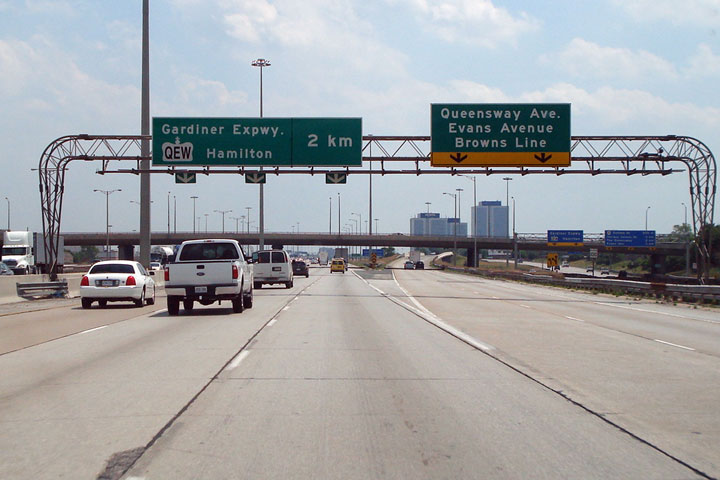
Overhead exit signs on Highway 427 formerly showed the Queensway as "Queensway Avenue" while present signs use the proper designation. It is unclear as to why the older signs use an incorrect name, but it was likely to avoid confusion with adjacent exit signs for the parallel Queen Elizabeth Way. After provincial downloading in 1998, there was no longer any need for the Queensway Avenue signage once the eastern QEW was redesignated as the Gardiner Expressway, although that signage was still present mixed with the proper signs for a time after the downloading.[3]
From 1953 to 1954, the Queensway was signed briefly as Ontario Highway 108 when it was under the-then Department of Highways from Highway 27 (Highway 427) and the eastern end of the Queen Elizabeth Way.
History[]
What would become the Queensway in Mississauga was formerly the Upper Middle Road (or the 1st Concession South of Dundas Street).[4]

The section between Roncesvalles and the Humber River was built in the 1950s, in conjunction with the construction of the Gardiner Expressway. The Queensway was built before the Gardiner Expressway to provide an east–west route for traffic while Lake Shore Boulevard was rerouted to accommodate the Gardiner. The project cost $4.9 million. The project included a streetcar right-of-way in the middle of the Queensway from Parkside Drive to the Humber River.[5]
The section from the Humber River west predates the High Park section and was previously known as Stock's Side Road, and then Queen Street. It originally spurred off Lake Shore Boulevard (then known as Lake Shore Road) at the Humber River, but that connection was severed with the building of the Queen Elizabeth Way.
To build the Parkside Drive to Ellis Drive section, the Metro government bought 7.3 hectares (18 acres) of High Park from the city. This was in contravention of stipulations by original High Park owner John Howard that the lands be used for parkland only. Metro officials searched for descendants of Howard to obtain their consent.[5]
During the post-2000 period, the Queensway has been subject to new condominium development, particularly in the vicinity of the Humber River. An attraction to this development is the proximity to downtown streetcar service.[citation needed]
Streetcar right-of-way[]


The streetcar right-of-way (ROW) along the Queensway opened on July 20, 1957, together with the new Humber Loop. Construction of the Gardiner Expressway had forced the abandonment of streetcar tracks along Lake Shore Boulevard between Sunnyside and the Humber River. From the intersection of King Street, the Queensway, Queen Street and Roncesvalles Avenue (KQQR), streetcars run in mixed traffic passing the Sunnyside Loop to about Claude Avenue where the ROW begins. The ROW goes westwards, crosses the Humber River and then turns into Humber Loop.[6]
On January 8, 2017, the ROW was closed in order to reconstruct the Queensway Bridge, carrying streetcar tracks over the Humber River, and to replace streetcar tracks and overhead wire on the ROW and at Humber Loop.[7] Streetcar service resumed to South Kingsway (with streetcars continuing without passengers to turn at Humber Loop) on April 1, 2018, and to Humber loop with passengers on June 24, 2018.[8][9]
On March 31, 2021, the KQQR intersection closed for track replacement and a redesign of the intersection. As a result, buses replaced streetcar service along the Queensway. The intersection is scheduled to reopen on November 23, 2021.[10] As part of the construction project, the ROW on the Queensway will be extended from Claude Avenue to Roncesvalles Avenue. At Sunnyside Avenue, traffic signals will be added to facilitate streetcar movements from the Sunnyside Loop. At Glendale Avenue, the westbound near-side platform will be relocated to the far side, and both the westbound and the far-side eastbound platforms will be widened for accessibility. Transit priority signals will be installed at Glendale Avenue, Sunnyside Avenue, and Roncesvalles Avenue. At KQQR, the eastbound platform on the Queensway will be replaced with a far-side platform on Queen Street, the new platform being similar to the "bumpouts" along Roncesvalles Avenue.[11]: 5
At its west end, the ROW passes through Humber Loop running in a tunnel under the Gardiner Expressway to end in mixed traffic on Lake Shore Boulevard. In November 2017, the TTC issued a report recommending that the ROW be extended along Lake Shore Boulevard from the tunnel to Park Lawn Road, where a new Park Lawn Loop would be constructed. At that time, the TTC considered this to be a high-priority project. Extending the ROW further west was considered unjustified given projected ridership.[12]
The Queensway right-of-way is currently used by the 501 Queen and 508 Lake Shore streetcar routes.[13][14]
Nearby landmarks[]
From east to west:
Toronto
- Roncesvalles Carhouse, TTC streetcar facility
- St. Joseph's Health Centre
- High Park
- Ontario Food Terminal
- Palace Pier Park
- Humber Bay Park
- Church on the Queensway (formerly named Queensway Cathedral),[2] a Pentecostal megachurch
- Queensway Health Centre
- Sherway Gardens
Mississauga
- Mississauga Hospital
- Huron Park Recreation Centre (north off of the Queensway)
- Credit Valley Golf and Country Club
References[]
- ^ "East-West Roads - The Queensway". Etobicoke Historical Society.
- ^ Jump up to: a b "The Queensway". Etobicoke Historical Society. Retrieved 2019-09-11.
- ^ "King's Highway 427 - Images". www.onthighways.com.
- ^ "Dixie: Orchards to Industry. p. 28" (PDF). Hicks, Kathleen. Mississauga Library System. 2006. Retrieved December 21, 2018.
- ^ Jump up to: a b "Award Expressway Contract Today for Queen St. Bridge Over Humber". The Globe and Mail. March 22, 1955. p. 1.
- ^ Bow, James (June 25, 2015). "The Humber Loop Interchange". Transit Toronto. Archived from the original on January 8, 2018. Retrieved January 2, 2018.
- ^ "TTC 501 Queen route converts to buses west of Roncesvalles for 2017". Toronto Transit Commission. December 16, 2016. Retrieved February 1, 2018.
- ^ "TTC service improvements and changes". Toronto Transit Commission. Archived from the original on April 11, 2018. Retrieved April 1, 2018.
- ^ "TTC service improvements and changes". Toronto Transit Commission. June 24, 2018. Archived from the original on June 25, 2018. Retrieved June 24, 2018.
- ^ "Construction Update #2 (KQQR)" (PDF). City of Toronto. March 12, 2021. Archived from the original (PDF) on March 16, 2021. Retrieved June 16, 2021.
- ^ "Improvements at The Queensway, Queen Street West, King Street West and Roncesvalles Avenue Intersection to Improve Safety, Operations, and Extend Bicycle Lanes" (PDF). Toronto Transit Commission. June 24, 2020. Archived from the original (PDF) on December 19, 2020. Retrieved June 3, 2021.
- ^ "Waterfront Transit Update" (PDF). Toronto Transit Commission. November 13, 2017. Retrieved November 13, 2017.
- ^ "501 Queen". Toronto Transit Commission. Retrieved June 16, 2021.
- ^ "508 Lake Shore". Toronto Transit Commission. Retrieved June 16, 2021.
External links[]
- Toronto's Two-Storey Streetcar Stop on YouTube, short documentary about the Parkside Drive streetcar stop along the Queensway
| show Major roads, highways and streets in Toronto |
|---|
- Roads in Toronto
- Roads in Mississauga
- Peel Regional Roads