Keele Street
  | |||
|---|---|---|---|
 Keele within Toronto | |||
| Location | Toronto, Vaughan, King | ||
| North end | King Street, in the Holland Marsh | ||
| South end | Bloor Street | ||
| East | Dufferin Street | ||
| West | Jane Street | ||
Keele Street is a north–south road in Toronto, Vaughan and King in Ontario, Canada. It stretches 47 km, running from Bloor Street in Toronto to the Holland Marsh. South of Bloor Street, the roadway is today known as Parkside Drive, but was originally part of Keele Street.[1] It was renamed in 1921 by the City of Toronto.[2]
Most of Keele runs directly along a former concession road (Third Line West of Yonge Street) allowance. Keele street was named for local businessman and farmer William Conway Keele, who lived in what is West Toronto Junction or Lambton Mills area.
Route[]
Parkside Drive begins at Lake Shore Boulevard near Sunnyside Beach, site of the former Sunnyside Amusement Park. It runs north forming the eastern boundary to High Park until Bloor Street. To the east is the Roncesvalles neighbourhood.
North of Bloor it becomes Keele. It runs through the residential High Park North neighbourhood and into the Junction, which contains a mix of residential and industrial areas around the railway tracks. It passes near the once important CPR West Toronto Yard. While Keele originally ran straight north, today there is a brief cut-off to deviate around the Canadian National and Canadian Pacific Railway corridors, near the former Canada Packers stock yards.
It resumes south of Eglinton Avenue, and connects with Weston Road by Rogers Road. There is a minor jog at Eglinton, via Trethewey Drive and Yore Road. The road servers major arteries for suburban neighbourhoods in York and North York such as Silverthorn, Amesbury, and Maple Leaf. North of Highway 401 it passes by Downsview Airport and forms the border between the residential neighbourhoods to the west and the large Keele-Finch industrial area to the east. Keele also forms the eastern border of York University.
At Steeles Avenue, the road allowance between the former North York and Vaughan Townships was connected in the early 1960s. North of Steeles, in Vaughan, Keele continues to pass through industrial areas. It runs to the west of the MacMillan Yard, Canada's largest rail yard. North of Rutherford Road Keele Street is the main street for Maple, once a small town, but today a rapidly growing suburb. North of Maple, Keele Street passes through largely rural areas, but also serves as a major street for Hope and King City.
Intersections[]

Major streets in Toronto which intersect with Keele (south to north):
- Bloor Street
- Dundas Street
- St. Clair Avenue
- Eglinton Avenue
- Lawrence Avenue
- Wilson Avenue
- Sheppard Avenue
- Finch Avenue
- Steeles Avenue
Transit[]

A portion of Keele was once a major streetcar route. The Toronto Suburban Railway ran streetcars along Keele from Dundas West to Weston Rd to connect to Lambton, Weston, and Woodbridge. The Toronto Transit Commission took over the Toronto Suburban Railway routes in the 1920s, and continued to run the northwestern streetcars on behalf of York Township. The streetcar lines were converted to buses in the late 1940s, and since then Keele has been served by buses.[3]
Today Keele is served by the 41 Keele bus route, which runs from Keele station to Pioneer Village station via York University. North of Steeles Avenue operates the York Region Transit 107 Keele along Keele Street, running from Pioneer Village station to Teston Road in Vaughan. It is also served on weekdays by the 96 Keele-Yonge Route which runs north from Pioneer Village to King Road before turning right on King Road to go to Yonge Street which leads it to the Newmarket Terminal.[4]
Landmarks[]
| Landmark | Cross street | Notes | Image |
|---|---|---|---|
| High Park | Bloor Street West | One of the city's oldest parks (opened 1876) and largest park entirely within city limits | 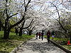
|
| Keele station | Bloor Street West | 
| |
| CPR West Toronto Yard | Dundas Street West | Yard opened in 1882. | 
|
| George Harvey Collegiate Institute | Rogers Road | 
| |
| York Memorial Collegiate Institute | Eglinton Avenue West | 
| |
| Humber River Regional Hospital, Keele Street Campus | Wilson Avenue | ||
| Downsview Park | Sheppard Avenue West | Former airfield, now a park | 
|
| Finch West station | Finch Avenue West | 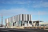
| |
| York University | Steeles Avenue West | Toronto's second largest university | 
|
| MacMillan Yard | Highway 7 (Ontario) | Largest rail yard in Canada | 
|
| Keele Valley Landfill | Major Mackenzie Drive West (York Regional Road 25) | Once Toronto's main landfill | 
|
| King City GO Station | Station Road | Site of original King Railway Station c. 1852 (moved to King Township Museum 1989) | 
|
| All Saints, King City | King Road (York Regional Road 11) | Original church building opened in 1871. | 
|
| (Hogan's Inn At Four Corners) | King Road | Main building built 1851. | |
| St. Thomas of Villanova College | 15th Sideroad | ||
| Mary Lake Augustinian Monastery | 15th Sideroad | Original summer home of Sir Henry Pellatt |
References[]
- ^ "Map of greater Toronto and suburbs (Toronto, Ontario, Canada) - 1916"
- ^ City of Toronto Bylaw 8663 (1921)
- ^ James Bow. "[The Township of York Railways. http://transittoronto.ca/streetcar/4119.shtml]" Transit Toronto. May 30, 2009.
- ^ "YRT Sysytem Map- January 6, 2019" (PDF). York Region Transit. Retrieved 2019-01-26.
| Wikimedia Commons has media related to Keele Street, Toronto. |
External links[]
Google Maps of Keele Street
Major roads, highways and streets in Toronto | |||||||||
|---|---|---|---|---|---|---|---|---|---|
| North–south |
| ||||||||
| East–west |
| ||||||||
| |||||||||
| |||||||||
- Roads in Toronto
- Transport in King, Ontario
- Transport in Vaughan