Blanchester, Ohio
Blanchester, Ohio | |
|---|---|
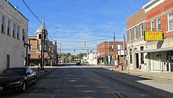
 Blanchester corporation limit sign | |
 Location of Blanchester, Ohio | |
 Location of Blanchester in Clinton County | |
| Coordinates: 39°17′32″N 83°59′9″W / 39.29222°N 83.98583°WCoordinates: 39°17′32″N 83°59′9″W / 39.29222°N 83.98583°W | |
| Country | United States |
| State | Ohio |
| Counties | Clinton, Warren |
| Government | |
| • Mayor | John M. Carman |
| Area | |
| • Total | 4.18 sq mi (10.81 km2) |
| • Land | 4.08 sq mi (10.57 km2) |
| • Water | 0.09 sq mi (0.24 km2) |
| Elevation | 971 ft (296 m) |
| Population | |
| • Total | 4,243 |
| • Estimate (2019)[2] | 4,262 |
| • Density | 1,044.35/sq mi (403.21/km2) |
| Time zone | UTC-5 (Eastern (EST)) |
| • Summer (DST) | UTC-4 (EDT) |
| ZIP code | 45107 |
| Area code(s) | 937, 326 |
| FIPS code | 39-06908[5] |
| GNIS feature ID | 1038105[4] |
| Website | www |

Blanchester is a village in Clinton and Warren counties in the U.S. state of Ohio. The population was 4,243 at the 2010 census. Blanchester is part of the Wilmington, Ohio Micropolitan Statistical Area, which is also included in the Cincinnati-Wilmington-Maysville, OH-KY-IN Combined Statistical Area.
History[]
Blanchester was laid out in 1832 by Joseph and John Blancett, and named for them.[6]
Geography[]
Blanchester is located at 39°17′32″N 83°59′9″W / 39.29222°N 83.98583°W (39.292314, -83.985769).[7]
According to the United States Census Bureau, the village has a total area of 4.25 square miles (11.01 km2), of which 4.15 square miles (10.75 km2) is land and 0.10 square miles (0.26 km2) is water.[8] There is no other community named "Blanchester" in the world.
Demographics[]
| Historical population | |||
|---|---|---|---|
| Census | Pop. | %± | |
| 1860 | 553 | — | |
| 1870 | 513 | −7.2% | |
| 1880 | 776 | 51.3% | |
| 1890 | 1,196 | 54.1% | |
| 1900 | 1,788 | 49.5% | |
| 1910 | 1,813 | 1.4% | |
| 1920 | 1,671 | −7.8% | |
| 1930 | 1,597 | −4.4% | |
| 1940 | 1,785 | 11.8% | |
| 1950 | 2,109 | 18.2% | |
| 1960 | 2,944 | 39.6% | |
| 1970 | 3,080 | 4.6% | |
| 1980 | 3,202 | 4.0% | |
| 1990 | 4,206 | 31.4% | |
| 2000 | 4,220 | 0.3% | |
| 2010 | 4,243 | 0.5% | |
| 2019 (est.) | 4,262 | [2] | 0.4% |
| U.S. Decennial Census[9] | |||
2010 census[]
As of the census[3] of 2010, there were 4,243 people, 1,636 households, and 1,113 families living in the village. The population density was 1,022.4 inhabitants per square mile (394.8/km2). There were 1,854 housing units at an average density of 446.7 per square mile (172.5/km2). The racial makeup of the village was 97.8% White, 0.4% African American, 0.3% Native American, 0.3% Asian, and 1.1% from two or more races. Hispanic or Latino of any race were 0.4% of the population.
There were 1,636 households, of which 34.8% had children under the age of 18 living with them, 47.9% were married couples living together, 14.4% had a female householder with no husband present, 5.7% had a male householder with no wife present, and 32.0% were non-families. 27.8% of all households were made up of individuals, and 11.9% had someone living alone who was 65 years of age or older. The average household size was 2.53 and the average family size was 3.08.
The median age in the village was 37.3 years. 25.5% of residents were under the age of 18; 8.1% were between the ages of 18 and 24; 26.4% were from 25 to 44; 24.5% were from 45 to 64; and 15.6% were 65 years of age or older. The gender makeup of the village was 47.1% male and 52.9% female.
2000 census[]
As of the census[5] of 2000, there were 4,220 people, 1,645 households, and 1,131 families living in the village. The population density was 1,424.8 people per square mile (550.5/km2). There were 1,766 housing units at an average density of 596.3 per square mile (230.4/km2). The racial makeup of the village was 98.70% White, 0.14% African American, 0.17% Native American, 0.36% Asian, 0.02% from other races, and 0.62% from two or more races. Hispanic or Latino of any race were 0.62% of the population.
There were 1,645 households, out of which 35.0% had children under the age of 18 living with them, 53.2% were married couples living together, 12.0% had a female householder with no husband present, and 31.2% were non-families. 27.8% of all households were made up of individuals, and 14.4% had someone living alone who was 65 years of age or older. The average household size was 2.49 and the average family size was 3.05.
In the village, the population was spread out, with 27.1% under the age of 18, 8.5% from 18 to 24, 27.3% from 25 to 44, 20.5% from 45 to 64, and 16.6% who were 65 years of age or older. The median age was 36 years. For every 100 females there were 85.6 males. For every 100 females age 18 and over, there were 80.9 males.
The median income for a household in the village was $35,608, and the median income for a family was $42,018. Males had a median income of $32,088 versus $24,531 for females. The per capita income for the village was $17,112. About 6.9% of families and 11.0% of the population were below the poverty line, including 12.4% of those under age 18 and 21.1% of those age 65 or over.
Economy[]
As of 2015, Blanchester Showplace Cinemas was reported as having the cheapest first run movie theater seating in America.[10]
Education[]
Blanchester Local School District consists of Putman Elementary School, an Intermediate School, Middle School & High School. The mascot is the Blanchester Wildcat. Blanchester Schools are known for academic excellence. Blanchester High School currently holds a "Bronze" national rating by U.S. News & World Report.
Blanchester has a lending library, the Blanchester Public Library.[11]
Notable people[]
- Clarence J. Brown - newspaper publisher, member of the United States House of Representatives, Lieutenant Governor of Ohio, and Ohio Secretary of State
- Clarence J. "Bud" Brown Jr. - newspaper publisher, member of the United States House of Representatives, and Secretary of Commerce
- Frank M. Casto, orthodontist and Past President of AAO and ADA
- Cooper Snyder, businessman and politician
References[]
- ^ "2019 U.S. Gazetteer Files". United States Census Bureau. Retrieved July 27, 2020.
- ^ Jump up to: a b "Population and Housing Unit Estimates". Retrieved May 21, 2020.
- ^ Jump up to: a b "U.S. Census website". United States Census Bureau. Retrieved 2013-01-06.
- ^ Jump up to: a b "US Board on Geographic Names". United States Geological Survey. 2007-10-25. Retrieved 2008-01-31.
- ^ Jump up to: a b "U.S. Census website". United States Census Bureau. Retrieved 2008-01-31.
- ^ Brown, Albert J. (1915). History of Clinton County, Ohio: Its People, Industries, and Institutions. B.F. Bowen. pp. 287.
- ^ "US Gazetteer files: 2010, 2000, and 1990". United States Census Bureau. 2011-02-12. Retrieved 2011-04-23.
- ^ "US Gazetteer files 2010". United States Census Bureau. Archived from the original on 2012-01-24. Retrieved 2013-01-06.
- ^ "Census of Population and Housing". Census.gov. Retrieved June 4, 2015.
- ^ "Is This the Cheapest Movie Theater in America?". 23 June 2014. Retrieved 13 January 2015.
- ^ "Homepage". Blanchester Public Library. Retrieved 3 March 2018.
External links[]
 Media related to Blanchester, Ohio at Wikimedia Commons
- Official website
| show Municipalities and communities of Clinton County, Ohio, United States |
|---|

| show Municipalities and communities of Warren County, Ohio, United States |
|---|

| show Authority control |
|---|
- Villages in Clinton County, Ohio
- Villages in Warren County, Ohio
- Villages in Ohio
- Populated places established in 1832
- 1832 establishments in Ohio