Boisbriand
Boisbriand | |
|---|---|
City | |
 | |
|
Flag | |
 Location within Thérèse-De Blainville RCM | |
 Boisbriand Location in southwestern Quebec | |
| Coordinates: 45°37′12″N 73°49′48″W / 45.62000°N 73.83000°WCoordinates: 45°37′12″N 73°49′48″W / 45.62000°N 73.83000°W[1] | |
| Country | Canada |
| Province | Quebec |
| Region | Laurentides |
| RCM | Thérèse-De Blainville |
| Constituted | January 1, 1946 |
| Government | |
| • Mayor | Marlene Cordato |
| • Federal riding | Rivière-des-Mille-Îles |
| • Prov. riding | Groulx |
| Area | |
| • Total | 29.50 km2 (11.39 sq mi) |
| • Land | 27.75 km2 (10.71 sq mi) |
| Population (2016)[3] | |
| • Total | 26,884 |
| • Density | 966.5/km2 (2,503/sq mi) |
| • Pop 2011–2016 | |
| Time zone | UTC−05:00 (EST) |
| • Summer (DST) | UTC−04:00 (EDT) |
| Postal code(s) | J7G 2J7 |
| Area code(s) | 450 and 579 |
| Highways | |
| Website | www |
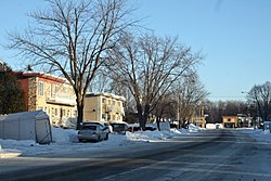
Boisbriand is an off-island suburb of Montreal, in southwestern Quebec, Canada, on the north shore of the Rivière des Mille Îles in the Thérèse-De Blainville Regional County Municipality.
The Hasidic community of Kiryas Tosh is located within the city limits and make up about 10% of its population. The rapidly growing community of 470 families and about 2,700 people was home to the former Tosher Rebbe, Meshulim Feish (Ferencz) Lowy, who established the community in 1963.
Although relatively small, Boisbriand is bisected by three highways: Highway 13 on the west, Highway 15 on the east, and Highway 640 in the middle/north.
Demographics[]
| Canada Census Mother Tongue - Boisbriand, Quebec[4] | ||||||||||||||||||
|---|---|---|---|---|---|---|---|---|---|---|---|---|---|---|---|---|---|---|
| Census | Total | French
|
English
|
French & English
|
Other
| |||||||||||||
| Year | Responses | Count | Trend | Pop % | Count | Trend | Pop % | Count | Trend | Pop % | Count | Trend | Pop % | |||||
2016
|
26,860
|
21,285 | 79.24% | 1,035 | 3.85% | 260 | 0.96% | 3,945 | 14.68% | |||||||||
2011
|
26,816
|
22,160 | 82.65% | 895 | 3.34% | 200 | 0.74% | 3,350 | 12.49% | |||||||||
2006
|
26,420
|
22,905 | 86.70% | 635 | 2.4% | 165 | 0.62% | 2,715 | 10.27% | |||||||||
2001
|
26,670
|
22,960 | 86.08% | 800 | 2.99% | 140 | 0.53% | 2,775 | 10.40% | |||||||||
1996
|
25,227
|
22,235 | n/a | 88.30% | 750 | n/a | 2.97% | 155 | n/a | 0.62% | 1855 | n/a | 7.36% | |||||

Sport[]
Boisbriand is home to the Blainville-Boisbriand Armada of the Quebec Major Junior Hockey League. The Armada play their home games at Centre d'Excellence Sports Rousseau.
The city promotes several sports teams of different categories like minor hockey, aquatic club, athletics club, fencing, karate, synchronized swimming, figure skating.[5]
Education[]
The Commission scolaire de la Seigneurie-des-Mille-Îles (CSSMI) operates Francophone public schools.[6]
Some areas are served by École Le Tandem in Sainte-Thérèse.[13]
Sir Wilfrid Laurier School Board operates Anglophone schools:
- Pierre Elliot Trudeau Elementary School in Blainville[14]
- Rosemere High School in Rosemère[15]
Climate[]
The climate of Boisbriand is a humid continental climate. Winters are cold with a lot of snowfall and summers are hot and humid. There are 4 seasons spring, summer, autumn and winter.
Twin cities[]
- France, Annemasse
References[]
- ^ Reference number 72364 of the Commission de toponymie du Québec (in French)
- ^ Jump up to: a b Geographic code 73005 in the official Répertoire des municipalités (in French)
- ^ Jump up to: a b Statistics Canada 2011 Census - Boisbriand census profile
- ^ Statistics Canada: 1996, 2001, 2006, 2011, 2016 census
- ^ "Sportif | Ville de Boisbriand". www.ville.boisbriand.qc.ca. Retrieved 2019-08-09.
- ^ "Admission et inscription Archived 2015-01-31 at the Wayback Machine." Commission scolaire de la Seigneurie-des-Mille-Iles. Retrieved on December 7, 2014. "La Commission scolaire de la Seigneurie-des-Mille-Iles (CSSMI) offre ses services aux résidents des municipalités de : Blainville, Boisbriand, Bois-des-Filion, Deux-Montagnes, Lorraine, Mirabel (Saint-Augustin, Saint-Benoît, Sainte-Scholastique et secteur du Domaine-Vert), Oka, Pointe-Calumet, Rosemère, Sainte-Anne-des-Plaines, Sainte-Marthe-sur-le-Lac, Sainte-Thérèse, Saint-Eustache, Saint-Joseph-du-Lac, Saint-Placide et Terrebonne Ouest."
- ^ "de la Clairière." Commission scolaire de la Seigneurie-des-Mille-Îles. Retrieved on September 20, 2017.
- ^ "des Grands-Chemins." Commission scolaire de la Seigneurie-des-Mille-Îles. Retrieved on September 20, 2017.
- ^ "du Mai." Commission scolaire de la Seigneurie-des-Mille-Îles. Retrieved on September 20, 2017.
- ^ "Gabrielle-Roy." Commission scolaire de la Seigneurie-des-Mille-Îles. Retrieved on September 20, 2017.
- ^ "Gaston-Pilon." Commission scolaire de la Seigneurie-des-Mille-Îles. Retrieved on September 20, 2017.
- ^ "Le Sentier." Commission scolaire de la Seigneurie-des-Mille-Îles. Retrieved on September 20, 2017.
- ^ "Répertoire des aires de desserte par ville 2017 - 2018 (Généré le 7/9/2017) Boisbriand Archived 2017-09-20 at the Wayback Machine." Commission scolaire de la Seigneurie-des-Mille-Îles. Retrieved on September 20, 2017.
- ^ "PIERRE ELLIOT TRUDEAU ELEMENTARY ZONE." Sir Wilfrid Laurier School Board. Retrieved on September 16, 2017.
- ^ "Rosemere High School Zone." Sir Wilfrid Laurier School Board. Retrieved on December 8, 2014.
External links[]
| Wikimedia Commons has media related to Boisbriand. |
| show Places adjacent to Boisbriand |
|---|
| hide | |
|---|---|
| Cities | |
| |
| show Authority control |
|---|
- Boisbriand
- Cities and towns in Quebec