Boulogne–Pont de Saint-Cloud (Paris Métro)
Boulogne–Pont de Saint-Cloud | |||||||||||
|---|---|---|---|---|---|---|---|---|---|---|---|
| Paris Métro station | |||||||||||
 | |||||||||||
| Location | Boulogne-Billancourt Île-de-France France | ||||||||||
| Coordinates | 48°50′26″N 2°13′42″E / 48.840684°N 2.228331°ECoordinates: 48°50′26″N 2°13′42″E / 48.840684°N 2.228331°E | ||||||||||
| Owned by | RATP | ||||||||||
| Operated by | RATP | ||||||||||
| Other information | |||||||||||
| Fare zone | 2 | ||||||||||
| History | |||||||||||
| Opened | 2 October 1981 | ||||||||||
| Services | |||||||||||
| |||||||||||
| Location | |||||||||||
 Boulogne–Pont de Saint-Cloud Location within Paris | |||||||||||

Boulogne–Pont de Saint-Cloud (French pronunciation: [bulɔɲ pɔ̃ də sɛ̃ klu]) is the western terminus of Line 10 of the Paris Métro. The station lies under the Rond-Point Rhin et Danube, near the Pont de Saint-Cloud bridge over the Seine, in the commune of Boulogne-Billancourt. The station was opened on 2 October 1981 when Line 10 was extended from Boulogne–Jean Jaurès.[1] The station is the most westerly station on Paris Métro system.
Station layout[]
| Street Level |
| B1 | Mezzanine |
| Platform level | Eastbound | |
| Island platform, doors will open on the left, right | ||
| Eastbound | | |
Gallery[]
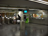
Boulogne–Pont de Saint-Cloud ticket hall

Line 10 platforms at Boulogne–Pont de Saint-Cloud


References[]
- ^ Tricoire, Jean (1998). Un Siècle de Métro en 14 Lignes (in French). Éditions la Vie du Rail. p. 273. ISBN 2-902808-87-9.
| Wikimedia Commons has media related to Boulogne - Pont de Saint-Cloud (Paris Metro). |
Categories:
- Paris Métro line 10
- Paris Métro stations in Boulogne-Billancourt
- Railway stations in France opened in 1981