Tramways in Île-de-France
 Tram on Line T3a in front of the Cité Internationale Universitaire de Paris | |||
| Overview | |||
|---|---|---|---|
| Native name | Tramways d'Île-de-France | ||
| Locale | Île-de-France, France | ||
| Transit type | Light rail/tram | ||
| Number of lines | 11 | ||
| Number of stations | 212 | ||
| Daily ridership | 1,098,000 per day 2019[1] 340 million per year 2019[2] | ||
| Operation | |||
| Began operation | 1992 | ||
| Operator(s) | RATP / SNCF / Transkeo | ||
| Technical | |||
| System length | 104.7 km (65.1 mi)[3][4][5] | ||
| Track gauge | 1,435 mm (4 ft 8+1⁄2 in) standard gauge for conventional lines | ||
| |||

The Île-de-France tramways (French: Tramways d'Île-de-France) consists of a network of modern tram lines in the Île-de-France region of France. Eleven lines are currently operational (counting Lines 3a and 3b as separate lines), with extensions and additional lines in the planning and construction stage. Although the system mainly runs in the suburban regions of Paris, lines T3a and T3b run entirely within Paris city limits, and line T2 also does so for part of its route. While the lines operate independently of each other and are generally unconnected, some connections do exist: between lines T2 and T3a (at the Porte de Versailles station, since 2009), T3a and T3b (at the Porte de Vincennes station, since 2012), T1 and T5 (at the Marché de Saint-Denis station, since 2013), T1 and T8 (at the Saint-Denis train station, since 2014) and T8 and T11 Express (at two stations : Villetaneuse-Université and Épinay-sur-Seine, since 2009). However, the final design of the entire planned tram network is fairly integrated.
Almost all lines (Lines 4 & 11 Express being the sole exceptions) are operated by the Régie Autonome des Transports Parisiens (RATP), which also operates the Paris Métro and most bus services in the Paris immediate area. Furthermore, while most lines use conventional steel-wheel rolling stock, two lines (T5 and T6) use rubber-tired trams. Moreover, line T4, which uses tram-train technology, is operated by the French national rail operator SNCF as part of its Transilien regional rail network. Line T11 Express, which also uses tram-train technology, is operated by SNCF's subsubsidiary Transkeo.
History[]

From 1855 to 1938, Paris was served by an extensive tramway network, predating the Paris Métro by nearly a half-century.[6] In 1925 the network had a 1,111 km (690 mi) length, with 122 lines.[citation needed] In the 1930s, the oil and automobile industry lobbies put pressure on the Paris Police Prefecture to remove tram tracks and make room for cars.[7] The last of these first generation tram lines inside of Paris, that connected Porte de Saint-Cloud to Porte de Vincennes, was closed in 1937,[8] and the last line in the entire Paris agglomeration, running between Le Raincy and Montfermeil, ended its service on 14 August 1938.[7]
Originally horse-powered, Paris trams used steam, as well as later pneumatic engines, then electricity. The funicular that operated in Belleville from 1891 to 1924 is sometimes erroneously thought of as a tramway, but was actually a cable car system. The first of the new generation of trams in Paris, the current Line T1, opened in 1992, with Line T2 opening in 1997 and Lines T3 and T4 in 2006. Lines T5 and T7, opened in 2013 while T6 and T8 opened in 2014. T11 opened in 2017, while T9 and T10, held back into the project stage for many years, are still under preparative works, now joined by Lines T12 Express and T13 Express, the last parts of the former Grande Ceinture Line that are not covered by Line T11 Express.
Lines[]


| Line | Opening[9] | Length | Stations | Operator |
|---|---|---|---|---|
| 1992[10] | 17 km (11 mi)[citation needed] | 36 | RATP | |
| 1997[10] | 17.9 km (11.1 mi)[citation needed] | 24 | RATP | |
| 2006[10] | 12.4 km (7.7 mi)[citation needed] | 25 | RATP | |
| 2012[10] | 9.9 km (6.2 mi)[citation needed] | 18 | RATP | |
| 2006[4] | 7.9 km (4.9 mi)[4] | 11[4] | SNCF | |
| 2013[10] | 6.6 km (4.1 mi)[10] | 16[10] | RATP | |
| 2014[5] | 14 km (8.7 mi)[5] | 21[5] | RATP | |
| 2013[10] | 11.2 km (7.0 mi)[10] | 18[10] | RATP | |
| 2014[5][11] | 8.5 km (5.3 mi)[5][11] | 17[5][11] | RATP | |
| 2021[12] | 10.3 km (6.4 mi) | 19 | Keolis | |
| Planned in 2023 | 8.2 km (5.1 mi) | 14 | TBD | |
| 2017 | 11 km (6.8 mi) | 7 | Transkeo | |
| Planned in 2022 | 20 km (12 mi) | 16 | SNCF | |
| Planned in 2022 | 18.8 km (11.7 mi) | 11 | SNCF | |
| TOTAL: | 173.7 km (107.9 mi) | 253 | ||
T1[]
Line T1 currently connects Asnières-sur-Seine and Gennevilliers to Noisy-le-Sec, running almost parallel to the Paris city's northern limit. It opened in 1992 from Saint Denis's RER station to the Bobigny–Pablo Picasso Paris Métro station, where is located the prefecture building of the Seine-Saint-Denis department.[13] The extension from Bobigny to Noisy-le-Sec was completed in 2003. An extension west to Asnières-sur-Seine and Gennevilliers, connecting to western branch of Paris Métro Line 13, opened in 2012; a continuation towards Nanterre is planned. An eastwards extension to Montreuil and to the Val de Fontenay RER station is also planned.
T2[]
Line T2 (Trans Val-de-Seine) connects the bridge of Bezons (Pont de Bezons) to the Porte de Versailles Paris Métro station (near Paris's main exhibit grounds) via La Défense and Issy-les-Moulineaux business districts. It opened in 1997 between La Défense and Issy–Val de Seine station stations, mostly on a former SNCF line, the Moulineaux Line (which closed in 1993). An extension south, from Issy–Val de Seine station to Porte de Versailles, opened in 2009, while the second extension, to the north this time, opened in 2012 from La Défense to Pont de Bezons.
T3a and T3b[]
Line T3 is the first modern tramway line to actually enter Paris itself. It is divided into two sections, called T3a and T3b, separated at the Porte de Vincennes stop in order not to cut the road traffic there, despite rail and electrical infrastructure being present and operational. The line is also known as the Tramway des Maréchaux because it follows the Boulevards of the Marshals, a series of boulevards that encircle Paris along the route of the former Thiers Wall, built from 1841 to 1844. The boulevards are, with three exceptions, named for Napoleon's First Empire marshals (maréchaux).
T3a connects the Pont du Garigliano–Hôpital européen Georges-Pompidou RER station in the western part of the 15th arrondissement with the Porte de Vincennes Métro station in the 12th arrondissement. T3b connects Porte de Vincennes with the Porte de la Chapelle Métro station in the 18th arrondissement, this with an extension to Porte d'Asnières (17th arrondissement), opened in 2018. The extension opened on 24 November 2018.[14]
T4[]
Line T4 is an 8-kilometre (5.0 mi), 11-stop[4] tram-train line, operating in part on SNCF lines, connecting the Bondy RER station with the Aulnay-sous-Bois RER station. It opened on 18 November 2006. Unlike the other tramways in Île-de-France, Line T4 is operated by the SNCF. A new branch of this tram-train line, heading east towards Montfermeil, opened in 2020.
T5[]
Tramway T5[15] is a Translohr tram-on-tyres[16] running along a mainly segregated "track" on the busy Route Nationale 1 (similar to the systems in Nancy or Caen), replacing the often busy bus lines 168 and 268. The 6.6-kilometre (4.1 mi) route[16] serves 16 stops[16] between Saint-Denis, Pierrefitte-sur-Seine, Sarcelles and Garges-lès-Gonesse. It has an interchange with T1 at its southerly terminus marché de Saint-Denis and with RER D at its northern terminus, the Garges-Sarcelles RER station.[17] Line T5 opened in July 2013.[18]
T6[]
Tramway Line 6 is a 14-kilometre (8.7 mi) Translohr tram-on-tyres serving 21 stations, from the Châtillon–Montrouge Métro station (the southern terminus of Paris Métro Line 13) to the Viroflay-Rive-Droite Transilien station. The 1.6 kilometres (0.99 mi) serving at the western (Viroflay) end, is in a tunnel crossing the town from south to north, including two stops, namely the two train stations the city has, Rive-Gauche (Line C and Line N) and Rive-Droite (Line L). The majority of the current line opened in 2014, with said tunnel section opening in 2016. It replaced bus line 295, that became too crowded and slow for proper use.
T7[]
Tramway Line 7 is an 11.2-kilometre (7.0 mi) route serving 18 stations[10] between Villejuif–Louis Aragon (southwestern terminus of Paris Métro Line 7) and Athis-Mons, via Rungis International Market and Orly Airport. It opened in 2013[19] in order to both allow a supplemental rail service from Paris to Orly Airport and replace bus line 285, which had become overly crowded.
T8[]
Formerly known as Tram'y due to its opening-day Y-shape, this 8.46-kilometre (5.26 mi) line goes from the Saint-Denis–Porte de Paris Métro station to Épinay-sur-Seine—Orgemont, with a branch to the university campus of Villetaneuse, where it connects to the more recent T11 Express Line. An extension is also planned south, to Paris itself, at the Rosa Parks RER station. Construction of the line began in 2010; service began in 2014.[19]
T9[]
T9 is a tram line that runs between the Porte de Choisy Paris Métro station and the centre of Orly with a length of 10.3 km (6.4 mi) and 19 stops.
T11 Express[]
First "Express" tram line of the Parisian network — due to reusing the long-closed Grande Ceinture, with only a handful of stations in — Line T11 Express is actually the most recent tramway line of the Parisian network, serving as the first of three lines to cover the former Grande Ceinture rail line and offering eventually a second circular railroad service around Paris, something the Paris public transport system sorely lacked for many years
Line T11 Express opened in 2017 between the Épinay-sur-Seine RER station and Le Bourget RER station, the middle part of its expected full route between Sartrouville and Noisy-le-Sec RER stations.
Future lines[]
T10[]
T10 is a planned tram route from Antony to Clamart in the southwestern suburbs of Paris with a length of 8.2 km (5.1 mi) and 14 stops.
T12 Express[]
T12 Express is a tram-train line currently under construction between Évry-Courcouronnes station (RER D) and Massy-Palaiseau station (RER B and C) via Épinay-sur-Orge station (RER C), with a length of 20 km (12 mi) and 16 stops.
T13 Express[]
T13 Express is a tram-train line currently under construction between Saint-Germain-en-Laye station (RER A) and Saint-Cyr station (RER C and Transilien lines N and U) with a length of 18.8 km (11.7 mi) and 11 stops.
TVM[]
The Trans-Val-de-Marne bus line, which runs in a designated bus lane and is intended to provide high-capacity, rapid transit southeast of Paris in the department of Val-de-Marne, is operated by RATP unlike most suburban bus lines. Despite beginning with a T, it is not a tramway. The RATP however considers it to be part of the T network, and is currently drawing plans for more BRT lines.
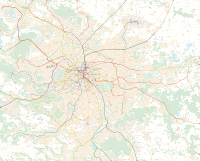
Network Map[]

See also[]
- List of tram stops in Île-de-France
- Transportation in Paris
- Trams in France
- List of town tramway systems in France
- List of tram and light rail transit systems
References[]
- ^ https://omnil.fr/IMG/xlsx/trafic_version_en_ligne_-_journalier.xlsx
- ^ https://omnil.fr/IMG/xlsx/trafic_version_en_ligne_annuel.xlsx
- ^ "RATP's tram network in Île-de-France". RATP. Archived from the original on 2014-04-26. Retrieved 2014-04-25.
- ^ Jump up to: a b c d e "BIENVENUE SUR LA LIGNE T4" [WELCOME TO THE T4 LINE]. sncf.com (in French). SNCF Transilien. 2013. Retrieved 2013-09-13.
- ^ Jump up to: a b c d e f g "2014, the next year of the tram". RATP. Archived from the original on 2014-12-25. Retrieved 2014-12-16.
- ^ LE CHEVAL A PARIS DE 1850 a 1914 (in French). Librairie Droz. pp. 84ff. ISBN 978-2-600-04536-0.
- ^ Jump up to: a b Dominique Larroque; Michel Margairaz; Pierre Zembri; Association pour l'histoire des chemins de fer en France (2002). Paris et ses transports: XIXe-XXe siècles, deux siècles de décisions pour la ville et sa région. Recherches. p. 131. ISBN 978-2-86222-042-0.
- ^ Ralf Roth; Colin Divall (28 March 2015). From Rail to Road and Back Again?: A Century of Transport Competition and Interdependency. Ashgate Publishing, Ltd. pp. 351ff. ISBN 978-1-4094-7115-8.
- ^ "RATP's tram network in Île-de-France". RATP. Archived from the original on 2014-10-26. Retrieved 2014-12-16.
- ^ Jump up to: a b c d e f g h i j k "2013, another year of the tram". RATP. Archived from the original on 2014-10-26. Retrieved 2014-12-16.
- ^ Jump up to: a b c "Paris opens tram Route T8". Railway Gazette International. 16 December 2014. Retrieved 2014-12-16.
- ^ "T9 : ouverture le 10 avril - transportparis - Le webmagazine des transports parisiens". transportparis.canalblog.com (in French). 2021-03-11. Retrieved 2021-03-14.
- ^ Trams return to Paris Trolley Wire issue 250 August 1992 pages 27/28
- ^ http://www.leparisien.fr/info-paris-ile-de-france-oise/transports/paris-le-tramway-jusqu-a-porte-d-asnieres-c-est-parti-23-11-2018-7951791.php
- ^ "Tramway 5 - le T5 en ligne" [Tramway 5 - The T5 line] (in French). RATP. Retrieved 2013-09-13.
- ^ Jump up to: a b c "le T5 en ligne - Le projet - L'essentiel" [The T5 line - the project - essentials] (in French). RATP. Archived from the original on 2013-10-04. Retrieved 2013-09-13.
- ^ http://www.anous.fr/paris/traffic/un-nouveau-tram-en-banlieue/3897.html[dead link]
- ^ "Home - In Ile-de-France - Extending the network - Tramway - Créations : T5". Archived from the original on 2013-04-20. Retrieved 2013-09-12.
- ^ Jump up to: a b "Citadis remains popular in Paris". Railway Gazette International. 28 January 2011. Retrieved 2014-07-12.
External links[]
| Wikimedia Commons has media related to Trams in Paris. |
- Official RATP website
- Official SNCF Transilien website
- Comprehensive map of the Paris tram network including track layouts (in French)
| show City of Paris |
|---|

- Tramways in Île-de-France
- Tramways in Paris
- Rail transport in Île-de-France
- Rail transport in Paris
- RATP Group
- Tram transport in France