Brunei Bay
| Brunei Bay Teluk Brunei | |
|---|---|
 Brunei Bay from space | |
 Brunei Bay Teluk Brunei | |
| Location | Southeast Asia |
| Coordinates | 5°00′43.44″N 115°17′26.66″E / 5.0120667°N 115.2907389°E |
| Type | Bay |
| Primary inflows | South China Sea |
| Basin countries | Brunei, Malaysia |

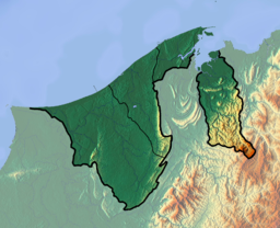
Brunei Bay (Malay: Teluk Brunei) is on the northwestern coast of Borneo island, in Brunei and Malaysia.
Brunei Bay is located 5°00'43.44", 115°17'26.66"; east of Bandar Seri Begawan, Brunei.
It is the ocean gateway to the isolated Temburong District of Brunei, separated from the rest of Brunei by the Malaysian Sarawak State surrounding it to the bay.
A 30-kilometre (19 mi) roadway connecting the Muara and Temburong districts of Brunei, completed in 2018, crosses over the Brunei bay. The section going across the Brunei bay measures in at 14-kilometre (8.7 mi).[1]
Environment[]
Brunei Bay contains some 8,000 ha of tidal mudflats and sandflats, seagrass beds, coral reefs, mangroves, beach forest and sandstone islets. These have been identified by BirdLife International as an Important Bird Area (IBA) because it supports significant numbers of the populations of various bird species, including Bonaparte's nightjars, lesser adjutants, Storm's storks, Chinese egrets, greater sandplovers, spotted greenshanks and roseate terns. Threats include inshore trawling, waterbird hunting, and habitat fragmentation through mangrove clearance.[2]
References[]
- ^ Rabiatul, Kamit (10 May 2013). "Temburong bridge ready 2018". Brunei Times. Archived from the original on 2013-12-03. Retrieved 10 July 2013.
- ^ "Brunei Bay". BirdLife Data Zone. BirdLife International. Retrieved 3 October 2020.
Other sources[]
- Caldecott (1987); Currie (1979a, 1979b, 1980 & 1982); Farmer (1986); Farmer et al. (1986); Howes & Sahat (in prep); Karpowicz (1985); Lindley (1982); Sahat (1987); Teng (1970 & 1971); UGL Consultants Ltd (1983).
- John R. Howes, Mohammad Jaya bin Haji Sahat and Euan G. Ross.
| show Authority control |
|---|
This Brunei location article is a stub. You can help Wikipedia by . |
- Bays of Brunei
- Bays of Malaysia
- Landforms of Sarawak
- Temburong District
- Brunei–Malaysia border
- Important Bird Areas of Brunei
- Brunei geography stubs