Erica Reef
| Disputed island Other names: Enola Reef Terumbu Siput (Malay) Gabriela Silang Reef (Philippine English) Bahura ng Gabriela Silang (Filipino) Đá Én Ca (Vietnamese) 簸箕礁 Bòji Jiāo (Chinese) | |
|---|---|
 Satellite image of Erica Reef by NASA. | |
| Geography | |
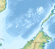 | |
| Location | South China Sea |
| Coordinates | 8°6′0″N 114°8′37″E / 8.10000°N 114.14361°ECoordinates: 8°6′0″N 114°8′37″E / 8.10000°N 114.14361°E 8°6′0″N 114°8′37″E / 8.10000°N 114.14361°E |
| Archipelago | Spratly Islands |
| Administered by | |
| Malaysia | |
| Claimed by | |
| People's Republic of China | |
| City | Sansha, Hainan |
| Philippines | |
| Municipality | Kalayaan, Palawan |
| Republic of China (Taiwan) | |
| Municipality | Cijin, Kaohsiung |
| Vietnam | |
| District | Trường Sa, Khánh Hòa |

Erica Reef, also known as Enola Reef; Malay: Terumbu Siput, lit. 'Shell Reef'; Gabriela Silang Reef (Tagalog: Bahura ng Gabriela Silang); Vietnamese: đá Én Ca; Mandarin Chinese: 簸箕礁; pinyin: Bòji Jiāo, is located in the SW of Dangerous Ground, 24km east-northeast of Mariveles Reef in the Spratly Islands.[1]
It is small, almost circular, with an outside radius about 1 km. It dries entirely at low tide, enclosing a shallow lagoon. A few rocks remain visible on the east side at high water but there is no obvious point of reference. The lagoon is too shallow to be of much interest and the outer reef is a steep slope rather than a drop-off, but it descends into very deep water. Healthy stony corals harbouring a myriad of reef creatures descend into the depths and many shoals of semi-pelagic fish are seen in the clear visibility. On each reef the south walls are precipitous while their other boundaries are slopes, the walls are a result of prevailing currents and the direction of maximum sunlight encouraging coral growth.[citation needed]
It is one of the areas in the Spratly Islands occupied by Malaysia. The Royal Malaysian Navy has maintained an "offshore naval station" there called "Station Sierra" since 1999.[2] The reef is also claimed by the People's Republic of China, Republic of China (Taiwan), the Philippines, and Vietnam. The Filipino(Tagalog) name is named after Philippine revolutionary leader, Gabriela Silang.
References[]
- ^ http://www.oceangrafix.com/chart/zoom?chart=93047 SW Dangerous Ground
- ^ Joshua Ho; Sam Bateman (15 February 2013). Maritime Challenges and Priorities in Asia: Implications for Regional Security. Routledge. pp. 74–. ISBN 978-1-136-29820-2.
This Malaysia-related article is a stub. You can help Wikipedia by . |
- Reefs of the Spratly Islands
- Malaysia stubs