Royal Captain Shoal
| Disputed island Other names: Kanduli Shoal (Philippine English) Kulumpol ng Kanduli (Filipino) 艦長礁 / 舰长礁 Jiànzhǎng Jiāo (Chinese) Bãi Đồi Mồi (Vietnamese) | |
|---|---|
 | |
| Geography | |
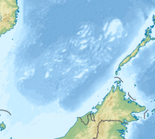 | |
| Location | South China Sea |
| Coordinates | 9°01′N 116°40′E / 9.017°N 116.667°ECoordinates: 9°01′N 116°40′E / 9.017°N 116.667°E |
| Archipelago | Spratly Islands |
| Claimed by | |
Royal Captain Shoal, also known as Kanduli Shoal (Tagalog: Kulumpol ng Kanduli); Mandarin Chinese: 艦長礁/舰长礁; pinyin: Jiànzhǎng Jiāo; Vietnamese: Bãi Đồi Mồi, is a shoal in the South China Sea and a part of Spratly Islands. It is located in the vicinity of Northeast Investigator Shoal and Half Moon Shoal, at the eastern edge of the area named "Dangerous Ground".[1]
History and etymology[]
The shoal is named after the East India company ship Royal Captain that ran aground in the vicinity of this shoal in 1773. The ship was subsequently wrecked and lost.[2]
Charged with Chinese merchandise(porcelain, tea, silk, glass and gold etc.) and a few passengers, the ship made her journey from Canton, China to British port at situated in north of Sabah and to the west of Pulau Banggi in December, 1773. On the 17th of the same month, at half past two A.M. it struck an unnamed island which was later called Royal Captain Shoal to mark the event. The ship was seriously damaged. The crew repaired it and got on running. It struck again and wrecked in the sea of the west Palawan coast. Fortunately most crew and passengers got saved.[2]
Location and topography[]
Spread over an area of 8 square kilometres, Royal Captain Shoal is centered at 9°01’N 116°40’E near the . It is located 16 nautical miles southeast of Northeast Investigator Shoal, and north of Half Moon Shoal.[3] It lies off the coast of Palawan, Philippines and consists of a few rocks that are above water at low tide that surrounded a lagoon.[4] The rocks in the shoal dry at 1.2 metres. The lagoon has depths of up to 31 metres and contains a number of coral heads.[1]
Named features in this shoal include Observation Rock (at the northern tip of the shoal) that shows at half tide. The shoal can only be entered at high water.[5]
References[]
- ^ a b Hancox, D.J.; Prescott, John Robert (1995). A geographical description of Spratly islands (Volume 1, Number 6 ed.). Durham, UK: IBRU (International Boundaries Research Unit). p. 39.
- ^ a b Poling, Gregory (26 July 2013). The South China Sea in focus (1 ed.). Washington DC: Centre for Strategic and International Studies / Rowman and Littlefield.
- ^ United States Coast Pilot - Philippine islands (Volume 2). US Coast and geodetic Survey. 2001.
- ^ Rosenberg, David (19 August 2011). Digital Gazetter of the South China Sea. Retrieved 2 September 2016.
- ^ Mccarthy, Terry (8 March 1999). Reef wars. New York: Time.
| Confrontations |
| ||||||||||
|---|---|---|---|---|---|---|---|---|---|---|---|
| Regions | |||||||||||
| Occupied features | |||||||||||
| Unoccupied features | |||||||||||
| Related articles | |||||||||||
- Shoals of the Spratly Islands
- Reefs of China
- Reefs of the Philippines
- Reefs of Taiwan
- Reefs of Vietnam
- Disputed reefs