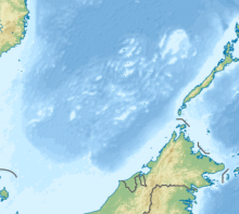
Bombay Castle (South China Sea)
| Disputed island Other names: Bãi Ba Kè (Vietnamese) 蓬勃堡 Péngbó Bǎo (Chinese) Abad Santos Shoal (Philippine English) Kulumpol ng Abad Santos (Filipino) | |
|---|---|
| Geography | |
 | |
| Location | South China Sea |
| Coordinates | 07°50′N 111°40′E / 7.833°N 111.667°ECoordinates: 07°50′N 111°40′E / 7.833°N 111.667°E |
| Archipelago | Spratly Islands |
| Administered by | |
| Vietnam | |
| Province | Bà Rịa–Vũng Tàu province |
| Claimed by | |
| China | |
| Taiwan | |

Bombay Castle, also known in Vietnamese: Bãi Ba Kè; Mandarin Chinese: 蓬勃堡; pinyin: Péngbó Bǎo;[1] Abad Santos Shoal (Tagalog: Kulumpol ng Abad Santos, lit. 'Cluster of Abad Santos'), is a shoal with a lighthouse in the of the southern Spratly Islands. It is occupied by Vietnam,[2] but also claimed by China (PRC) and Taiwan (ROC).
Location and topography[]
Bombay Castle consists of a submerged reef located between 07°50′N 111°40′E / 7.833°N 111.667°E and 07°56′N 111°42′E / 7.933°N 111.700°E (between 07°50′N 111°40′E / 7.833°N 111.667°E and 07°56′N 111°42′E / 7.933°N 111.700°E) at the northern end of Rifleman Bank.[3][4] At its shallowest point, it has a depth of 3 metres (9.8 ft) consisting of sand and coral.[5] It is 80 miles (130 km) east of Huyền Trân () and nearly 80 miles (130 km) west of An Bang (Amboyna Cay).[6]
Bombay Castle has a 22.5 metres (74 ft) tall lighthouse on steel pilings that was built in 1995. The lighthouse is two storied, with accommodation for the lighthouse keepers and a dish antenna.[7][8]
The reef is named after the East Indiaman Bombay Castle.[9]
DK1 rigs[]
In addition to the lighthouse (DK1/21), three other DK1 rigs ("economic, scientific and technological service stations") have been constructed by Vietnam in this area. The current (2015) cluster has 3 rigs in use.
- DK1/4: Completed 16 June 1989, was the 2nd DK1 rig completed. It collapsed on the night of 4 December 1990 during a heavy storm.[10]
- DK1/9: Completed 22 August 1993.[11]
- DK1/20: Completed 13 August 1998.[12]
- DK1/21: Completed 19 August 1998. This rig includes a lighthouse.[13]
See also[]
References[]
- ^ "Glossary of names - South China Sea". www.globalsecurity.org. Retrieved 6 June 2014.
- ^ "Bombay Castle". East Asian Studies Library. Retrieved 6 June 2014.
- ^ Pub 161 - Sailing Directions - South China Sea and the Gulf of Thailand (Ninth ed.). U.S.A: ProStar Publications, Inc. 20 November 2004. p. 14. ISBN 157785652X. Retrieved 6 June 2014.
- ^ Samuels, Marwyn (2013). Contest for the South China Sea. Routledge. p. 191. ISBN 1136575537. Retrieved 6 June 2014.
- ^ Valencia, Mark J.; Dyke, Jon M. Van; Ludwig, Noel A. (July 1999). Sharing the Resources of the South China Sea. University of Hawaii Press. ISBN 0824818814. Retrieved 6 June 2014.
- ^ Rowlett, Russ. "Lighthouses of the Spratly Islands". The Lighthouse Directory. University of North Carolina at Chapel Hill. Retrieved 6 June 2014.
- ^ "Lighthouse - VMS South - Ba Kè". Southern Vietnam Maritime Safety Corporation. Retrieved 6 June 2014.
- ^ "Photo of Bombay Castle Lighthouse, Rifleman Bank". Archived from the original on 6 June 2014. Retrieved 6 June 2014.
- ^ "The voyages of Bombay Castle". RMG Archives. Retrieved 6 June 2014.
- ^ "Photographs of DK1/4". hoangsa.org. Archived from the original on 2015-04-11.
- ^ "Photographs of DK1/9". hoangsa.org. Archived from the original on 2015-04-11. close-up Archived 2015-04-11 at the Wayback Machine
- ^ "Photographs of DK1/20". hoangsa.org. Archived from the original on 2014-06-06.
- ^ "Photographs of DK1/21". hoangsa.org. Archived from the original on 2015-04-11.
External links[]
- Vietnamese lighthouse on Bombay Castle (photo)
- NGA chart 93049 showing Rifleman, Southwest and Vanguard Banks, (7-9N,109-112E), oceangrafix.com
- Larger scale charts also showing Vietnam coast: NGA chart 93020 (7-10N,104-110E), NGA chart 93030 (9-16N,105-116E), oceangrafix.com
- DK1 rigs photo gallery, hoangsa.org
- Rifleman Bank
