Northeast Investigator Shoal
| Disputed island Other names: Investigator Northeast Shoal Dalagang Bukid Shoal (Philippine English) Kulumpol ng Dalagang Bukid (Filipino) 海口礁 Hǎikǒu Jiāo (Chinese) Bãi Phù Mỹ (Vietnamese) | |
|---|---|
| Geography | |
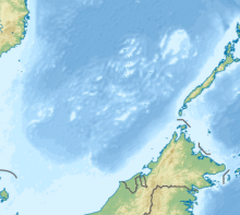 | |
| Location | South China Sea |
| Coordinates | 9°10′N 116°28′E / 9.167°N 116.467°ECoordinates: 9°10′N 116°28′E / 9.167°N 116.467°E |
| Archipelago | Spratly Islands |
| Administered by | |
| Philippines | |
| Municipality | Kalayaan, Palawan |
| Claimed by | |
| People's Republic of China | |
| Philippines | |

Northeast Investigator Shoal, also known as Dalagang Bukid Shoal (Tagalog: Kulumpol ng Dalagang Bukid, lit. 'Cluster of the Field Maiden'); Mandarin Chinese: 海口礁; pinyin: Hǎikǒu Jiāo; Vietnamese: Bãi Phù Mỹ, also marked as Investigator Northeast Shoal on some nautical charts, is a shoal in the Spratly group of islands in South China sea.[1][2]
The submerged coral atoll is located 32 nautical miles from at 9° 10' N, 116° 28' E. A small feature with an area of just 2 square kilometres, the shoal has a few rocks at the western edge that are just about visible at high water.[3]
References[]
- ^ Wu, Shucun (30 September 2013). Solving disputes for regional cooperation in South China Sea. Oxford: Elsevier / Chandos Publishing.
- ^ "NGA Chart 93046 - Mantangule Island to Eran Bay (Palawan Passage)". nauticalchartsonline.com. NGA, USA. Retrieved 2 September 2016.
- ^ hancox, D.J. A geographical description of Spratly islands (Volume 1 Number 6 ed.). Durham, UK: InBRU - International Boundaries Research Unit.
| Confrontations |
| ||||||||||
|---|---|---|---|---|---|---|---|---|---|---|---|
| Regions | |||||||||||
| Occupied features | |||||||||||
| Unoccupied features | |||||||||||
| Related articles | |||||||||||
Categories:
- Shoals of the Spratly Islands
- Reefs of China
- Reefs of the Philippines
- Reefs of Taiwan
- Reefs of Vietnam
- Disputed reefs