Bucoda, Washington
Bucoda, Washington | |
|---|---|
Town | |
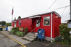 Post Office | |
 Location of Bucoda, Washington | |
| Coordinates: 46°47′52″N 122°52′6″W / 46.79778°N 122.86833°WCoordinates: 46°47′52″N 122°52′6″W / 46.79778°N 122.86833°W | |
| Country | United States |
| State | Washington |
| County | Thurston |
| Area | |
| • Total | 0.60 sq mi (1.56 km2) |
| • Land | 0.58 sq mi (1.51 km2) |
| • Water | 0.02 sq mi (0.05 km2) |
| Elevation | 266 ft (81 m) |
| Population | |
| • Total | 562 |
| • Estimate (2019)[3] | 592 |
| • Density | 1,015.44/sq mi (392.40/km2) |
| Time zone | UTC-8 (Pacific (PST)) |
| • Summer (DST) | UTC-7 (PDT) |
| ZIP code | 98530 |
| Area code | 360 |
| FIPS code | 53-08605 |
| GNIS feature ID | 1531901[4] |
| Website | bucoda |

Bucoda (/bjuːˈkoʊdə/) is a town in Thurston County, Washington, United States. The population was 562 at the 2010 census.
History[]
The first American settler at what is now Bucoda was Aaron Webster (1828–1911) who arrived in 1854.[5] In the 1860s Webster sold his claim and sawmill to who officially named the settlement "Seatco", a native word meaning evil spirit or devil. The Northern Pacific Railroad located a station at Seatco in 1872. Later the town was renamed Bucoda using the first two letters of three principal investors in local industries- Buckley, Coulter, and David.[6] In the 1880s investors began operations to mine coal in the area, but the coal was of poor quality and operations were sporadic. From 1874 to 1888 Bucoda was the site of Washington's first territorial prison. It garnered a reputation as a harsh institution as the inmates were used for dangerous and brutal manual labor in local industry. It was discontinued when the state opened the Washington State Penitentiary in Walla Walla, Washington.[7] Bucoda was officially incorporated on June 7, 1910. The town had a water tower that was scrapped in the early 1980s. The Mutual Lumber Mill was so productive the town was once billed as the "Town with the Million Dollar Payroll". The mill burned down and was rebuilt only to have demand wane and once again it was consumed by flames.
Geography[]
Bucoda is located at 46°47′52″N 122°52′6″W / 46.79778°N 122.86833°W (46.797722, -122.868454).[8]
According to the United States Census Bureau, the town has a total area of 0.59 square miles (1.53 km2), of which, 0.57 square miles (1.48 km2) is land and 0.02 square miles (0.05 km2) is water.[9]
Demographics[]
| Historical population | |||
|---|---|---|---|
| Census | Pop. | %± | |
| 1890 | 945 | — | |
| 1920 | 442 | — | |
| 1930 | 703 | 59.0% | |
| 1940 | 541 | −23.0% | |
| 1950 | 473 | −12.6% | |
| 1960 | 390 | −17.5% | |
| 1970 | 421 | 7.9% | |
| 1980 | 519 | 23.3% | |
| 1990 | 536 | 3.3% | |
| 2000 | 628 | 17.2% | |
| 2010 | 562 | −10.5% | |
| 2019 (est.) | 592 | [3] | 5.3% |
| U.S. Decennial Census[10] 2018 Estimate[11] | |||
2010 census[]
As of the census[2] of 2010, there were 562 people, 222 households, and 148 families living in the town. The population density was 986.0 inhabitants per square mile (380.7/km2). There were 243 housing units at an average density of 426.3 per square mile (164.6/km2). The racial makeup of the town was 91.6% White, 1.2% African American, 0.9% Native American, 0.5% Asian, 0.2% Pacific Islander, 1.8% from other races, and 3.7% from two or more races. Hispanic or Latino of any race were 5.7% of the population.
There were 222 households, of which 30.2% had children under the age of 18 living with them, 41.9% were married couples living together, 18.5% had a female householder with no husband present, 6.3% had a male householder with no wife present, and 33.3% were non-families. 22.5% of all households were made up of individuals, and 7.2% had someone living alone who was 65 years of age or older. The average household size was 2.53 and the average family size was 2.92.
The median age in the town was 40.3 years. 20.1% of residents were under the age of 18; 9.5% were between the ages of 18 and 24; 26.3% were from 25 to 44; 31.1% were from 45 to 64; and 12.8% were 65 years of age or older. The gender makeup of the town was 51.1% male and 48.9% female.
2000 census[]
As of the census of 2000, there were 628 people, 219 households, and 169 families living in the town. The population density was 1,419.7 people per square mile (551.1/km2). There were 236 housing units at an average density of 533.5 per square mile (207.1/km2). The racial makeup of the town was 92.04% White, 0.80% Native American, 2.23% Asian, 0.32% Pacific Islander, 1.27% from other races, and 3.34% from two or more races. Hispanic or Latino of any race were 2.07% of the population.
There were 219 households, out of which 37.0% had children under the age of 18 living with them, 56.6% were married couples living together, 15.1% had a female householder with no husband present, and 22.8% were non-families. 13.7% of all households were made up of individuals, and 4.1% had someone living alone who was 65 years of age or older. The average household size was 2.87 and the average family size was 3.18.
In the town, the age distribution of the population shows 29.8% under the age of 18, 8.8% from 18 to 24, 29.6% from 25 to 44, 23.4% from 45 to 64, and 8.4% who were 65 years of age or older. The median age was 34 years. For every 100 females, there were 109.3 males. For every 100 females age 18 and over, there were 117.2 males.
The median income for a household in the town was $34,286, and the median income for a family was $32,708. Males had a median income of $36,071 versus $22,321 for females. The per capita income for the town was $16,613. About 18.5% of families and 25.1% of the population were below the poverty line, including 41.2% of those under age 18 and 2.7% of those age 65 or over.
References in popular culture[]
Bucoda, Washington is the setting of episode 97 "We All Ignore the Pit" of the horror podcast The Magnus Archives.[12]
See also[]
- List of cities and towns in Washington
References[]
- ^ "2019 U.S. Gazetteer Files". United States Census Bureau. Retrieved August 7, 2020.
- ^ a b "U.S. Census website". United States Census Bureau. Retrieved December 19, 2012.
- ^ a b "Population and Housing Unit Estimates". United States Census Bureau. May 24, 2020. Retrieved May 27, 2020.
- ^ "US Board on Geographic Names". United States Geological Survey. October 25, 2007. Retrieved January 31, 2008.
- ^ Majors, Harry M. (1975). Exploring Washington. Van Winkle Publishing Co. p. 120. ISBN 978-0-918664-00-6.
- ^ "Thurston County Place Names: A Heritage Guide" (PDF). Thurston County Historical Commission. 1992. p. 10. Retrieved 28 March 2018.
- ^ William Prosser, A History of the Puget Sound Country vol. 1. New York, Lewis Publishing Co., 1903, 249
- ^ "US Gazetteer files: 2010, 2000, and 1990". United States Census Bureau. 2011-02-12. Retrieved 2011-04-23.
- ^ "US Gazetteer files 2010". United States Census Bureau. Archived from the original on 2012-07-02. Retrieved 2012-12-19.
- ^ United States Census Bureau. "Census of Population and Housing". Retrieved October 11, 2013.
- ^ "Population Estimates". United States Census Bureau. Retrieved June 15, 2019.
- ^ "The Magnus Archives".
{{cite web}}: CS1 maint: url-status (link)
External links[]
| Wikimedia Commons has media related to Bucoda, Washington. |
Municipalities and communities of Thurston County, Washington, United States | ||
|---|---|---|
| Cities |  | |
| Town | ||
| CDPs |
| |
| Unincorporated communities | ||
| Indian reservation | ||
| Ghost town | ||
| Footnotes | ‡This populated place also has portions in an adjacent county or counties | |
| ||
- Towns in Thurston County, Washington
- Towns in Washington (state)