Bugojno
Bugojno
Бугојно | |
|---|---|
Town and municipality | |
 Panorama of Bugojno | |
 Coat of arms | |
 Bugojno Location of Bugojno | |
| Coordinates: 44°03′N 17°27′E / 44.050°N 17.450°ECoordinates: 44°03′N 17°27′E / 44.050°N 17.450°E | |
| Country | |
| Entity | Federation of Bosnia and Herzegovina |
| Canton | |
| Government | |
| • Municipal mayor | Hasan Ajkunić (SDA) |
| Area | |
| • Municipality | 360.83 km2 (139.32 sq mi) |
| Population (2013[1]) | |
| • Municipality | 31,470 |
| • Density | 96/km2 (250/sq mi) |
| • Urban | 15,555 |
| Time zone | UTC+1 (CET) |
| • Summer (DST) | UTC+2 (CEST) |
| Area code(s) | +387 30 |
| Website | www |
Bugojno (Serbian Cyrillic: Бугојно) is a town and municipality located in Central Bosnia Canton of the Federation of Bosnia and Herzegovina, an entity of Bosnia and Herzegovina. It is situated on river Vrbas, 130 km (81 mi) to the northwest from Sarajevo. According to the 2013 census, the town has a population of 15,555 inhabitants, with 31,470 inhabitants in the municipality.[2]
To the west towards Kupres is a region called Koprivica. This enormous forest was once one of President Tito's favorite hunting spots. The uninhabited dense forest has created a sanctuary for wild animals. Hunting associations are very active in this region and there are many mountain and hunting lodges dotting the forest. Duboka Valley (deep valley) is a designated hunting area covered by thick spruce. Kalin Mountain is a popular weekend area for hikers and nature lovers.
Geography[]
The municipality has an average elevation of 570 meters above sea level. Much of its 366 km2 is forested. The terrain is mountainous with several prominent features. Stozer (1662m), Kalin (1,530m) and Rudina (1,385m) are the tallest mountains in Bugojno.
Demographics[]
The town and municipality is inhabited by a Bosniak majority. The town, prior to the war, was multi-ethnic, with virtually identical numbers of Croats, Bosniaks and Serbs. Today, only 325 Serbs live in the town, with 376 in the municipality.[3][4] The number of Croats in the municipality has gone down from 16,031 to 5,767 (2013 census).[5]
Town[]
In 1991 town of Bugojno had a population of 22,641 including;
Municipality[]
| Ethnic Composition[6] | |||||||||||||
| Year | Serbs | % | Bosniaks | % | Croats | % | Yugoslavs | % | Others | % | Total | ||
|---|---|---|---|---|---|---|---|---|---|---|---|---|---|
| 1961 | 5,212 | 21.61% | 7,194 | 29.83% | 9,682 | 40.15% | 1,871 | 7.76% | 155 | 0.64% | 24,114 | ||
| 1971 | 6,295 | 19.76% | 13,050 | 40.96% | 12.040 | 37.79% | 197 | 0.61% | 274 | 0.88% | 31,856 | ||
| 1981 | 7,458 | 18.65% | 16,214 | 40.56% | 14,187 | 35.49% | 1,731 | 4.33% | 379 | 0.97% | 39,969 | ||
| 1991 | 8,673 | 18.50% | 19,697 | 42.01% | 16,031 | 34.19% | 1,561 | 3.33% | 927 | 1.98% | 46,889 | ||
| 2013 | 376 | 01.19% | 24,650 | 78.32% | 5,767 | 18.32% | 0 | 0% | 493 | 1.56% | 31,470 | ||
Climate[]
| hideClimate data for Bugojno (1961–1990) | |||||||||||||
|---|---|---|---|---|---|---|---|---|---|---|---|---|---|
| Month | Jan | Feb | Mar | Apr | May | Jun | Jul | Aug | Sep | Oct | Nov | Dec | Year |
| Record high °C (°F) | 16.6 (61.9) |
20.0 (68.0) |
25.0 (77.0) |
28.2 (82.8) |
33.0 (91.4) |
33.8 (92.8) |
37.6 (99.7) |
37.2 (99.0) |
37.2 (99.0) |
28.8 (83.8) |
22.9 (73.2) |
19.4 (66.9) |
37.6 (99.7) |
| Average high °C (°F) | 2.7 (36.9) |
5.6 (42.1) |
10.2 (50.4) |
15.0 (59.0) |
20.1 (68.2) |
23.2 (73.8) |
25.8 (78.4) |
25.8 (78.4) |
22.1 (71.8) |
16.5 (61.7) |
9.8 (49.6) |
3.6 (38.5) |
15.0 (59.0) |
| Daily mean °C (°F) | −1.7 (28.9) |
0.7 (33.3) |
4.5 (40.1) |
8.9 (48.0) |
13.4 (56.1) |
16.3 (61.3) |
18.2 (64.8) |
17.6 (63.7) |
14.2 (57.6) |
9.5 (49.1) |
4.5 (40.1) |
−0.4 (31.3) |
8.8 (47.8) |
| Average low °C (°F) | −5.9 (21.4) |
−3.7 (25.3) |
−0.8 (30.6) |
2.9 (37.2) |
6.6 (43.9) |
9.6 (49.3) |
10.7 (51.3) |
10.4 (50.7) |
7.9 (46.2) |
4.0 (39.2) |
0.1 (32.2) |
−4.1 (24.6) |
3.1 (37.6) |
| Record low °C (°F) | −29.4 (−20.9) |
−22.4 (−8.3) |
−22.6 (−8.7) |
−7.8 (18.0) |
−2.4 (27.7) |
−1.4 (29.5) |
2.7 (36.9) |
1.0 (33.8) |
−5.7 (21.7) |
−7.8 (18.0) |
−20.0 (−4.0) |
−24.4 (−11.9) |
−29.4 (−20.9) |
| Average precipitation mm (inches) | 50.9 (2.00) |
56.2 (2.21) |
61.0 (2.40) |
64.4 (2.54) |
71.9 (2.83) |
77.2 (3.04) |
62.6 (2.46) |
64.5 (2.54) |
70.7 (2.78) |
74.4 (2.93) |
94.5 (3.72) |
78.9 (3.11) |
827.4 (32.57) |
| Average precipitation days (≥ 0.1 mm) | 12.7 | 13.2 | 13.2 | 14.3 | 14.2 | 14.4 | 10.2 | 9.9 | 10.1 | 10.4 | 12.4 | 13.8 | 148.7 |
| Average snowy days (≥ 1.0 cm) | 17.3 | 13.4 | 6.2 | 0.9 | 0.0 | 0.0 | 0.0 | 0.0 | 0.0 | 0.1 | 4.8 | 15.6 | 58.2 |
| Average relative humidity (%) | 81.9 | 77.8 | 72.4 | 68.2 | 70.4 | 73.3 | 71.0 | 72.6 | 76.5 | 78.8 | 80.4 | 83.7 | 75.6 |
| Mean monthly sunshine hours | 65.9 | 83.8 | 125.4 | 154.5 | 178.0 | 189.6 | 243.3 | 219.6 | 164.1 | 125.9 | 76.8 | 51.1 | 1,678 |
| Source: [7] | |||||||||||||
Economy[]
Bugojno was once a major industrial center in Bosnia and Herzegovina. In 1981, Bugojno's GDP per capita was 98% of the Yugoslav average.[8] However, hardships caused by the war in Bosnia and Herzegovina took a toll on the industry and overall economy of Bugojno. Apart from industry, forestry has been an important contributor to the local economy and continues to be. In recent years, agriculture has grown in sustaining the Bugojno's economy as many people are investing in land and agronomy.
Gallery[]

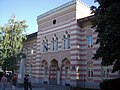
Town center

Town center
High school
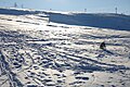
Ski lift Rostovo

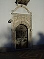
Princess Gevher mosque

Sultan Ahmed mosque, 1693

Sultan Ahmed mosque, 1693
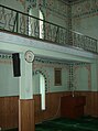
Sultan Ahmed mosque, 1693
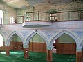
Sultan Ahmed mosque, 1693

Sultan Ahmed mosque, 1693

Catholic church of Saint Anthony of Padua
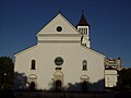
Catholic church of Saint Anthony of Padua
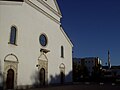
Catholic church of Saint Anthony of Padua and Princess Gevher mosque in background
Catholic church of Saint Anthony of Padua


Notable people[]
- Stjepan Domaćinović - Kokan (1931-2009), Politician
- Edin Atić (born 1997), basketball player
- Željko Bebek (born 1945), singer
- Ivona Dadic (born 1993), Austrian heptathlete, whose parents were born in Bugojno
- Zenit Đozić (born 1961), actor and humorist
- Vlatko Marković (1937–2013), football executive, former manager and footballer
- Branko Mikulić (1928–1994), Prime Minister of Yugoslavia (1986–1989), President of Organizing Committee of 1984 Winter Olympics
- Stjepan Tomas (born 1976), manager and former footballer
- Ermin Zec (born 1988), footballer
References[]
- ^ "Archived copy" (PDF). Archived from the original (PDF) on 2018-11-23. Retrieved 2013-11-19.CS1 maint: archived copy as title (link)
- ^ "2013 census in B&H, Bogojno". Retrieved January 18, 2021.
- ^ "BUGOJNO: I Bog i svijet znaju da su Vučići pravoslavci!". Bugojno danas. 2015.
- ^ "BiH: Bugojno opština bez Srba". Novosti. 2014.
- ^ "Izumiru bugojanski Hrvati i Srbi". Nezavisne. 2008.
- ^ Link text, additional text.
- ^ "Meteorlogical data for station Bugojno in period 1961–1990". Meteorological Institute of Bosnia and Herzegovina. Archived from the original on 1 May 2018. Retrieved 30 April 2018.
- ^ Radovinović, Radovan; Bertić, Ivan, eds. (1984). Atlas svijeta: Novi pogled na Zemlju (in Croatian) (3rd ed.). Zagreb: Sveučilišna naklada Liber.
External links[]
| Wikimedia Commons has media related to Bugojno. |
| show Municipalities of the Central Bosnia Canton |
|---|

| show Authority control |
|---|
- Bugojno
- Populated places in Bugojno