Button Township, Ford County, Illinois
Button Township | |
|---|---|
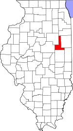
 Location in Ford County | |
 Ford County's location in Illinois | |
| Coordinates: 40°26′54″N 87°59′36″W / 40.44833°N 87.99333°WCoordinates: 40°26′54″N 87°59′36″W / 40.44833°N 87.99333°W | |
| Country | United States |
| State | Illinois |
| County | Ford |
| Established | December, 1864 |
| Area | |
| • Total | 34.1 sq mi (88 km2) |
| • Land | 34.04 sq mi (88.2 km2) |
| • Water | 0.06 sq mi (0.2 km2) 0.18% |
| Elevation | 784 ft (239 m) |
| Population (2010) | |
| • Estimate (2016)[1] | 269 |
| • Density | 8.3/sq mi (3.2/km2) |
| Time zone | UTC-6 (CST) |
| • Summer (DST) | UTC-5 (CDT) |
| ZIP codes | 60957, 60960 |
| FIPS code | 17-053-10214 |

Button Township is one of twelve townships in Ford County, Illinois, USA. As of the 2010 census, its population was 281 and it contained 116 housing units.[2] The township was formed from a portion of Patton Township in December 1864.
History[]
Button Township was named for James Porter Button, who served as township supervisor, justice of the peace, and county treasurer.[3]
Geography[]
According to the 2010 census, the township has a total area of 34.1 square miles (88 km2), of which 34.04 square miles (88.2 km2) (or 99.82%) is land and 0.06 square miles (0.16 km2) (or 0.18%) is water.[2]
Unincorporated towns[]
Cemeteries[]
The township contains these three cemeteries: Mount Olivet, Pleasant Grove and Trickle Grove.
Major highways[]
Demographics[]
| Historical population | |||
|---|---|---|---|
| Census | Pop. | %± | |
| 2016 (est.) | 269 | [1] | |
| U.S. Decennial Census[4] | |||
School districts[]
- Hoopeston Area Community Unit School District 11
- Paxton-Buckley-Loda Community Unit School District 10
Political districts[]
- Illinois' 15th congressional district
- State House District 106
- State Senate District 53
References[]
- "Button Township, Ford County, Illinois". Geographic Names Information System. United States Geological Survey. Retrieved 2010-01-16.
- United States Census Bureau 2007 TIGER/Line Shapefiles
- United States National Atlas
- ^ a b "Population and Housing Unit Estimates". Retrieved June 9, 2017.
- ^ a b "Population, Housing Units, Area, and Density: 2010 - County -- County Subdivision and Place -- 2010 Census Summary File 1". United States Census. Archived from the original on 2020-02-12. Retrieved 2013-05-28.
- ^ Callary, Edward. 2009. Place Names of Illinois. Champaign: University of Illinois Press, p. 52.
- ^ "Census of Population and Housing". Census.gov. Retrieved June 4, 2016.
External links[]
Places adjacent to Button Township, Ford County, Illinois | |
|---|---|
Municipalities and communities of Ford County, Illinois, United States | ||
|---|---|---|
| Cities | ||
| Villages | ||
| Townships | ||
| Unincorporated communities | ||
| Footnotes | ‡This populated place also has portions in an adjacent county or counties | |
| ||
Categories:
- Townships in Ford County, Illinois
- Townships in Illinois