Harwood Township, Champaign County, Illinois
Harwood Township | |
|---|---|
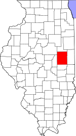
 Location in Champaign County | |
 Champaign County's location in Illinois | |
| Coordinates: 40°21′48″N 88°03′06″W / 40.36333°N 88.05167°WCoordinates: 40°21′48″N 88°03′06″W / 40.36333°N 88.05167°W | |
| Country | United States |
| State | Illinois |
| County | Champaign |
| Established | September 1869 |
| Area | |
| • Total | 36.86 sq mi (95.5 km2) |
| • Land | 36.85 sq mi (95.4 km2) |
| • Water | 0.01 sq mi (0.03 km2) 0.03% |
| Elevation | 755 ft (230 m) |
| Population (2010) | |
| • Estimate (2016)[1] | 632 |
| • Density | 16.9/sq mi (6.5/km2) |
| Time zone | UTC-6 (CST) |
| • Summer (DST) | UTC-5 (CDT) |
| FIPS code | 17-019-33422 |

Harwood Township is a township in Champaign County, Illinois, USA. As of the 2010 census, its population was 623 and it contained 282 housing units.[2]
History[]
Harwood Township formed from Ludlow Township as Sheldon Township in September, 1869. Then the name was changed to Shuck Township on an unknown date, then to Harwood Township on February 22, 1870.
Geography[]
Harwood is Township 22 North, Range 10 East of the Third Principal Meridian.
According to the 2010 census, the township has a total area of 36.86 square miles (95.5 km2), of which 36.85 square miles (95.4 km2) (or 99.97%) is land and 0.01 square miles (0.026 km2) (or 0.03%) is water.[2]
Cities and towns[]
- Gifford (northwest quarter)
Unincorporated towns[]
(This list is based on USGS data and may include former settlements.)
Cemeteries[]
The township contains six cemeteries: Harwood Chapel, Heater, Hitz Family, Holy Sepulchre, Holy Sepulchre and Huffman.
Major highways[]
Demographics[]
| Historical population | |||
|---|---|---|---|
| Census | Pop. | %± | |
| 2016 (est.) | 632 | [1] | |
| U.S. Decennial Census[3] | |||
References[]
- "Harwood Township, Champaign County, Illinois". Geographic Names Information System. United States Geological Survey. Retrieved 2010-01-04.
- United States Census Bureau cartographic boundary files
- ^ a b "Population and Housing Unit Estimates". Retrieved June 9, 2017.
- ^ a b "Population, Housing Units, Area, and Density: 2010 - County -- County Subdivision and Place -- 2010 Census Summary File 1". United States Census. Archived from the original on 2020-02-12. Retrieved 2013-05-28.
- ^ "Census of Population and Housing". Census.gov. Retrieved June 4, 2016.
External links[]
Places adjacent to Harwood Township, Champaign County, Illinois | |
|---|---|
Municipalities and communities of Champaign County, Illinois, United States | ||
|---|---|---|
| Cities | ||
| Villages | ||
| Townships | ||
| CDPs | ||
| Other unincorporated communities | ||
| Ghost town | ||
| Footnotes | ‡This populated place also has portions in an adjacent county or counties | |
| ||
- Townships in Champaign County, Illinois
- Townships in Illinois
- 1869 establishments in Illinois