Newcomb Township, Champaign County, Illinois
Newcomb Township | |
|---|---|
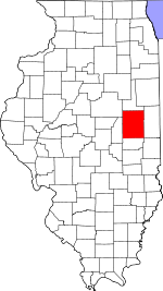
 Location in Champaign County | |
 Champaign County's location in Illinois | |
| Coordinates: 40°16′14″N 88°24′26″W / 40.27056°N 88.40722°WCoordinates: 40°16′14″N 88°24′26″W / 40.27056°N 88.40722°W | |
| Country | United States |
| State | Illinois |
| County | Champaign |
| Established | November 8, 1859 |
| Area | |
| • Total | 36.37 sq mi (94.2 km2) |
| • Land | 36.22 sq mi (93.8 km2) |
| • Water | 0.15 sq mi (0.4 km2) 0.41% |
| Elevation | 738 ft (225 m) |
| Population (2010) | |
| • Estimate (2016)[1] | 1,291 |
| • Density | 35.7/sq mi (13.8/km2) |
| Time zone | UTC-6 (CST) |
| • Summer (DST) | UTC-5 (CDT) |
| FIPS code | 17-019-52376 |

Newcomb Township is a township in Champaign County, Illinois, USA. As of the 2010 census, its population was 1,292 and it contained 492 housing units.[2]
Geography[]
Newcomb is Township 21 North, Range 7 East of the Third Principal Meridian.
According to the 2010 census, the township has a total area of 36.37 square miles (94.2 km2), of which 36.22 square miles (93.8 km2) (or 99.59%) is land and 0.15 square miles (0.39 km2) (or 0.41%) is water.[2] Illinois Route 47 crosses the township from north to south. U.S. Route 136 forms the northern boundary. The historically registered Hazen Bridge crosses the Sangamon River in the eastern part of this township.
Cities and towns[]
- Fisher (southwest quarter)
Demographics[]
| Historical population | |||
|---|---|---|---|
| Census | Pop. | %± | |
| 1870 | 897 | — | |
| 1880 | 992 | 10.6% | |
| 1890 | 959 | −3.3% | |
| 1900 | 854 | −10.9% | |
| 1910 | 744 | −12.9% | |
| 1920 | 755 | 1.5% | |
| 1930 | 643 | −14.8% | |
| 1940 | 664 | 3.3% | |
| 2016 (est.) | 1,291 | [1] | |
| U.S. Decennial Census[3] | |||
Natural gas storage area[]

Though the township is mostly farmland, it also contains the Manlove Field Natural gas storage area operated by Peoples Gas Light & Coke Company.(40°14′33″N 088°25′17″W / 40.24250°N 88.42139°W) The storage facility is an underground aquifer opened in 1966 capable of storing around 150 billion cubic feet (4.2×10⁹ m3)[1] of natural gas for delivery to the Chicago area via connected pipelines. Peoples gas holds property easements covering around 32,000 acres (129.5 km2) for the storage facility and co-located liquefied natural gas (LNG) plant.[2]
Cemeteries[]
The township contains two cemeteries: Naylor and Shiloh.
Major highways[]
 Illinois State Route 47
Airports and landing strips[]
- Furtney Airport
History[]
Newcomb Township was created as a civil township in 1860, after Champaign County adopted the township form of government, and originally comprised two survey townships. It is said to have been named after Joseph Newcomb, an early settler.[4][5] The eastern half of Newcomb Township was set off in 1867 to create Condit Township.
References[]
- "Newcomb Township, Champaign County, Illinois". Geographic Names Information System. United States Geological Survey. Retrieved 2010-01-04.
- United States Census Bureau cartographic boundary files
- ^ a b "Population and Housing Unit Estimates". Retrieved June 9, 2017.
- ^ a b "Population, Housing Units, Area, and Density: 2010 - County -- County Subdivision and Place -- 2010 Census Summary File 1". United States Census. Archived from the original on 2020-02-12. Retrieved 2013-05-28.
- ^ "Census of Population and Housing". Census.gov. Retrieved 17 Oct 2019.
- ^ J. S. Lothrop, Champaign County Directory, 1870-1 (Chicago: Rand, McNally & Co., 1871), pp. 131, 384.
- ^ History of Champaign County, Illinois (Philadelphia: Brink, McDonough & Co., 1878), pp. 156, 160.
External links[]
Places adjacent to Newcomb Township, Champaign County, Illinois | |
|---|---|
Municipalities and communities of Champaign County, Illinois, United States | ||
|---|---|---|
| Cities | ||
| Villages | ||
| Townships | ||
| CDPs | ||
| Other unincorporated communities | ||
| Ghost town | ||
| Footnotes | ‡This populated place also has portions in an adjacent county or counties | |
| ||
- Townships in Champaign County, Illinois
- Townships in Illinois
- 1859 establishments in Illinois
- Populated places established in 1859