Hensley Township, Champaign County, Illinois
Hensley Township | |
|---|---|
 Rising road and the Rising Farmers Grain Company elevator in the southwest corner of section 29. | |
 Location in Champaign County | |
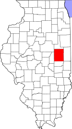 Champaign County's location in Illinois | |
| Coordinates: 40°10′42″N 88°17′12″W / 40.17833°N 88.28667°WCoordinates: 40°10′42″N 88°17′12″W / 40.17833°N 88.28667°W | |
| Country | United States |
| State | Illinois |
| County | Champaign |
| Established | September 1866 |
| Area | |
| • Total | 30.16 sq mi (78.1 km2) |
| • Land | 30.16 sq mi (78.1 km2) |
| • Water | 0 sq mi (0 km2) 0% |
| Elevation | 774 ft (236 m) |
| Population (2010) | |
| • Estimate (2016)[1] | 1,256 |
| • Density | 42.4/sq mi (16.4/km2) |
| Time zone | UTC-6 (CST) |
| • Summer (DST) | UTC-5 (CDT) |
| FIPS code | 17-019-34189 |


Hensley Township is a township in Champaign County, Illinois, USA. As of the 2010 census, its population was 1,278 and it contained 542 housing units.[2]
History[]
Hensley Township formed from Champaign Township in September, 1866 as Grant Township, but the name was changed to Hensley on an unknown date. Hensley Township received its name from Archibald P. Hensley (1806-1876), one of the earliest settlers of that part of the country.
Geography[]
Hensley is Township 20 North, Range 8 East of the Third Principal Meridian.
According to the 2010 census, the township has a total area of 30.16 square miles (78.1 km2), all land.[2] The source of the Kaskaskia River is located in section 19 of this township, rising from the Kaskaskia ditch. The Kaskaskia watershed drains directly into the Mississippi River.
Cities and towns[]
- Mahomet (east edge)
Unincorporated towns[]
Cemeteries[]
The township contains seven cemeteries: Bethlehem [2], Fisher [3], George Peters Family, Grandview Memorial Gardens [4], Gregory Burial and Haines Family.
Grain elevators[]
The Andersons Grain and Fertilizer (Section 29), 3515 North Staley Road (County Road 800 East) opened in 1968. The Andersons grain assets were sold to Total Grain Marketing of Effingham, Illinois in September 2021. It is the largest grain elevator in Illinois with more than 16 million bushels of storage capacity.[3]
Rising Station elevator (Section 29) was built along the Big Four—Conrail System railroad in 1917. It is operated by the Rising Farmer's Grain Company. It has the original wooden elevator and several concrete silos on Rising Road (County Road 700 East).[4]
Major highways[]
Airports and landing strips[]
- Andrew RLA Airport
- Champaign Airport (historical)
- McCulley Airport (closed)
Demographics[]
| Historical population | |||
|---|---|---|---|
| Census | Pop. | %± | |
| 2016 (est.) | 1,256 | [1] | |
| U.S. Decennial Census[5] | |||
References[]
- "Hensley Township, Champaign County, Illinois". Geographic Names Information System. United States Geological Survey. Retrieved 2010-01-04.
- United States Census Bureau cartographic boundary files
- ^ a b "Population and Housing Unit Estimates". Retrieved June 9, 2017.
- ^ a b "Population, Housing Units, Area, and Density: 2010 - County -- County Subdivision and Place -- 2010 Census Summary File 1". United States Census. Archived from the original on 2020-02-12. Retrieved 2013-05-28.
- ^ ″Sale of Champaign grain elevator finalized″ by Debra Pressey. The News–Gazette. Champaign, Illinois, 9 September 2021. pp. A–1, A−6, illus.
- ^ "Cathedrals of the Countryside" by Anne Cook. The News–Gazette. Champaign, Illinois, 9 July 2000. pp. E–1, E–5, illus.
- ^ "Census of Population and Housing". Census.gov. Retrieved June 4, 2016.
External links[]
Places adjacent to Hensley Township, Champaign County, Illinois | |
|---|---|
Municipalities and communities of Champaign County, Illinois, United States | ||
|---|---|---|
| Cities | ||
| Villages | ||
| Townships | ||
| CDPs | ||
| Other unincorporated communities | ||
| Ghost town | ||
| Footnotes | ‡This populated place also has portions in an adjacent county or counties | |
| ||
- Townships in Champaign County, Illinois
- Townships in Illinois
- 1866 establishments in Illinois