Kerr Township, Champaign County, Illinois
Kerr Township | |
|---|---|
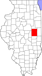
 Location in Champaign County | |
 Champaign County's location in Illinois | |
| Coordinates: 40°21′35″N 87°57′48″W / 40.35972°N 87.96333°WCoordinates: 40°21′35″N 87°57′48″W / 40.35972°N 87.96333°W | |
| Country | United States |
| State | Illinois |
| County | Champaign |
| Established | November 8, 1859 |
| Area | |
| • Total | 22.25 sq mi (57.6 km2) |
| • Land | 22.11 sq mi (57.3 km2) |
| • Water | 0.14 sq mi (0.4 km2) 0.63% |
| Elevation | 705 ft (215 m) |
| Population (2010) | |
| • Estimate (2016)[1] | 162 |
| • Density | 7.4/sq mi (2.9/km2) |
| Time zone | UTC-6 (CST) |
| • Summer (DST) | UTC-5 (CDT) |
| FIPS code | 17-019-39688 |

Kerr Township is a township in Champaign County, Illinois, USA. As of the 2010 census, its population was 163 and it contained 66 housing units.[2]
History[]
Kerr Township changed its name from Middlefork Township on April 30, 1860.[citation needed]
Geography[]
Kerr is Township 22 North, Range 11 East of the Third Principal Meridian and part of Range 14 West of the Second Principal Meridian.
According to the 2010 census, the township has a total area of 22.25 square miles (57.6 km2), of which 22.11 square miles (57.3 km2) (or 99.37%) is land and 0.14 square miles (0.36 km2) (or 0.63%) is water.[2] The stream of Sugar Creek runs through this township.
Cemeteries[]
The township contains four cemeteries: Chenoweth, Patton, Peabody and Tomlinson.[citation needed]
Major highways[]
Demographics[]
| Historical population | |||
|---|---|---|---|
| Census | Pop. | %± | |
| 2016 (est.) | 162 | [1] | |
| U.S. Decennial Census[3] | |||
References[]
- "Kerr Township, Champaign County, Illinois". Geographic Names Information System. United States Geological Survey. Retrieved 2010-01-04.
- United States Census Bureau cartographic boundary files
- ^ Jump up to: a b "Population and Housing Unit Estimates". Retrieved June 9, 2017.
- ^ Jump up to: a b "Population, Housing Units, Area, and Density: 2010 - County -- County Subdivision and Place -- 2010 Census Summary File 1". United States Census. Archived from the original on 2020-02-12. Retrieved 2013-05-28.
- ^ "Census of Population and Housing". Census.gov. Retrieved June 4, 2016.
External links[]
| show Places adjacent to Kerr Township, Champaign County, Illinois |
|---|
| show Municipalities and communities of Champaign County, Illinois, United States |
|---|
Categories:
- Townships in Champaign County, Illinois
- Townships in Illinois
- 1859 establishments in Illinois
- Populated places established in 1859