Foosland, Illinois
Foosland | |
|---|---|
 Foosland Post Office | |
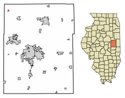 Location of Foosland in Champaign County, Illinois. | |
 Location of Illinois in the United States | |
| Coordinates: 40°21′41″N 88°25′41″W / 40.36139°N 88.42806°WCoordinates: 40°21′41″N 88°25′41″W / 40.36139°N 88.42806°W[1] | |
| Country | United States |
| State | Illinois |
| County | Champaign |
| Area | |
| • Total | 0.07 sq mi (0.18 km2) |
| • Land | 0.07 sq mi (0.18 km2) |
| • Water | 0.00 sq mi (0.00 km2) |
| Elevation | 735 ft (224 m) |
| Population (2010) | |
| • Total | 101 |
| • Estimate (2019)[3] | 98 |
| • Density | 1,420.29/sq mi (552.25/km2) |
| Time zone | UTC-6 (CST) |
| • Summer (DST) | UTC-5 (CDT) |
| ZIP Code(s) | 61845 |
| Area code(s) | 217 |
| FIPS code | 17-26662 |

Foosland is a village in Champaign County, Illinois, United States. The population was 101 at the 2010 census. The village is named after William Foos, who owned 3,500 acres in the area in the 1840s.[4]
Geography[]
Foosland is located in the northwest corner of Champaign County three miles southeast of Illinois Route 54. Gibson City lies nine miles to the northeast along Route 54 and Champaign is approximately 22 miles to the southeast. , a tributary to the Sangamon River, flows past the south side of the community.[5]
According to the 2010 census, Foosland has a total area of 0.07 square miles (0.18 km2), all land.[6]
Demographics[]
| Historical population | |||
|---|---|---|---|
| Census | Pop. | %± | |
| 1960 | 150 | — | |
| 1970 | 172 | 14.7% | |
| 1980 | 153 | −11.0% | |
| 1990 | 132 | −13.7% | |
| 2000 | 90 | −31.8% | |
| 2010 | 101 | 12.2% | |
| 2019 (est.) | 98 | [3] | −3.0% |
| U.S. Decennial Census[7] | |||

As of the census[8] of 2000, there were 90 people, 40 households, and 25 families residing in the village. The population density was 1,246.6 people per square mile (496.4/km2). There were 44 housing units at an average density of 609.5 per square mile (242.7/km2). The racial makeup of the village was 100.00% White.
There were 40 households, out of which 22.5% had children under the age of 18 living with them, 57.5% were married couples living together, 2.5% had a female householder with no husband present, and 37.5% were non-families. 37.5% of all households were made up of individuals, and 17.5% had someone living alone who was 65 years of age or older. The average household size was 2.25 and the average family size was 3.00.

In the village, the population was spread out, with 25.6% under the age of 18, 5.6% from 18 to 24, 27.8% from 25 to 44, 23.3% from 45 to 64, and 17.8% who were 65 years of age or older. The median age was 40 years. For every 100 females, there were 100.0 males. For every 100 females age 18 and over, there were 97.1 males.
The median income for a household in the village was $36,250, and the median income for a family was $53,125. Males had a median income of $31,750 versus $22,188 for females. The per capita income for the village was $20,173. There were 8.0% of families and 15.5% of the population living below the poverty line, including 37.5% of under eighteens and 15.4% of those over 64.
History[]
Foosland was founded in 1874 and a post office was established on June 19 that year.[4] The town is named after William Foos, an Ohioan who was instrumental in the establishment of the town, and in the placement there of a station of the Chicago-Paducah railroad. He bought and drained about 3,500 acres of nearby land and, through a local superintendent, managed a tenant farming operation.[9] Foosland was incorporated in 1959. Champaign County Judge Frederick S. Green approved a canvass of votes of elected officers. The first mayor was Paul Verkler.
References[]
- ^ Jump up to: a b U.S. Geological Survey Geographic Names Information System: Foosland, Illinois
- ^ "2019 U.S. Gazetteer Files". United States Census Bureau. Retrieved July 14, 2020.
- ^ Jump up to: a b "Population and Housing Unit Estimates". United States Census Bureau. May 24, 2020. Retrieved May 27, 2020.
- ^ Jump up to: a b Callary, Edward. 2009. Place Names of Illinois. Champaign: University of Illinois Press, pp. 123–124.
- ^ Illinois Atlas & Gazetteer, DeLorme, 6th ed. 2010, p.53 ISBN 0899333214
- ^ "G001 - Geographic Identifiers - 2010 Census Summary File 1". United States Census Bureau. Archived from the original on 2020-02-13. Retrieved 2015-08-03.
- ^ "Census of Population and Housing". Census.gov. Retrieved June 4, 2015.
- ^ "U.S. Census website". United States Census Bureau. Retrieved 2008-01-31.
- ^ Crane, Tracy (June 23, 2019). "Residents stick together in Foosland". The News-Gazette. Retrieved 2019-07-06.
| show Municipalities and communities of Champaign County, Illinois, United States |
|---|
| show Authority control |
|---|
- Villages in Champaign County, Illinois
- Villages in Illinois
- Populated places established in 1959
- 1959 establishments in Illinois