Sidney Township, Champaign County, Illinois
Sidney Township | |
|---|---|
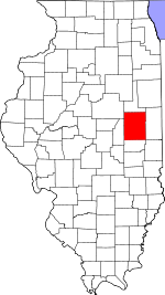
 Location in Champaign County | |
 Champaign County's location in Illinois | |
| Coordinates: 40°00′38″N 88°03′59″W / 40.01056°N 88.06639°WCoordinates: 40°00′38″N 88°03′59″W / 40.01056°N 88.06639°W | |
| Country | United States |
| State | Illinois |
| County | Champaign |
| Established | November 8, 1859 |
| Area | |
| • Total | 36.44 sq mi (94.4 km2) |
| • Land | 36.32 sq mi (94.1 km2) |
| • Water | 0.12 sq mi (0.3 km2) 0.33% |
| Elevation | 669 ft (204 m) |
| Population (2010) | |
| • Estimate (2016)[1] | 1,708 |
| • Density | 47.7/sq mi (18.4/km2) |
| Time zone | UTC-6 (CST) |
| • Summer (DST) | UTC-5 (CDT) |
| FIPS code | 17-019-69888 |

Sidney Township is a township in Champaign County, Illinois, USA. As of the 2010 census, its population was 1,733 and it contained 715 housing units.[2]
Geography[]
Sidney is Township 18 North, Range 10 East of the Third Principal Meridian.
In 1881 the Wabash railroad built a spur from Sidney to Urbana on the route of a vanished 1838 unpaved dirt road going from Paris in Edgar County to Urbana. In 1854 the road was part of the mail stage route from Urbana to Vincennes, Indiana. The road disappeared when township roads on section lines were established in 1860.
According to the 2010 census, the township has a total area of 36.44 square miles (94.4 km2), of which 36.32 square miles (94.1 km2) (or 99.67%) is land and 0.12 square miles (0.31 km2) (or 0.33%) is water.[2] The stream of Rush Branch runs through this township. The Salt Fork of the Vermilion River winds its way through the northern sections of the township. Frito-Lay has a large corn handling facility located in section 12 (40°1′50″N 88°1′34″W / 40.03056°N 88.02611°W) along the county highway between Sidney and Homer; it sits near a major Norfolk Southern east–west rail line.

Cities and towns[]
Unincorporated towns[]
(This list is based on USGS data and may include former settlements.)
Cemeteries[]
The township contains six cemeteries: Bliss (Section 11), Boys Family, Brownfield, Brumley, Lynn Grove (Section 31) and Mount Hope.
The historic 1867 Umbanhower Cemetery was in Section 1.
Grain Elevators[]
Block elevators. Two elevators (Section 33) were built along the Chicago and Eastern Illinois—Union Pacific railroad. Isaac Cole Grain and Coal operated a wooden elevator there in 1913.
Deers elevator (Section 6) was built along the Wabash—Norfolk Southern railroad spur running between Urbana and Sidney 1881−1990, and was operated by Dryer and Burt Grain and Coal in 1913. The elevator has been demolished. Deers Station depot had a post office 1887−1913 at the southeast intersection of county roads 1200N and 1800E, that was also demolished. The railroad spur and adjacent siding were abandoned and the tracks taken up in the 1990s.
Sidney elevator (Section 16) was built along the Wabash—Norfolk Southern railroad, and was operated by Isaac Cole Grain and Coal in 1913; Sidney Grain Company in 1929.
Mills[]
George Akers built a water-powered mill on the Salt Fork in Section 2 in the 1830s. Remains of the mill were on the property owned by James Michael West after 1854.
Airports and landing strips[]
- Justus Airport
Demographics[]
| Historical population | |||
|---|---|---|---|
| Census | Pop. | %± | |
| 2016 (est.) | 1,708 | [1] | |
| U.S. Decennial Census[3] | |||
References[]
- "Sidney Township, Champaign County, Illinois". Geographic Names Information System. United States Geological Survey. Retrieved 2010-01-04.
- United States Census Bureau cartographic boundary files
- ^ a b "Population and Housing Unit Estimates". Retrieved June 9, 2017.
- ^ a b "Population, Housing Units, Area, and Density: 2010 - County -- County Subdivision and Place -- 2010 Census Summary File 1". United States Census. Archived from the original on 2020-02-12. Retrieved 2013-05-28.
- ^ "Census of Population and Housing". Census.gov. Retrieved June 4, 2016.
External links[]
Places adjacent to Sidney Township, Champaign County, Illinois | |
|---|---|
Municipalities and communities of Champaign County, Illinois, United States | ||
|---|---|---|
| Cities | ||
| Villages | ||
| Townships | ||
| CDPs | ||
| Other unincorporated communities | ||
| Ghost town | ||
| Footnotes | ‡This populated place also has portions in an adjacent county or counties | |
| ||
- Townships in Champaign County, Illinois
- Townships in Illinois
- 1859 establishments in Illinois
- Populated places established in 1859