Ayers Township, Champaign County, Illinois
Ayers Township | |
|---|---|
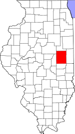
 Location in Champaign County | |
 Champaign County's location in Illinois | |
| Coordinates: 39°54′58″N 87°57′59″W / 39.91611°N 87.96639°WCoordinates: 39°54′58″N 87°57′59″W / 39.91611°N 87.96639°W | |
| Country | United States |
| State | Illinois |
| County | Champaign |
| Area | |
| • Total | 22.88 sq mi (59.3 km2) |
| • Land | 22.88 sq mi (59.3 km2) |
| • Water | 0 sq mi (0 km2) 0% |
| Elevation | 702 ft (214 m) |
| Population (2010) | |
| • Estimate (2016)[1] | 455 |
| • Density | 19.8/sq mi (7.6/km2) |
| Time zone | UTC-6 (CST) |
| • Summer (DST) | UTC-5 (CDT) |
| ZIP codes | 61810, 61816, 61849 |
| FIPS code | 17-019-03246 |

Ayers Township is one of thirty townships in Champaign County, Illinois, USA. As of the 2010 census, its population was 453 and it contained 195 housing units.[2]
History[]
Ayers Township was formed from a portion of South Homer Township in 1885.
Geography[]
Ayers is Township 17 North, Range 11 East of the Third Principal Meridian and part of Range 14 West of the Second Principal Meridian. When the federal township land surveys were done in 1821 one group of surveyors went west from the Second Principal Meridian and another went east from the Third Principal Meridian. Both groups used rawhide measuring lines that expanded and contracted with the weather. When the two groups met in eastern Champaign County the surveys didn't agree, resulting in double section numbers in the eastern townships and ongoing property line confusion among landowners.[3]
Lost Grove (Section 6, T17N, R11E) was a timber grove along the upper Little Vermilion River. It was a well known traveler's landmark on the 1838 unpaved dirt road going from Paris in Edgar County to Urbana. The road ceased to exist when township roads on section lines were established in 1860.
According to the 2010 census, the township has a total area of 22.88 square miles (59.3 km2), all land.[2]

Cities, towns, villages[]
- Allerton (west quarter)
- Broadlands
Cemeteries[]
The township contains these two cemeteries: Immanuel Lutheran (Section 18, T17N, R11E) and Saint John (Section 19, T17N, R11E).
Major highways[]
Demographics[]
| Historical population | |||
|---|---|---|---|
| Census | Pop. | %± | |
| 2016 (est.) | 455 | [1] | |
| U.S. Decennial Census[4] | |||
School districts[]
- Heritage Community Unit School District 8
Political districts[]
- Illinois' 15th congressional district
- State House District 104
- State Senate District 52
References[]
- "Ayers Township, Champaign County, Illinois". Geographic Names Information System. United States Geological Survey. Retrieved 2010-01-04.
- United States Census Bureau 2007 TIGER/Line Shapefiles
- United States National Atlas
- ^ a b "Population and Housing Unit Estimates". Retrieved June 9, 2017.
- ^ a b "Population, Housing Units, Area, and Density: 2010 - County -- County Subdivision and Place -- 2010 Census Summary File 1". United States Census. Archived from the original on 2020-02-12. Retrieved 2013-05-28.
- ^ Historical Map of Champaign County 1819−1940 by Champaign County Regional Planning Commission, Karl B. Lohmann, chairman; M. Eugene Baughman, cartographer. Urbana, Illinois: 1940. Reprinted 1968.
- ^ "Census of Population and Housing". Census.gov. Retrieved June 4, 2016.
External links[]
Places adjacent to Ayers Township, Champaign County, Illinois | |
|---|---|
Municipalities and communities of Champaign County, Illinois, United States | ||
|---|---|---|
| Cities | ||
| Villages | ||
| Townships | ||
| CDPs | ||
| Other unincorporated communities | ||
| Ghost town | ||
| Footnotes | ‡This populated place also has portions in an adjacent county or counties | |
| ||
- Townships in Champaign County, Illinois
- Townships in Illinois