South Homer Township, Champaign County, Illinois
South Homer Township | |
|---|---|
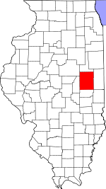
 Location in Champaign County | |
 Champaign County's location in Illinois | |
| Coordinates: 40°01′24″N 87°58′19″W / 40.02333°N 87.97194°WCoordinates: 40°01′24″N 87°58′19″W / 40.02333°N 87.97194°W | |
| Country | United States |
| State | Illinois |
| County | Champaign |
| Settled | November 8, 1859 |
| Area | |
| • Total | 28.26 sq mi (73.2 km2) |
| • Land | 27.96 sq mi (72.4 km2) |
| • Water | 0.3 sq mi (0.8 km2) 1.06% |
| Elevation | 669 ft (204 m) |
| Population (2010) | |
| • Estimate (2016)[1] | 1,585 |
| • Density | 57.3/sq mi (22.1/km2) |
| Time zone | UTC-6 (CST) |
| • Summer (DST) | UTC-5 (CDT) |
| FIPS code | 17-019-70863 |

South Homer Township is a township in Champaign County, Illinois, USA. As of the 2010 census, its population was 1,601 and it contained 681 housing units.[2]
Geography[]
South Homer is composed of parts of Townships 18 and 19 North, Range 11 East of the Third Principal Meridian; and Townships 18 and 19 North, Range 14 West of the Second Principal Meridian. When the federal township land surveys were done in 1821 one group of surveyors went west from the Second Principal Meridian and another went east from the Third Principal Meridian. Both groups used rawhide measuring lines that expanded and contracted with the weather. When the two groups met in eastern Champaign County the surveys didn't agree, resulting in double section numbers in the eastern townships and ongoing property line confusion among landowners.[3]
According to the 2010 census, the township has a total area of 28.26 square miles (73.2 km2), of which 27.96 square miles (72.4 km2) (or 98.94%) is land and 0.3 square miles (0.78 km2) (or 1.06%) is water.[2] The Salt Fork of the Vermilion River winds its way through the north west section of the township. The confluence of 40°N 88°W / 40°N 88°W lies in a farm field, in section 19 of the township.
Cities and towns[]
Unincorporated towns[]
(This list is based on USGS data and may include former settlements.)
Cemeteries[]
The township contains three cemeteries: Homer Grand Army of the Republic (Section 9, T18N, R14W, Village of Homer), Lost Grove (Section 30, T18N, R11E) and Old Homer—Dunkard Cemetery (Section 32, T19N, R14W).
Grain elevators[]
Homer elevators (Sections 8 and 9, T18N, R14W) were built along the Wabash—Norfolk Southern railroad. J.C. Koehn operated an elevator in 1929.
Mills[]
In 1834 Moses Thomas, a native of Pennsylvania, built a water-powered grist and sawmill on the Salt Fork creek about a mile north of the present village of Homer (Section 33, T19N, R14W) and began to mill grain. The millpond and dam formed the central attraction of the Homer Park amusement area 1905–1931. The site is now part of the Homer Lake Forest Preserve.
Homer Park[]
Homer Park was a rural amusement area on the Salt Fork river established in 1905 on the Illinois Traction System electric interurban north−south line between Ogden and Homer. Built at the site of the Moses Thomas mill of the 1830s it was intended to provide a recreational destination for riders of the trolley cars. The interurban bridge, a high trestle structure, ran straight across a lake created from the old millpond. A wooden walkway at lake level was located beside the bridge. The rebuilt mill dam was downstream from the trolley bridge. The local road curved around the upstream end of the lake and crossed the river on a covered bridge built in the mid−1800s. Park buildings and rental boats lined the lake shore.
Outdoor activities for visitors included boating, swimming, dancing, roller skating and other amusements. An open−air movie theater showed silent films, and local and touring musical groups such as Bohumir Kryl′s well−known concert band gave performances in the bandstand. There was a zoo for children and refreshments for their parents.
The park gradually declined in the late 1920s until it closed in 1931. On 6 April 1934 the covered bridge collapsed overnight. The interurban line was discontinued, and the trolley bridge was replaced by a highway bridge, now Illinois Route 49. In 1998 Bill and Marion Edwards of Homer donated 28 acres of the old park site to the Homer Lake Forest Preserve. The stone abutments of the covered bridge and a stone fountain remain for visitors to seek out.
Major highways[]
 Illinois State Route 49
Airports and landing strips[]
- Homer Airport (historical)
Demographics[]
| Historical population | |||
|---|---|---|---|
| Census | Pop. | %± | |
| 2016 (est.) | 1,585 | [1] | |
| U.S. Decennial Census[4] | |||
References[]
- "South Homer Township, Champaign County, Illinois". Geographic Names Information System. United States Geological Survey. Retrieved 2010-01-04.
- United States Census Bureau cartographic boundary files
- ^ a b "Population and Housing Unit Estimates". Retrieved June 9, 2017.
- ^ a b "Population, Housing Units, Area, and Density: 2010 - County -- County Subdivision and Place -- 2010 Census Summary File 1". United States Census. Archived from the original on 2020-02-12. Retrieved 2013-05-28.
- ^ Historical Map of Champaign County 1819−1940 by Champaign County Regional Planning Commission, Karl B. Lohmann, chairman; M. Eugene Baughman, cartographer. Urbana, Illinois: 1940. Reprinted 1968.
- ^ "Census of Population and Housing". Census.gov. Retrieved June 4, 2016.
External links[]
Places adjacent to South Homer Township, Champaign County, Illinois | |
|---|---|
Municipalities and communities of Champaign County, Illinois, United States | ||
|---|---|---|
| Cities | ||
| Villages | ||
| Townships | ||
| CDPs | ||
| Other unincorporated communities | ||
| Ghost town | ||
| Footnotes | ‡This populated place also has portions in an adjacent county or counties | |
| ||
- Townships in Champaign County, Illinois
- Townships in Illinois