Carobbio degli Angeli
Carobbio degli Angeli | |
|---|---|
| Comune di Carobbio degli Angeli | |
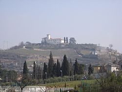 View of the Castello degli Angeli | |
 Coat of arms | |
show Location of Carobbio degli Angeli | |
 Carobbio degli Angeli Location of Carobbio degli Angeli in Italy | |
| Coordinates: 45°40′N 9°50′E�� / 45.667°N 9.833°ECoordinates: 45°40′N 9°50′E / 45.667°N 9.833°E | |
| Country | Italy |
| Region | Lombardy |
| Province | Bergamo (BG) |
| Frazioni | Cicola, Santo Stefano degli Angeli |
| Government | |
| • Mayor | Giuseppe Ondei |
| Area | |
| • Total | 6.7 km2 (2.6 sq mi) |
| Elevation | 232 m (761 ft) |
| Population (31 December 2010)[3] | |
| • Total | 4,619 |
| • Density | 690/km2 (1,800/sq mi) |
| Demonym(s) | Carobbiesi |
| Time zone | UTC+1 (CET) |
| • Summer (DST) | UTC+2 (CEST) |
| Postal code | 24060 |
| Dialing code | 035 |
| Patron saint | St. Pancratius |
| Saint day | July 9 |


Carobbio degli Angeli (Bergamasque: Caròbe di Àngei) is a comune (municipality) in the Province of Bergamo in the Italian region of Lombardy, located about 60 kilometres (37 mi) northeast of Milan and about 13 kilometres (8 mi) southeast of Bergamo.
Carobbio degli Angeli borders the following municipalities: Bolgare, Chiuduno, Gandosso, Gorlago, Grumello del Monte, Trescore Balneario.
History[]
The village has Roman origins. In the 14th century AD it received a castle. Later it was a possession of the Republic of Venice.
The current comune was created in 1928 through the merger of Carobbio and Santo Stefano degli Angeli.
Main sights[]
- Castello degli Angeli ("Castle of the Angels")
- Villa Riccardi, used by the bishops of Bergamo for their leisure.
References[]
- ^ "Superficie di Comuni Province e Regioni italiane al 9 ottobre 2011". Istat. Retrieved 16 March 2019.
- ^ "Popolazione Residente al 1° Gennaio 2018". Istat. Retrieved 16 March 2019.
- ^ All demographics and other statistics: Italian statistical institute Istat.
| Authority control |
|
|---|
This article on a location in the Province of Bergamo is a stub. You can help Wikipedia by . |
Categories:
- Cities and towns in Lombardy
- Municipalities of the Province of Bergamo
- Province of Bergamo geography stubs