Colzate
Colzate | |
|---|---|
| Comune di Colzate | |
 Colzate | |
show Location of Colzate | |
 Colzate Location of Colzate in Italy | |
| Coordinates: 45°49′N 9°52′E / 45.817°N 9.867°ECoordinates: 45°49′N 9°52′E / 45.817°N 9.867°E | |
| Country | Italy |
| Region | Lombardy |
| Province | Province of Bergamo (BG) |
| Frazioni | Bondo di Colzate, Piani di Rezzo |
| Area | |
| • Total | 6.7 km2 (2.6 sq mi) |
| Elevation | 424 m (1,391 ft) |
| Population (Dec. 2004)[2] | |
| • Total | 1,638 |
| • Density | 240/km2 (630/sq mi) |
| Demonym(s) | Colzatesi |
| Time zone | UTC+1 (CET) |
| • Summer (DST) | UTC+2 (CEST) |
| Postal code | 24020 |
| Dialing code | 035 |


Parish church
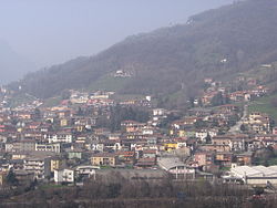
Colzate (Bergamasque: Colgiàt) is a comune (municipality) in the Province of Bergamo in the Italian region of Lombardy, located about 70 kilometres (43 mi) northeast of Milan and about 20 kilometres (12 mi) northeast of Bergamo. As of 31 December 2004, it had a population of 1,638 and an area of 6.7 square kilometres (2.6 sq mi).[3]
The municipality of Colzate contains the frazioni (subdivisions, mainly villages and hamlets) Bondo di Colzate and Piani di Rezzo.
Colzate borders the following municipalities: Casnigo, Gorno, Oneta, Vertova.
Demographic evolution[]

References[]
- ^ "Superficie di Comuni Province e Regioni italiane al 9 ottobre 2011". Istat. Retrieved 16 March 2019.
- ^ "Popolazione Residente al 1° Gennaio 2018". Istat. Retrieved 16 March 2019.
- ^ All demographics and other statistics: Italian statistical institute Istat.
This article on a location in the Province of Bergamo is a stub. You can help Wikipedia by . |
| Authority control |
|
|---|
Categories:
- Cities and towns in Lombardy
- Municipalities of the Province of Bergamo
- Province of Bergamo geography stubs