Chêne-en-Semine
Chêne-en-Semine | |
|---|---|
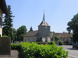 The church and the village | |
show Location of Chêne-en-Semine | |
 Chêne-en-Semine | |
| Coordinates: 46°02′51″N 5°51′34″E / 46.0475°N 5.8594°ECoordinates: 46°02′51″N 5°51′34″E / 46.0475°N 5.8594°E | |
| Country | France |
| Region | Auvergne-Rhône-Alpes |
| Department | Haute-Savoie |
| Arrondissement | Saint-Julien-en-Genevois |
| Canton | Saint-Julien-en-Genevois |
| Intercommunality | CC Usses et Rhône |
| Government | |
| • Mayor (2020–2026) | Paul Rannard[1] |
| Area 1 | 9.46 km2 (3.65 sq mi) |
| Population (Jan. 2018)[2] | 513 |
| • Density | 54/km2 (140/sq mi) |
| Time zone | UTC+01:00 (CET) |
| • Summer (DST) | UTC+02:00 (CEST) |
| INSEE/Postal code | 74068 /74270 |
| Elevation | 320–553 m (1,050–1,814 ft) |
| 1 French Land Register data, which excludes lakes, ponds, glaciers > 1 km2 (0.386 sq mi or 247 acres) and river estuaries. | |


Chêne-en-Semine (French pronunciation: [ʃɛn ɑ̃ səmin]; Arpitan: Châno-en-Semena) is a commune in the Haute-Savoie department in the Auvergne-Rhône-Alpes region in south-eastern France.
See also[]
References[]
- ^ "Répertoire national des élus: les maires". data.gouv.fr, Plateforme ouverte des données publiques françaises (in French). 2 December 2020. Retrieved 7 December 2020.
- ^ "Populations légales 2018". INSEE. 28 December 2020.
| Wikimedia Commons has media related to Chêne-en-Semine. |
This Haute-Savoie geographical article is a stub. You can help Wikipedia by . |
Categories:
- Communes of Haute-Savoie
- Haute-Savoie geography stubs