Chapeiry
Chapeiry | |
|---|---|
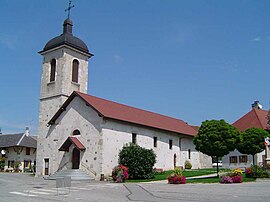 The church in Chapeiry | |
show Location of Chapeiry | |
 Chapeiry | |
| Coordinates: 45°46′26″N 6°02′18″E / 45.7739°N 6.0383°ECoordinates: 45°46′26″N 6°02′18″E / 45.7739°N 6.0383°E | |
| Country | France |
| Region | Auvergne-Rhône-Alpes |
| Department | Haute-Savoie |
| Arrondissement | Annecy |
| Canton | Rumilly |
| Intercommunality | CA Grand Annecy |
| Government | |
| • Mayor (2020–2026) | Gilles Ardin[1] |
| Area 1 | 5.76 km2 (2.22 sq mi) |
| Population (Jan. 2018)[2] | 909 |
| • Density | 160/km2 (410/sq mi) |
| Demonym(s) | Chapériens |
| Time zone | UTC+01:00 (CET) |
| • Summer (DST) | UTC+02:00 (CEST) |
| INSEE/Postal code | 74061 /74540 |
| Elevation | 420–725 m (1,378–2,379 ft) |
| 1 French Land Register data, which excludes lakes, ponds, glaciers > 1 km2 (0.386 sq mi or 247 acres) and river estuaries. | |


Chapeiry is a commune in the Haute-Savoie department in the Auvergne-Rhône-Alpes region in south-eastern France.
See also[]
References[]
- ^ "Répertoire national des élus: les maires". data.gouv.fr, Plateforme ouverte des données publiques françaises (in French). 2 December 2020.
- ^ "Populations légales 2018". INSEE. 28 December 2020.
| Wikimedia Commons has media related to Chapeiry. |
This Haute-Savoie geographical article is a stub. You can help Wikipedia by . |
Categories:
- Communes of Haute-Savoie
- Haute-Savoie geography stubs