Clyde, Arkansas
Clyde, Arkansas | |
|---|---|
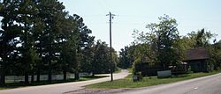 Clyde at the intersection of AR 45 and Washington County Route 8. | |
 Clyde, Arkansas Clyde's position in Arkansas. | |
| Coordinates: 35°53′29″N 94°24′24″W / 35.89139°N 94.40667°WCoordinates: 35°53′29″N 94°24′24″W / 35.89139°N 94.40667°W[1] | |
| Country | |
| State | |
| County | Washington |
| Township | Cane Hill |
| Elevation | 403 m (1,322 ft) |
| Time zone | UTC-6 (Central (CST)) |
| • Summer (DST) | UTC-5 (CDT) |
| ZIP code | 72717 |
| Area code(s) | 479 |
| GNIS feature ID | 76643 [1] |


Clyde (historically Newtown) is an unincorporated community in Cane Hill Township, Washington County, Arkansas, United States.[1] Clyde is on Arkansas Highway 45, approximately 26 miles southwest of Fayetteville and six miles east of the Oklahoma border.
Within the Canehill, Arkansas ZIP code (72717), the population of the ZCTA was 847 at the 2000 census. It is part of the Fayetteville–Springdale–Rogers, AR-MO Metropolitan Statistical Area.
A post office was established at Clyde in 1879, and closed the next year.[2]
References[]
- ^ a b c d "Clyde". Geographic Names Information System. United States Geological Survey. Retrieved 2010-09-15.
- ^ History of Benton, Washington, Carroll, Madison, Crawford, Franklin, and Sebastian Counties, Arkansas. Higginson Book Company. 1889. p. 319.
Municipalities and communities of Washington County, Arkansas, United States | ||
|---|---|---|
| Cities |  | |
| Town | ||
| Townships | ||
| CDPs | ||
| Other unincorporated communities |
| |
| Ghost towns | ||
| Footnotes | ‡This populated place also has portions in an adjacent county or counties | |
| ||
Categories:
- Unincorporated communities in Washington County, Arkansas
- Unincorporated communities in Arkansas
- 1879 establishments in Arkansas