Rhea's Mill Township, Washington County, Arkansas
Township of Rhea's Mill | |
|---|---|
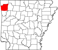 Location of Washington County in Arkansas | |
| Coordinates: 36°01′5″N 94°23′21″W / 36.01806°N 94.38917°WCoordinates: 36°01′5″N 94°23′21″W / 36.01806°N 94.38917°W | |
| Country | |
| State | |
| County | Washington |
| Established | 1880-90[1] |
| Area | |
| • Total | 16.4 sq mi (42 km2) |
| • Land | 16.2 sq mi (42 km2) |
| • Water | 0.2 sq mi (0.5 km2) |
| Elevation | 1,112 ft (339 m) |
| Population (2000) | |
| • Total | 480 |
| • Density | 30/sq mi (10/km2) |
| Time zone | UTC-6 (CST) |
| • Summer (DST) | UTC-5 (CDT) |
| Area code(s) | 479 |
| GNIS feature ID | 69801 |
| U.S. Geological Survey Geographic Names Information System: Rhea's Mill Township, Washington County, Arkansas | |

Rhea's Mill Township is one of thirty-seven townships in Washington County, Arkansas, USA.[2] As of the 2000 census, its total population was 480.
Geography[]
According to the United States Census Bureau, Rhea's Mill Township covers an area of 16.4 square miles (42 km2), with 16.2 square miles (42 km2) of land and 0.2 square miles (0.52 km2) of water.[2]
Cities, towns, villages[]
Cemeteries[]
The township contains Crawford Cemetery.
Major routes[]
The township contains no state highways.
References[]
- United States Census Bureau 2008 TIGER/Line Shapefiles
- United States Board on Geographic Names (GNIS)
- United States National Atlas
- ^ Baker, Russell (1985). Arkansas Township Atlas 1819-1930. Hot Springs, AR: Arkansas Genealogical Society. p. 202. OCLC 11528205.
- ^ a b "Township of Rhea's Mill, Washington County, Arkansas". U.S. Census Bureau. Retrieved February 1, 2012.
External links[]
Places adjacent to Rhea's Mill Township, Washington County, Arkansas | ||||||||||||||||
|---|---|---|---|---|---|---|---|---|---|---|---|---|---|---|---|---|
| ||||||||||||||||
Municipalities and communities of Washington County, Arkansas, United States | ||
|---|---|---|
| Cities |  | |
| Town | ||
| Townships | ||
| CDPs | ||
| Other unincorporated communities |
| |
| Ghost towns | ||
| Footnotes | ‡This populated place also has portions in an adjacent county or counties | |
| ||
Categories:
- Townships in Washington County, Arkansas
- Populated places established in 1880
- 1880 establishments in Arkansas
- Townships in Arkansas