Evansville, Arkansas
Evansville, Arkansas | |
|---|---|
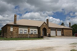 Community Center | |
 Evansville, Arkansas Evansville's position in Arkansas. | |
| Coordinates: 35°47′43.3″N 94°29′48.8″W / 35.795361°N 94.496889°WCoordinates: 35°47′43.3″N 94°29′48.8″W / 35.795361°N 94.496889°W | |
| Country | United States |
| State | Arkansas |
| County | Washington |
| Township | |
| Elevation | 1,122 ft (342 m) |
| Time zone | UTC-6 (Central (CST)) |
| • Summer (DST) | UTC-5 (CDT) |
| Area code(s) | 479 |
| GNIS feature ID | 76889 |
| U.S. Geological Survey Geographic Names Information System: Evansville, Arkansas | |

Evansville is an unincorporated community in southwest Washington County, Arkansas, United States.[1] It is located on Arkansas Highway 59 near the Oklahoma state line.[2]
History[]
A post office called Evansville has been in operation since 1838.[3] The community was named after Captain Lewis Evans, a local merchant.[4]
Education[]
The community is served by the Lincoln Consolidated School District.[5] Lincoln High School is its sole high school.
References[]
- ^ Jump up to: a b "Feature Detail Report for: Evansville, Arkansas." USGS. U.S. Geological Survey Geographic Names Information System: Evansville, Arkansas Retrieved April 12, 2011.
- ^ Arkansas Atlas and Gazetteer (Map) (Second ed.). DeLorme. 2002. p. 30. ISBN 0-89933-345-1.
- ^ "Post Offices". Jim Forte Postal History. Retrieved 4 February 2018.
- ^ History of Benton, Washington, Carroll, Madison, Crawford, Franklin, and Sebastian Counties, Arkansas. Higginson Book Company. 1889. p. 268.
- ^ "About". Lincoln Consolidated School District. Retrieved 2019-08-29.
| show Municipalities and communities of Washington County, Arkansas, United States |
|---|

| show Authority control |
|---|
Categories:
- Unincorporated communities in Washington County, Arkansas
- Unincorporated communities in Arkansas
- Northwest Arkansas geography stubs