Congtai District
Congtai
丛台区 | |
|---|---|
District | |
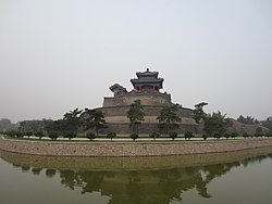 | |
 Congtai Location in Hebei | |
| Coordinates (Congtai District government): 36°38′11″N 114°29′34″E / 36.6364°N 114.4929°ECoordinates: 36°38′11″N 114°29′34″E / 36.6364°N 114.4929°E | |
| Country | People's Republic of China |
| Province | Hebei |
| Prefecture-level city | Handan |
| Area | |
| • Total | 28 km2 (11 sq mi) |
| Elevation | 61 m (199 ft) |
| Population | |
| • Total | 330,000 |
| • Density | 12,000/km2 (31,000/sq mi) |
| Time zone | UTC+8 (China Standard) |
| Postal code | 056004 |

Congtai District (simplified Chinese: 丛台区; traditional Chinese: 叢台區; pinyin: Cóngtái Qū) is a district of the city of Handan, Hebei, People's Republic of China, with a population of 330,000[when?] residing in an area of just 28 km2 (11 sq mi).
The district seats the Handan's executive, legislature and judiciary, together with its CPC and Public Security bureaus.
Administration[]
As of 2009, the district comprises 10 street committees and 1 township (乡; xiāng). There are a total of 70 block committees under these Subdistricts:
Subdistricts[]
- Renmin Road Subdistrict (人民路街道)
- (中华街道)
- (丛台东街道)
- (丛台西街道)
- (光明桥街道)
- (沁河街道)
- (和平街道)
- (柳林桥街道)
- (联纺东街道)
- (联纺西街道)
Township[]
- Sucao Township (苏曹乡)
References[]
| show Authority control |
|---|
This Handan location article is a stub. You can help Wikipedia by . |
Categories:
- County-level divisions of Hebei
- Handan
- Hebei geography stubs