Cummins, South Australia
| Cummins South Australia | |||||||||||||||
|---|---|---|---|---|---|---|---|---|---|---|---|---|---|---|---|
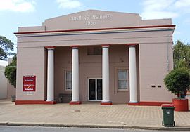 The Cummins Institute | |||||||||||||||
 Cummins | |||||||||||||||
| Coordinates | 34°15′0″S 135°44′0″E / 34.25000°S 135.73333°ECoordinates: 34°15′0″S 135°44′0″E / 34.25000°S 135.73333°E | ||||||||||||||
| Population | 959 (2016 census)[1] | ||||||||||||||
| Postcode(s) | 5631 | ||||||||||||||
| Elevation | 60 m (197 ft)[2] | ||||||||||||||
| Location |
| ||||||||||||||
| LGA(s) | District Council of Lower Eyre Peninsula | ||||||||||||||
| Region | Eyre Western[3] | ||||||||||||||
| County | Flinders[3] | ||||||||||||||
| State electorate(s) | Flinders | ||||||||||||||
| Federal Division(s) | Grey | ||||||||||||||
| |||||||||||||||
| |||||||||||||||
| Footnotes | [4] | ||||||||||||||

Cummins is a town on Eyre Peninsula in South Australia, 67 km north of Port Lincoln and 60 m above sea level. At the 2011 census, the town had a population of 719.[1]
Cummins was named after William Patrick Cummins, a member of the South Australian House of Assembly from 1896 to 1907.[5] The town of Cummins was developed in 1910 a few years after the first settlers in the area arrived.[4] The railway to Port Lincoln arrived in 1907.[6] The bounded locality of Cummins includes the former railway sidings of Pillana (south of the town) and Wildeloo (north of it).
The major industries are sheep farming and cereal grain growing. There is a junction of the narrow gauge Eyre Peninsula Railway within the town. The railway facilitates transfer of grain to the deep-water port at Port Lincoln, primarily for export. The Tod Highway and intersect at Cummins. A large grain storage and transshipment facility lies on the southern outskirts of town.
Cummins is the headquarters of the District Council of Lower Eyre Peninsula. It is in the state electoral district of Flinders and the federal Division of Grey.
The town has a bowls club with 3 greens which competes in the Southern Eyre Peninsula Men's Bowling Association.[7]
Cummins is the birthplace of former Australian tennis player John Fitzgerald who in a career spanning 1980-1997 won seven Grand Slam Doubles titles at all four major events (Australian Open (1982), French Open (1986, 1991), Wimbledon (1989, 1991), and the US Open (1984, 1991).[8]
The Traditional custodians of the district were the Nawu people.[9]
References[]
- ^ Jump up to: a b Australian Bureau of Statistics (31 October 2012). "Cummins (Locality)". 2011 Census QuickStats. Retrieved 24 October 2016.

- ^ Jump up to: a b c d "Monthly climate statistics: Summary statistics CUMMINS AERO (nearest weather station)". Commonwealth of Australia , Bureau of Meteorology. Retrieved 31 July 2019.
- ^ Jump up to: a b "Search results for "Cummins LOCB" with the following datasets selected - 'Suburbs and Localities', 'SA Government Regions' and 'Counties'". Loctation SA Map viewer. Government of South Australia. Retrieved 22 December 2017.
- ^ Jump up to: a b "Placename Details: Cummins". Property Location Browser. Government of South Australia. 7 January 2010. SA0017259. Archived from the original on 12 October 2016. Retrieved 25 October 2016.
- ^ Praite, R. and Tolley, J.C. (1970) Place Names of South Australia, p. 33. Adelaide: Rigby Limited. ISBN 0-85179-083-6
- ^ "Placename Details: Cummins Railway Station". Property Location Browser. Government of South Australia. 4 August 2005. SA0017265. Archived from the original on 12 October 2016. Retrieved 25 October 2016.
- ^ http://www.sportingpulse.com/assoc_page.cgi?c=0-5755-0-0-0&sID=188111
- ^ "Profiles: John Fitzgerald". Tennis Australia. Archived from the original on 28 October 2009. Retrieved 23 February 2010.
- ^ David Horton (ed.),Aboriginal Australia Map (The Encyclopedia of Aboriginal Australia by AIATSIS, 1994)
| Authority control |
|
|---|
- Towns in South Australia
- Eyre Peninsula