Daniels County, Montana
Daniels County | |
|---|---|
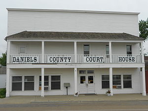 Daniels County Courthouse in Scobey | |
 Location within the U.S. state of Montana | |
 Montana's location within the U.S. | |
| Coordinates: 48°47′N 105°33′W / 48.79°N 105.55°W | |
| Country | |
| State | |
| Founded | 1920 |
| Named for | Mansfield Daniels |
| Seat | Scobey |
| Largest city | Scobey |
| Area | |
| • Total | 1,426 sq mi (3,690 km2) |
| • Land | 1,426 sq mi (3,690 km2) |
| • Water | 0.4 sq mi (1 km2) 0.03% |
| Population (2010) | |
| • Total | 1,751 |
| • Estimate (2020) | 1,638 |
| • Density | 1.2/sq mi (0.47/km2) |
| Time zone | UTC−7 (Mountain) |
| • Summer (DST) | UTC−6 (MDT) |
| Congressional district | At-large |
| |

Daniels County is a county located in the U.S. state of Montana. As of the 2010 United States Census, the population was 1,751.[1] Its county seat is Scobey.[2]
In 2000, Daniels County was considered the most rural county in the continental United States as measured by the Index of Relative Rurality.[3][4] It is on Montana's north border, and thus abuts the Canada–US border with Saskatchewan.
History[]
Daniels County was created in 1920 from portions of Sheridan and Valley Counties. The name comes from Mansfield Daniels, a local rancher.[5]
Geography[]
According to the U.S. Census Bureau, the county has a total area of 1,426 square miles (3,690 km2), of which 1,426 square miles (3,690 km2) is land and 0.4 square miles (1.0 km2) (0.03%) is water.[6]
Daniels County is predominately rolling plains. The Poplar River flows through the county.
Major highways[]
Adjacent counties and rural municipalities[]
- Old Post No. 43, Saskatchewan - northwest
- Poplar Valley No. 12, Saskatchewan - north
- Hart Butte No. 11, Saskatchewan - north
- Happy Valley No. 10, Saskatchewan - northeast
- Sheridan County - east
- Roosevelt County - south
- Valley County - west
Politics[]
Demographics[]
| Historical population | |||
|---|---|---|---|
| Census | Pop. | %± | |
| 1930 | 5,553 | — | |
| 1940 | 4,563 | −17.8% | |
| 1950 | 3,946 | −13.5% | |
| 1960 | 3,755 | −4.8% | |
| 1970 | 3,083 | −17.9% | |
| 1980 | 2,835 | −8.0% | |
| 1990 | 2,266 | −20.1% | |
| 2000 | 2,017 | −11.0% | |
| 2010 | 1,751 | −13.2% | |
| 2020 (est.) | 1,638 | [8] | −6.5% |
| US Decennial Census[9] 1790-1960[10] 1900-1990[11] 1990-2000[12] 2010-2020[1] | |||
2000 census[]
As of the 2000 United States Census,[13] there were 2,017 people, 892 households, and 561 families living in the county. The population density was 1.4 people per square mile (0.55/km2). There were 1,154 housing units at an average density of 1 per square mile (0/km2). The racial makeup of the county was 96.03% White, 1.29% Native American, 0.25% Asian, 0.10% Pacific Islander, 0.59% from other races, and 1.74% from two or more races. 1.59% of the population were Hispanic or Latino of any race. 35.7% were of Norwegian, 20.0% German, 7.8% Irish and 5.5% French ancestry.
There were 892 households, out of which 23.70% had children under the age of 18 living with them, 54.90% were married couples living together, 5.50% had a female householder with no husband present, and 37.10% were non-families. 33.60% of all households were made up of individuals, and 17.50% had someone living alone who was 65 years of age or older. The average household size was 2.22 and the average family size was 2.84.
The county population contained 22.10% under the age of 18, 4.90% from 18 to 24, 20.00% from 25 to 44, 29.50% from 45 to 64, and 23.50% who were 65 years of age or older. The median age was 47 years. For every 100 females there were 96.00 males. For every 100 females age 18 and over, there were 97.90 males.
The median income for a household in the county was $27,306, and the median income for a family was $35,722. Males had a median income of $24,405 versus $18,421 for females. The per capita income for the county was $16,055. About 13.40% of families and 16.90% of the population were below the poverty line, including 19.20% of those under age 18 and 13.20% of those age 65 or over.
2010 census[]
As of the 2010 United States Census, there were 1,751 people, 798 households, and 481 families living in the county.[14] The population density was 1.2 inhabitants per square mile (0.46/km2). There were 1,111 housing units at an average density of 0.8 per square mile (0.31/km2).[15] The racial makeup of the county was 95.7% white, 2.1% American Indian, 0.2% black or African American, 0.2% Asian, 0.1% from other races, and 1.7% from two or more races. Those of Hispanic or Latino origin made up 1.5% of the population.[14] In terms of ancestry, 39.4% were Norwegian, 31.8% were German, 9.0% were English, 8.3% were Irish, and 1.2% were American.[16]
Of the 798 households, 21.8% had children under the age of 18 living with them, 52.1% were married couples living together, 4.6% had a female householder with no husband present, 39.7% were non-families, and 35.1% of all households were made up of individuals. The average household size was 2.14 and the average family size was 2.77. The median age was 50.4 years.[14]
The median income for a household in the county was $38,125 and the median income for a family was $49,479. Males had a median income of $36,250 versus $25,921 for females. The per capita income for the county was $24,737. About 9.8% of families and 14.1% of the population were below the poverty line, including 20.6% of those under age 18 and 9.0% of those age 65 or over.[17]
Economy[]
The main source of income for Daniels County has been cattle and dryland wheat.[18]
Education[]
There is one K-12 school serving all of Daniels County, Scobey High School.[19]
Communities[]
City[]
- Scobey (county seat)
Town[]
- Flaxville
Unincorporated communities[]
See also[]
- List of lakes in Daniels County, Montana
- List of mountains in Daniels County, Montana
- National Register of Historic Places listings in Daniels County MT
References[]
- ^ Jump up to: a b "State & County QuickFacts". US Census Bureau. Archived from the original on June 6, 2011. Retrieved September 15, 2013.
- ^ "Find a County". National Association of Counties. Archived from the original on May 31, 2011. Retrieved June 7, 2011.
- ^ "Measuring Rurality". In Context. Indiana Business Research Center at IU's Kelley School of Business. Retrieved May 26, 2011.
- ^ "What's Rural". Daily Yonder Keep it Rural. Center for Rural Strategies. Retrieved May 26, 2011.
- ^ "Montana Place Names Companion". Montana Place Names From Alzada to Zortman. Montana Historical Society Research Center. Retrieved May 9, 2011.
- ^ "2010 Census Gazetteer Files". US Census Bureau. August 22, 2012. Archived from the original on December 5, 2014. Retrieved November 28, 2014.
- ^ Leip, David. "Atlas of US Presidential Elections". uselectionatlas.org. Retrieved April 2, 2018.
- ^ "County Population Totals: 2010-2020". Retrieved July 6, 2021.
- ^ "U.S. Decennial Census". United States Census Bureau. Retrieved November 28, 2014.
- ^ "Historical Census Browser". University of Virginia Library. Retrieved November 28, 2014.
- ^ "Population of Counties by Decennial Census: 1900 to 1990". US Census Bureau. Retrieved November 28, 2014.
- ^ "Census 2000 PHC-T-4. Ranking Tables for Counties: 1990 and 2000" (PDF). US Census Bureau. Retrieved November 28, 2014.
- ^ "U.S. Census website". US Census Bureau. Retrieved January 31, 2008.
- ^ Jump up to: a b c "Profile of General Population and Housing Characteristics: 2010 Demographic Profile Data". US Census Bureau. Archived from the original on February 13, 2020. Retrieved January 9, 2016.
- ^ "Population, Housing Units, Area, and Density: 2010 - County". US Census Bureau. Archived from the original on February 13, 2020. Retrieved January 9, 2016.
- ^ "Selected Social Characteristics in the US – 2006-2010 American Community Survey 5-Year Estimates". US Census Bureau. Archived from the original on February 13, 2020. Retrieved January 9, 2016.
- ^ "Selected Economic Characteristics – 2006-2010 American Community Survey 5-Year Estimates". US Census Bureau. Archived from the original on February 13, 2020. Retrieved January 9, 2016.
- ^ Merrill, Andrea; Judy Jacobson (1997). Montana almanac. Helena MT: Falcon Publishing. ISBN 1-56044-493-2.
- ^ Scobey Chamber of Commerce and Agriculture. "Education". Archived from the original on July 16, 2011. Retrieved July 24, 2011.
- ^ Carbert, Daniels County MT Google Maps (accessed January 1, 2019)
- ^ Navajo, Daniels County MT Google Maps (accessed January 1, 2019)
- ^ Pleasant Prairie, Daniels County MT Google Maps (accessed January 1, 2019)
- ^ Scobey, Daniels County MT Google Maps (accessed January 1, 2019)
- ^ West Fork, Daniels County MT Google Maps (accessed January 1, 2019)
| show Places adjacent to Daniels County, Montana |
|---|
| show Municipalities and communities of Daniels County, Montana, United States |
|---|


| show Authority control |
|---|
- Montana counties
- Daniels County, Montana
- 1920 establishments in Montana
- Populated places established in 1920