Daykundi Province
Daykundi
دایکندی | |
|---|---|
 | |
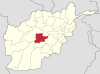
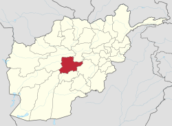 Map of Afghanistan with Daikundi highlighted | |
| Coordinates: 33°45′N 66°15′E / 33.75°N 66.25°ECoordinates: 33°45′N 66°15′E / 33.75°N 66.25°E | |
| Country | |
| Established | 2004 |
| Capital | Nili |
| Government | |
| • Governor | Sayed Anwar Rahmati |
| Area | |
| • Total | 18,088 km2 (6,984 sq mi) |
| Population (2021)[2] | |
| • Total | 525,529 |
| Time zone | UTC+4:30 (Afghanistan Time) |
| ISO 3166 code | AF-DAY |
| Main languages | Dari (Hazaragi dialect) |
| Website | daikundi |

Daykundi (Dari/Pashto: دایکندی), also spelled as Daikundi, Daikondi or Dai Kundi, is one of the thirty-four provinces of Afghanistan, located in the central part of the country. It has a population of about 516,504,[3] which is a Hazara Province.
Daykundi Province falls into the traditionally ethnic Hazara region known as the Hazarajat and the provincial capital is Nili. It is surrounded by Bamyan Province in the northeast, Ghazni Province in the southeast, Urozgan Province in the south, Helmand Province in the southwest, and Ghor Province in the northwest.
History[]
Daykundi was established on March 28, 2004, when it was created from the isolated Hazara-dominated northern districts of neighboring Oruzgan province.
Development and security[]
The province maintains its own security through the Afghan police and military.[4]
While the Government of Afghanistan, NGOs, the United Nations, and NATO's ISAF forces have had little involvement in reconstruction in the province, there have been some initiatives. Following heavy rainfall and flooding in February 2007 the United Nations Assistance Mission for Afghanistan (UNAMA) opened a sub-office in the province[5] and Oxfam, one of the few NGOs operating in the province, described UNAMA's input into coordinating flood relief as impressive.[5]
In November 2007 a World Food Programme convoy carrying mixed food aid was forced to abandon its mission due to security concerns and Afghanistan's Interior Ministry confirmed that Taliban insurgents had infiltrated the southern district of Kajran in a bid to destabilise the province. On 11 November 2007 Afghan forces launched a military operation to drive out the insurgents.[6]
The United States began building new government institutions in the province. The insurgency problem and shortage of food continued until 2012. Several government officials have warned in October 2012 that "If the government or NGOs (non-governmental organization) do not address the situation with proper assistances, Daikundi would witness many deaths this winter."[7] In the meantime, a rebel leader along with his 150 fighters joined the government-initiated peace drive in Nili, capital of Daikundi province.[8]
Culture[]
Daikundi has a lot of famous writers, researchers, artists, athletes, authors, story writers, for example:
- Sarwar Danish, lawyer, politician, who is second vice president of Afghanistan.
- Hussain Sadiqi, an athlete who won in some competition in world.
- Shakardokht Jafari, who is innovative in medical science.
- Sahraa Karimi, Movie maker.
- , story writer, researcher, journalist, and lawyer, who has written and has published 27 books which contain fictions, law, politic and governance, folklore.
- , writer.
- , Drama writer.
- Zahra Mahmoodi, Former Captain of Afghanistan Women's National Football Team.
- Hosain Haidarbigi
- Ali Najafi
- Sakina Mohammadi
- Amer Safaee, Entrepreneur and investor
Media[]
There are four radio stations in Daykundi: Sadaye Nili, Nasim, Aftab and Milli Radio.
Demographics[]
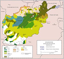
As of 2020, the total population of Daykundi province is estimated to around 516,504,[3] which is mostly a rural tribal society. The ethnic Hazaras make up the majority of the total population of the province. All the inhabitants follow Islam, with Shi'as the majority and Sunnis as the minority. Languages spoken in the province include Dari or Hazaragi.
Districts[]
Daikundi province has 9 districts: Nili, Sangi Takht, Khadir, Ishtarlay, Miramor, Shahristan, Kajran, Kiti, and Pato. Gizab District used to be in Daykundi, but moved to Urozgan.[9]

| District | Capital | Population[10] | Area | Number of villages and ethnic groups |
|---|---|---|---|---|
| Ashtarlay | 62,244 | 1,360 km2 | 343 villages. Hazaras[11] | |
| Kijran | 37,710 | 1,886 km2 | Hazaras[11] | |
| Khedir | 54,368 | 1,583 km2 | 294 villages. Hazaras[11] | |
| Kitti | 57,421 | 887 km2 | 196 villages. Hazaras[11] | |
| Miramor | 87,526 | 2,363 km2 | 326 villages. Hazaras[11] | |
| Nili | Nili | 43,580 | 445 km2 | 165 villages. Hazaras[12] |
| Sang Takh | 60,074 | 1,945 km2 | Hazaras[11] | |
| Shahristan | 82,152 | 1,963 km2 | 290 villages. Hazaras[11] | |
| Pato | 40,454 |
Economy[]
Agriculture is the main industry of the province. It is well known for its high-quality almonds, which are distributed throughout Afghanistan.
See also[]
References[]
- ^ "Statoids". Retrieved 2018-07-19.
- ^ "Estimated Population of Afghanistan 2021-22" (PDF). National Statistic and Information Authority (NSIA). April 2021. Retrieved June 21, 2021.
- ^ Jump up to: a b "Estimated Population of Afghanistan 2020-21" (PDF). Islamic Republic of Afghanistan, National Statistics and Information Authority. Retrieved 6 June 2021.
- ^ "Daykundi province reaches out for unity across Afghanistan | ISAF - International Security Assistance Force". Isaf.nato.int. Archived from the original on 2012-04-29. Retrieved 2012-07-30.
- ^ Jump up to: a b "UN Office For The Coordination of Humanitarian Affairs : UNAMA Facing New Humanitarian Challenges". Irinnews.org. 2007-05-28. Retrieved 2018-07-19.
- ^ John Pike (2007-11-14). "UN-OCHA Integrated Regional Information Networks : Insecurity Stops Food Aid to a Day Kundi District". Globalsecurity.org. Retrieved 2018-07-19.
- ^ Hadi Ghafari (2012-10-28). "Winter food crisis looms over Daikundi". Afghanistan Analysts Network. Retrieved 2018-07-19.
- ^ Hadi Ghafari (2012-10-30). "150 rebels in Daikundi give up insurgency". Pajhwok Afghan News. Retrieved 2018-07-19.
- ^ "Afghanistan District Maps". arcgis.com. Retrieved 10 September 2020.
- ^ "Estimated Population of Afghanistan 2021-22" (PDF). National Statistic and Information Authority (NSIA). April 2021. Retrieved June 21, 2021.
- ^ Jump up to: a b c d e f g "DaiKundi Province". Government of Afghanistan and United Nations Development Programme (UNDP). Ministry of Rural Rehabilitation and Development. Retrieved 2012-10-28.
- ^ Nili District
External links[]
| Wikimedia Commons has media related to Daykundi Province. |
- Daikundi Secure But Lacks Development: Residents on YouTube, April 6, 2018, TOLOnews.
- Angles UNFPA FHH in Daikundi 2015 on YouTube, May 25, 2016, United Nations Population Fund (UNFPA).
- On the Road - Daykundi Province Season 2 (Dari) on YouTube, December 26, 2011, TOLOnews/USAIDAfghanistan.
- Video: B-Roll, Daykundi Province Handover to GIRoA by Defense Video & Imagery Distribution System
| show Places adjacent to Daykundi Province |
|---|
| show Authority control |
|---|
- Daykundi Province
- Hazarajat
- Provinces of Afghanistan
- States and territories established in 2004
- Provinces of the Islamic Republic of Afghanistan