Denning Township, Franklin County, Illinois
Denning Township | |
|---|---|
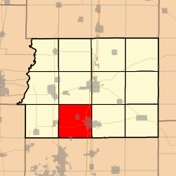 Location in Franklin County | |
 Franklin County's location in Illinois | |
| Coordinates: 37°54′29″N 88°59′03″W / 37.90806°N 88.98417°WCoordinates: 37°54′29″N 88°59′03″W / 37.90806°N 88.98417°W | |
| Country | United States |
| State | Illinois |
| County | Franklin |
| Established | November 4, 1884 |
| Area | |
| • Total | 37 sq mi (100 km2) |
| • Land | 35.84 sq mi (92.8 km2) |
| • Water | 1.16 sq mi (3.0 km2) 3.14% |
| Elevation | 387 ft (118 m) |
| Population (2010) | |
| • Estimate (2016)[1] | 5,082 |
| • Density | 145.1/sq mi (56.0/km2) |
| Time zone | UTC-6 (CST) |
| • Summer (DST) | UTC-5 (CDT) |
| ZIP codes | 62812, 62865, 62874, 62896 |
| FIPS code | 17-055-19421 |

Denning Township is one of twelve townships in Franklin County, Illinois, USA. As of the 2010 census, its population was 5,202 and it contained 2,371 housing units.[2]
Geography[]
According to the 2010 census, the township has a total area of 37 square miles (96 km2), of which 35.84 square miles (92.8 km2) (or 96.86%) is land and 1.16 square miles (3.0 km2) (or 3.14%) is water.[2]
Cities, towns, villages[]
- Freeman Spur (north half)
- Orient
- West Frankfort (west half)
Unincorporated towns[]
(This list is based on USGS data and may include former settlements.)
Cemeteries[]
The township contains these four cemeteries: Denning, Follis, Hanes and Rose.
Major highways[]
Lakes[]
- Beaver Lake
- Cambon Lake
Demographics[]
| Historical population | |||
|---|---|---|---|
| Census | Pop. | %± | |
| 2016 (est.) | 5,082 | [1] | |
| U.S. Decennial Census[3] | |||
School districts[]
- Frankfort Community Unit School District 168
- Herrin Community Unit School District 4
- Zeigler-Royalton Community Unit School District 188
Political districts[]
- Illinois' 12th congressional district
- State House District 117
- State Senate District 59
References[]
- "Denning Township, Franklin County, Illinois". Geographic Names Information System. United States Geological Survey. Retrieved 2010-01-16.
- United States Census Bureau 2007 TIGER/Line Shapefiles
- United States National Atlas
- ^ a b "Population and Housing Unit Estimates". Retrieved June 9, 2017.
- ^ a b "Population, Housing Units, Area, and Density: 2010 - County -- County Subdivision and Place -- 2010 Census Summary File 1". United States Census. Archived from the original on 2020-02-12. Retrieved 2013-05-28.
- ^ "Census of Population and Housing". Census.gov. Retrieved June 4, 2016.
External links[]
Places adjacent to Denning Township, Franklin County, Illinois | ||||||||||||||||
|---|---|---|---|---|---|---|---|---|---|---|---|---|---|---|---|---|
| ||||||||||||||||
Municipalities and communities of Franklin County, Illinois, United States | ||
|---|---|---|
| Cities | ||
| Villages | ||
| Townships | ||
| CDP | ||
| Other unincorporated communities | ||
| Footnotes | ‡This populated place also has portions in an adjacent county or counties | |
| ||
Categories:
- Townships in Franklin County, Illinois
- Townships in Illinois