Freeman Spur, Illinois
Freeman Spur, Illinois | |
|---|---|
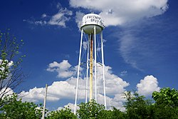 Water tower | |
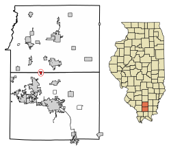 Location of Freeman Spur in Williamson & Franklin Counties, Illinois. | |
 Location of Illinois in the United States | |
| Coordinates: 37°51′36″N 89°0′0″W / 37.86000°N 89.00000°WCoordinates: 37°51′36″N 89°0′0″W / 37.86000°N 89.00000°W | |
| Country | United States |
| State | Illinois |
| Counties | Williamson, Franklin |
| Townships | Denning, Herrin Precinct |
| Area | |
| • Total | 0.40 sq mi (1.04 km2) |
| • Land | 0.40 sq mi (1.03 km2) |
| • Water | 0.00 sq mi (0.01 km2) |
| Elevation | 390 ft (120 m) |
| Population (2010) | |
| • Total | 287 |
| • Estimate (2019)[3] | 279 |
| • Density | 699.25/sq mi (269.68/km2) |
| Time zone | UTC-6 (CST) |
| • Summer (DST) | UTC-5 (CDT) |
| ZIP Code | 62841 |
| Area code(s) | 618 |
| FIPS code | 17-27858 |
| GNIS feature ID | 2398925[2] |
| Wikimedia Commons | Freeman Spur, Illinois |

Freeman Spur is a village in Williamson and Franklin Counties, Illinois, United States. The population was 287 at the 2010 census.[4]
History[]
Freeman Spur is rooted in several small communities that sprang up in the early 1900s with the opening of the Possum Ridge coal mine. These small communities voted to merge and incorporate as "Freeman Spur" in 1913. The village is named for James R. Freeman, who owned the land upon which the mine was located.[5]
Geography[]
According to the 2010 census, Freeman Spur has a total area of 0.403 square miles (1.04 km2), of which 0.4 square miles (1.04 km2) (or 99.26%) is land and 0.003 square miles (0.01 km2) (or 0.74%) is water.[6]
The shaft of the Possum Ridge Mine, which opened in 1908, is located at Freeman Spur. In 1912, a tornado destroyed above-ground structures at the mine.[7][8]
Demographics[]
| Historical population | |||
|---|---|---|---|
| Census | Pop. | %± | |
| 1920 | 325 | — | |
| 1930 | 277 | −14.8% | |
| 1940 | 258 | −6.9% | |
| 1950 | 451 | 74.8% | |
| 1960 | 406 | −10.0% | |
| 1970 | 363 | −10.6% | |
| 1980 | 377 | 3.9% | |
| 1990 | 290 | −23.1% | |
| 2000 | 273 | −5.9% | |
| 2010 | 287 | 5.1% | |
| 2019 (est.) | 279 | [3] | −2.8% |
| U.S. Census[9] | |||
At the 2000 census there were 273 people in 110 households, including 76 families, in the village. The population density was 676.0 people per square mile (263.5/km2). There were 123 housing units at an average density of 304.6 per square mile (118.7/km2). The racial makeup of the village was 91.21% White, 4.76% African American, 0.37% Native American, and 3.66% from two or more races. Hispanic or Latino of any race were 2.56%.[10]
Of the 110 households 32.7% had children under the age of 18 living with them, 48.2% were married couples living together, 13.6% had a female householder with no husband present, and 30.9% were non-families. 27.3% of households were one person and 17.3% were one person aged 65 or older. The average household size was 2.48 and the average family size was 2.97.
The age distribution was 26.4% under the age of 18, 9.2% from 18 to 24, 27.1% from 25 to 44, 23.1% from 45 to 64, and 14.3% 65 or older. The median age was 36 years. For every 100 females, there were 97.8 males. For every 100 females age 18 and over, there were 91.4 males.
The median household income was $24,219 and the median family income was $28,750. Males had a median income of $26,250 versus $23,750 for females. The per capita income for the village was $11,416. About 15.5% of families and 22.1% of the population were below the poverty line, including 34.5% of those under the age of eighteen and 8.6% of those sixty five or over.
References[]
- ^ "2019 U.S. Gazetteer Files". United States Census Bureau. Retrieved July 14, 2020.
- ^ a b U.S. Geological Survey Geographic Names Information System: Freeman Spur, Illinois
- ^ a b "Population and Housing Unit Estimates". United States Census Bureau. May 24, 2020. Retrieved May 27, 2020.
- ^ "Geographic Identifiers: 2010 Census Summary File 1 (G001), Freeman Spur village, Illinois". American FactFinder. U.S. Census Bureau. Archived from the original on February 13, 2020. Retrieved May 4, 2016.
- ^ Barbara Barr Hubbs, "Freeman Spur History," Williamson County Illinois Historical Society website. Accessed 12 June 2021.
- ^ "G001 - Geographic Identifiers - 2010 Census Summary File 1". United States Census Bureau. Archived from the original on 2020-02-13. Retrieved 2015-08-03.
- ^ Hubbs, Barbara Barr. "Freeman Spur History". Williamson County Illinois Historical Society. Retrieved 2018-06-24.
- ^ Hubbs, Barbara Barr. "Possum Ridge Mine History". Williamson County Illinois Historical Society. Retrieved 2018-06-24.
- ^ Census of Population and Housing, U.S. Census Bureau
- ^ "U.S. Census website". United States Census Bureau. Retrieved 2008-01-31.
| Wikimedia Commons has media related to Freeman Spur, Illinois. |
Municipalities and communities of Franklin County, Illinois, United States | ||
|---|---|---|
| Cities | ||
| Villages | ||
| Townships | ||
| CDP | ||
| Other unincorporated communities | ||
| Footnotes | ‡This populated place also has portions in an adjacent county or counties | |
| ||
Municipalities and communities of Williamson County, Illinois, United States | ||
|---|---|---|
| Cities | ||
| Villages | ||
| Precincts | ||
| CDPs | ||
| Other communities | ||
| Ghost towns | ||
| Footnotes | ‡This populated place also has portions in an adjacent county or counties | |
| ||
- Villages in Franklin County, Illinois
- Villages in Williamson County, Illinois
- Villages in Illinois
- Populated places in Southern Illinois