Thompsonville, Illinois
Thompsonville, Illinois | |
|---|---|
 Village Hall | |
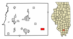 Location of Thompsonville in Franklin County, Illinois. | |
 Location of Illinois in the United States | |
| Coordinates: 37°54′59″N 88°45′42″W / 37.91639°N 88.76167°WCoordinates: 37°54′59″N 88°45′42″W / 37.91639°N 88.76167°W | |
| Country | United States |
| State | Illinois |
| County | Franklin |
| Township | Cave |
| Area | |
| • Total | 2.05 sq mi (5.30 km2) |
| • Land | 2.03 sq mi (5.26 km2) |
| • Water | 0.02 sq mi (0.04 km2) |
| Elevation | 502 ft (153 m) |
| Population (2010) | |
| • Total | 543 |
| • Estimate (2019)[3] | 526 |
| • Density | 258.99/sq mi (100.00/km2) |
| Time zone | UTC-6 (CST) |
| • Summer (DST) | UTC-5 (CDT) |
| ZIP Code(s) | 62890 |
| Area code(s) | 618 |
| FIPS code | 17-75159 |
| GNIS feature ID | 419677[2] |
| Wikimedia Commons | Thompsonville, Illinois |

Thompsonville is a village in Franklin County, Illinois, United States. The population was 543 at the 2010 census.[4]
History[]
There was an early settlement started in the general vicinity called "Jordan's Settlement". It was founded in 1811.[citation needed]
Geography[]
Thompsonville is located in southeastern Franklin County at 37°54′59″N 88°45′42″W / 37.91639°N 88.76167°W (37.916443, -88.761564).[5] Illinois Route 34 passes through the village, leading northwest 10 miles (16 km) to Benton, the county seat, and southeast 21 miles (34 km) to Harrisburg. Illinois Route 149 leads west from Thompsonville 9 miles (14 km) to West Frankfort.
According to the 2010 census, Thompsonville has a total area of 2.046 square miles (5.30 km2), of which 2.03 square miles (5.26 km2) (or 99.22%) is land and 0.016 square miles (0.04 km2) (or 0.78%) is water.[6]
Demographics[]
| Historical population | |||
|---|---|---|---|
| Census | Pop. | %± | |
| 1880 | 172 | — | |
| 1890 | 309 | 79.7% | |
| 1900 | 398 | 28.8% | |
| 1910 | 573 | 44.0% | |
| 1920 | 577 | 0.7% | |
| 1930 | 569 | −1.4% | |
| 1940 | 568 | −0.2% | |
| 1950 | 530 | −6.7% | |
| 1960 | 428 | −19.2% | |
| 1970 | 449 | 4.9% | |
| 1980 | 610 | 35.9% | |
| 1990 | 602 | −1.3% | |
| 2000 | 571 | −5.1% | |
| 2010 | 543 | −4.9% | |
| 2019 (est.) | 526 | [3] | −3.1% |
| U.S. Decennial Census[7] | |||
At the 2000 census there were 571 people, 222 households, and 166 families in the village. The population density was 278.6 people per square mile (107.5/km2). There were 243 housing units at an average density of 118.6 per square mile (45.8/km2). The racial makeup of the village was 98.77% White, 0.35% Native American, and 0.88% from two or more races. Hispanic or Latino of any race were 0.70%.[8]
Of the 222 households 32.9% had children under the age of 18 living with them, 61.3% were married couples living together, 10.8% had a female householder with no husband present, and 25.2% were non-families. 21.2% of households were one person and 9.0% were one person aged 65 or older. The average household size was 2.57 and the average family size was 2.96.
The age distribution was 23.5% under the age of 18, 9.8% from 18 to 24, 31.0% from 25 to 44, 20.5% from 45 to 64, and 15.2% 65 or older. The median age was 38 years. For every 100 females, there were 95.5 males. For every 100 females age 18 and over, there were 94.2 males.
The median household income was $30,500 and the median family income was $33,750. Males had a median income of $25,563 versus $17,656 for females. The per capita income for the village was $13,327. About 14.0% of families and 17.8% of the population were below the poverty line, including 25.2% of those under age 18 and 12.3% of those age 65 or over.
References[]
| Wikimedia Commons has media related to Thompsonville, Illinois. |
- ^ "2019 U.S. Gazetteer Files". United States Census Bureau. Retrieved July 14, 2020.
- ^ Jump up to: a b U.S. Geological Survey Geographic Names Information System: Thompsonville, Illinois
- ^ Jump up to: a b "Population and Housing Unit Estimates". United States Census Bureau. May 24, 2020. Retrieved May 27, 2020.
- ^ "Geographic Identifiers: 2010 Census Summary File 1 (G001), Thompsonville village, Illinois". American FactFinder. U.S. Census Bureau. Archived from the original on February 13, 2020. Retrieved May 4, 2016.
- ^ "US Gazetteer files: 2010, 2000, and 1990". United States Census Bureau. 2011-02-12. Retrieved 2011-04-23.
- ^ "G001 - Geographic Identifiers - 2010 Census Summary File 1". United States Census Bureau. Archived from the original on 2020-02-13. Retrieved 2015-12-25.
- ^ "Census of Population and Housing". Census.gov. Retrieved June 4, 2015.
- ^ "U.S. Census website". United States Census Bureau. Retrieved 2008-01-31.
| hide Municipalities and communities of Franklin County, Illinois, United States | ||
|---|---|---|
| Cities | ||
| Villages | ||
| Townships | ||
| CDP | ||
| Other unincorporated communities | ||
| Footnotes | ‡This populated place also has portions in an adjacent county or counties | |
| ||
- Villages in Franklin County, Illinois
- Villages in Illinois
- Populated places in Southern Illinois