Royalton, Illinois
Royalton, Illinois | |
|---|---|
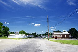 Main Street | |
 Location of Royalton in Franklin County, Illinois. | |
 Location of Illinois in the United States | |
| Coordinates: 37°52′49″N 89°6′49″W / 37.88028°N 89.11361°WCoordinates: 37°52′49″N 89°6′49″W / 37.88028°N 89.11361°W | |
| Country | United States |
| State | Illinois |
| County | Franklin |
| Township | Six Mile |
| Area | |
| • Total | 1.12 sq mi (2.91 km2) |
| • Land | 1.11 sq mi (2.89 km2) |
| • Water | 0.01 sq mi (0.02 km2) |
| Elevation | 390 ft (120 m) |
| Population (2010) | |
| • Total | 1,151 |
| • Estimate (2019)[3] | 1,117 |
| • Density | 1,001.79/sq mi (386.78/km2) |
| Time zone | UTC-6 (CST) |
| • Summer (DST) | UTC-5 (CDT) |
| ZIP Code(s) | 62983 |
| Area code(s) | 618 |
| FIPS code | 17-66209 |
| GNIS feature ID | 417020[2] |
| Wikimedia Commons | Royalton, Illinois |
| Website | www |

Royalton is a village in Franklin County, Illinois, United States. The population was 1,151 at the 2010 census.[4]
History[]
According to the original surveys of Illinois, in the early 19th century the Lusk's Ferry Road ran through the middle of what is now Royalton, heading on a diagonal line toward the southeast. The Lusk's Ferry Road was an important early road connecting Fort Kaskaskia with Lusk's Ferry on the Ohio River. No trace of this road remains near Royalton. It is not clear whether the road figured in the early history of the town, or if it was long forgotten before Royalton came into existence.
Royalton was established in 1907.
On October 22, 1914, an explosion in the North Mine of the Franklin Coal & Coke Company killed 51 miners. This was the worst mine disaster to date in the coal fields of southern Illinois.[5]
Geography[]
Royalton is located in southwestern Franklin County at 37°52′49″N 89°6′49″W / 37.88028°N 89.11361°W (37.880196, -89.113509).[6] Illinois Route 149 passes through the center of town, leading north and east 4.5 miles (7.2 km) to Zeigler and west and south 4.5 miles (7.2 km) to Hurst.
According to the 2010 census, Royalton has a total area of 1.128 square miles (2.92 km2), of which 1.12 square miles (2.90 km2) (or 99.29%) is land and 0.008 square miles (0.02 km2) (or 0.71%) is water.[7]
Demographics[]
| Historical population | |||
|---|---|---|---|
| Census | Pop. | %± | |
| 1910 | 357 | — | |
| 1920 | 2,043 | 472.3% | |
| 1930 | 2,108 | 3.2% | |
| 1940 | 1,772 | −15.9% | |
| 1950 | 1,506 | −15.0% | |
| 1960 | 1,225 | −18.7% | |
| 1970 | 1,166 | −4.8% | |
| 1980 | 1,320 | 13.2% | |
| 1990 | 1,191 | −9.8% | |
| 2000 | 1,130 | −5.1% | |
| 2010 | 1,151 | 1.9% | |
| 2019 (est.) | 1,117 | [3] | −3.0% |
| U.S. Decennial Census[8] | |||
As of the census[9] of 2000, there were 1,130 people, 516 households, and 314 families residing in the village. The population density was 999.2 people per square mile (386.1/km2). There were 577 housing units at an average density of 510.2 per square mile (197.2/km2). The racial makeup of the village was 99.65% White, 0.09% Native American, and 0.27% from two or more races. Hispanic or Latino of any race were 0.27% of the population.
There were 516 households, out of which 26.9% had children under the age of 18 living with them, 45.0% were married couples living together, 12.4% had a female householder with no husband present, and 39.1% were non-families. 35.5% of all households were made up of individuals, and 19.6% had someone living alone who was 65 years of age or older. The average household size was 2.19 and the average family size was 2.81.
In the village, the population was spread out, with 22.7% under the age of 18, 7.1% from 18 to 24, 24.2% from 25 to 44, 26.5% from 45 to 64, and 19.5% who were 65 years of age or older. The median age was 41 years. For every 100 females, there were 88.3 males. For every 100 females age 18 and over, there were 83.6 males.
The median income for a household in the village was $23,947, and the median income for a family was $29,886. Males had a median income of $28,542 versus $21,250 for females. The per capita income for the village was $15,778. About 16.8% of families and 20.3% of the population were below the poverty line, including 21.2% of those under age 18 and 15.4% of those age 65 or over.

Notable church[]
Royalton is home to the only Russian Orthodox church in southern Illinois.[10][11] At one time, there was a Russian Orthodox church in nearby Dowell, but it has closed. A memorial to the Dowell church is located in Royalton.
References[]
- ^ "2019 U.S. Gazetteer Files". United States Census Bureau. Retrieved July 14, 2020.
- ^ Jump up to: a b U.S. Geological Survey Geographic Names Information System: Royalton, Illinois
- ^ Jump up to: a b "Population and Housing Unit Estimates". United States Census Bureau. May 24, 2020. Retrieved May 27, 2020.
- ^ "Geographic Identifiers: 2010 Census Summary File 1 (G001), Royalton village, Illinois". American FactFinder. U.S. Census Bureau. Archived from the original on February 13, 2020. Retrieved May 4, 2016.
- ^ "Mine Explosion at Royalton, Ill.", Coal Age, Vol. 6, No. 19 (Nov. 7, 1914); pages 753-757. Includes several good photos.
- ^ "US Gazetteer files: 2010, 2000, and 1990". United States Census Bureau. 2011-02-12. Retrieved 2011-04-23.
- ^ "G001 - Geographic Identifiers - 2010 Census Summary File 1". United States Census Bureau. Archived from the original on 2020-02-13. Retrieved 2015-12-25.
- ^ "Census of Population and Housing". Census.gov. Retrieved June 4, 2015.
- ^ "U.S. Census website". United States Census Bureau. Retrieved 2008-01-31.
- ^ "Royalton Churches"
- ^ ""Shadows of the Motherland"". Archived from the original on 2012-02-26. Retrieved 2010-08-11.
External links[]
| Wikimedia Commons has media related to Royalton, Illinois. |
| hide Municipalities and communities of Franklin County, Illinois, United States | ||
|---|---|---|
| Cities | ||
| Villages | ||
| Townships | ||
| CDP | ||
| Other unincorporated communities | ||
| Footnotes | ‡This populated place also has portions in an adjacent county or counties | |
| ||
| Authority control |
|---|
- Villages in Franklin County, Illinois
- Villages in Illinois
- Populated places established in 1907
- Coal in Illinois
- Populated places in Southern Illinois