Dierre
Dierre | |
|---|---|
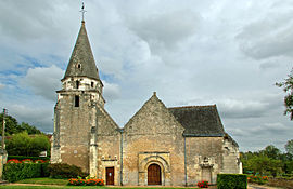 The church of Saint Médard, in Dierre | |
 Coat of arms | |
show Location of Dierre | |
 Dierre | |
| Coordinates: 47°20′49″N 0°57′11″E / 47.3469°N 0.9531°ECoordinates: 47°20′49″N 0°57′11″E / 47.3469°N 0.9531°E | |
| Country | France |
| Region | Centre-Val de Loire |
| Department | Indre-et-Loire |
| Arrondissement | Loches |
| Canton | Bléré |
| Government | |
| • Mayor (2020–2026) | Max Besnard[1] |
| Area 1 | 10.27 km2 (3.97 sq mi) |
| Population (Jan. 2018)[2] | 615 |
| • Density | 60/km2 (160/sq mi) |
| Time zone | UTC+01:00 (CET) |
| • Summer (DST) | UTC+02:00 (CEST) |
| INSEE/Postal code | 37096 /37150 |
| Elevation | 52–115 m (171–377 ft) |
| 1 French Land Register data, which excludes lakes, ponds, glaciers > 1 km2 (0.386 sq mi or 247 acres) and river estuaries. | |


Dierre (French pronunciation: [djɛʁ]) is a commune in the Indre-et-Loire department in central France.
Population[]
The inhabitants are called Dierrois.
|
|
See also[]
References[]
- ^ "Répertoire national des élus: les maires". data.gouv.fr, Plateforme ouverte des données publiques françaises (in French). 2 December 2020.
- ^ "Populations légales 2018". INSEE. 28 December 2020.
| Wikimedia Commons has media related to Dierre. |
| show Authority control |
|---|
This Indre-et-Loire geographical article is a stub. You can help Wikipedia by . |
Categories:
- Communes of Indre-et-Loire
- Indre-et-Loire geography stubs