Saint-Antoine-du-Rocher
Saint-Antoine-du-Rocher | |
|---|---|
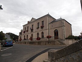 Town hall | |
show Location of Saint-Antoine-du-Rocher | |
 Saint-Antoine-du-Rocher | |
| Coordinates: 47°29′49″N 0°37′52″E / 47.4969°N 0.6311°ECoordinates: 47°29′49″N 0°37′52″E / 47.4969°N 0.6311°E | |
| Country | France |
| Region | Centre-Val de Loire |
| Department | Indre-et-Loire |
| Arrondissement | Chinon |
| Canton | Château-Renault |
| Intercommunality | Gâtine et Choisilles - Pays de Racan |
| Government | |
| • Mayor (2008–2014) | Suzel Roumeas |
| Area 1 | 24.23 km2 (9.36 sq mi) |
| Population (Jan. 2018)[1] | 1,717 |
| • Density | 71/km2 (180/sq mi) |
| Time zone | UTC+01:00 (CET) |
| • Summer (DST) | UTC+02:00 (CEST) |
| INSEE/Postal code | 37206 /37360 |
| Elevation | 60–127 m (197–417 ft) |
| 1 French Land Register data, which excludes lakes, ponds, glaciers > 1 km2 (0.386 sq mi or 247 acres) and river estuaries. | |


Saint-Antoine-du-Rocher is a commune in the Indre-et-Loire department in central France.
Population[]
|
|
See also[]
References[]
- ^ "Populations légales 2018". INSEE. 28 December 2020.
| Wikimedia Commons has media related to Saint-Antoine-du-Rocher. |
| show Authority control |
|---|
This Indre-et-Loire geographical article is a stub. You can help Wikipedia by . |
Categories:
- Communes of Indre-et-Loire
- Indre-et-Loire geography stubs