Drahanovice
Drahanovice | |
|---|---|
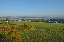 Drahanovice seen from the south | |
 Flag  Coat of arms | |
 Drahanovice Location in the Czech Republic | |
| Coordinates: 49°34′43″N 17°4′37″E / 49.57861°N 17.07694°ECoordinates: 49°34′43″N 17°4′37″E / 49.57861°N 17.07694°E | |
| Country | |
| Region | Olomouc |
| District | Olomouc |
| First mentioned | 1287 |
| Area | |
| • Total | 13.66 km2 (5.27 sq mi) |
| Elevation | 339 m (1,112 ft) |
| Population (2020-01-01[1]) | |
| • Total | 1,743 |
| • Density | 130/km2 (330/sq mi) |
| Time zone | UTC+1 (CET) |
| • Summer (DST) | UTC+2 (CEST) |
| Postal code | 783 43 |
| Website | www |

Drahanovice (German: Drahanowitz) is a municipality and village in Olomouc District in the Olomouc Region of the Czech Republic. It has about 1,700 inhabitants.
Drahanovice lies approximately 13 kilometres (8 mi) west of Olomouc and 199 km (124 mi) east of Prague.
Administrative parts[]
Villages of Kníničky, Lhota pod Kosířem, Ludéřov and Střížov are administrative parts of Drahanovice.
References[]
- ^ "Population of Municipalities – 1 January 2020". Czech Statistical Office. 2020-04-30.
| Wikimedia Commons has media related to Drahanovice. |
| show Authority control |
|---|
This Olomouc Region location article is a stub. You can help Wikipedia by . |
Categories:
- Villages in Olomouc District
- Olomouc Region geography stubs